Estimated Value: $387,000 - $535,000
2
Beds
3
Baths
1,592
Sq Ft
$290/Sq Ft
Est. Value
About This Home
This home is located at 1200 NE Territorial Rd Unit 42, Canby, OR 97013 and is currently estimated at $460,929, approximately $289 per square foot. 1200 NE Territorial Rd Unit 42 is a home located in Clackamas County with nearby schools including Josefa L. Sambrano Elementary School, Baker Prairie Middle School, and Canby High School.
Ownership History
Date
Name
Owned For
Owner Type
Purchase Details
Closed on
Aug 9, 2006
Sold by
Hooley John E
Bought by
Spilker Charles A and Spilker Julia A
Current Estimated Value
Home Financials for this Owner
Home Financials are based on the most recent Mortgage that was taken out on this home.
Original Mortgage
$193,600
Outstanding Balance
$115,632
Interest Rate
6.76%
Mortgage Type
Unknown
Estimated Equity
$345,297
Purchase Details
Closed on
Sep 24, 1998
Sold by
Graham Robert Benjamin and Graham Audrey Mae
Bought by
Hooley John E
Home Financials for this Owner
Home Financials are based on the most recent Mortgage that was taken out on this home.
Original Mortgage
$129,000
Interest Rate
6.88%
Mortgage Type
Seller Take Back
Purchase Details
Closed on
Jan 8, 1997
Sold by
Graham Patricia M A
Bought by
Graham Robert Benjamin
Purchase Details
Closed on
Dec 4, 1996
Sold by
Graham Robert Benjamin
Bought by
Graham Audrey Mae
Create a Home Valuation Report for This Property
The Home Valuation Report is an in-depth analysis detailing your home's value as well as a comparison with similar homes in the area
Home Values in the Area
Average Home Value in this Area
Purchase History
| Date | Buyer | Sale Price | Title Company |
|---|---|---|---|
| Spilker Charles A | $242,000 | Chicago Title Insurance Co | |
| Hooley John E | $139,000 | Chicago Title Insurance Co | |
| Graham Robert Benjamin | -- | -- | |
| Graham Audrey Mae | -- | -- |
Source: Public Records
Mortgage History
| Date | Status | Borrower | Loan Amount |
|---|---|---|---|
| Open | Spilker Charles A | $193,600 | |
| Previous Owner | Hooley John E | $129,000 |
Source: Public Records
Tax History Compared to Growth
Tax History
| Year | Tax Paid | Tax Assessment Tax Assessment Total Assessment is a certain percentage of the fair market value that is determined by local assessors to be the total taxable value of land and additions on the property. | Land | Improvement |
|---|---|---|---|---|
| 2025 | $4,945 | $279,110 | -- | -- |
| 2024 | $4,806 | $270,981 | -- | -- |
| 2023 | $4,806 | $263,089 | $0 | $0 |
| 2022 | $4,421 | $255,427 | $0 | $0 |
| 2021 | $4,257 | $247,988 | $0 | $0 |
| 2020 | $4,181 | $240,766 | $0 | $0 |
| 2019 | $3,981 | $233,754 | $0 | $0 |
| 2018 | $3,893 | $226,946 | $0 | $0 |
| 2017 | $3,794 | $220,336 | $0 | $0 |
| 2016 | $3,667 | $213,918 | $0 | $0 |
| 2015 | $3,541 | $207,687 | $0 | $0 |
| 2014 | $3,261 | $191,204 | $0 | $0 |
Source: Public Records
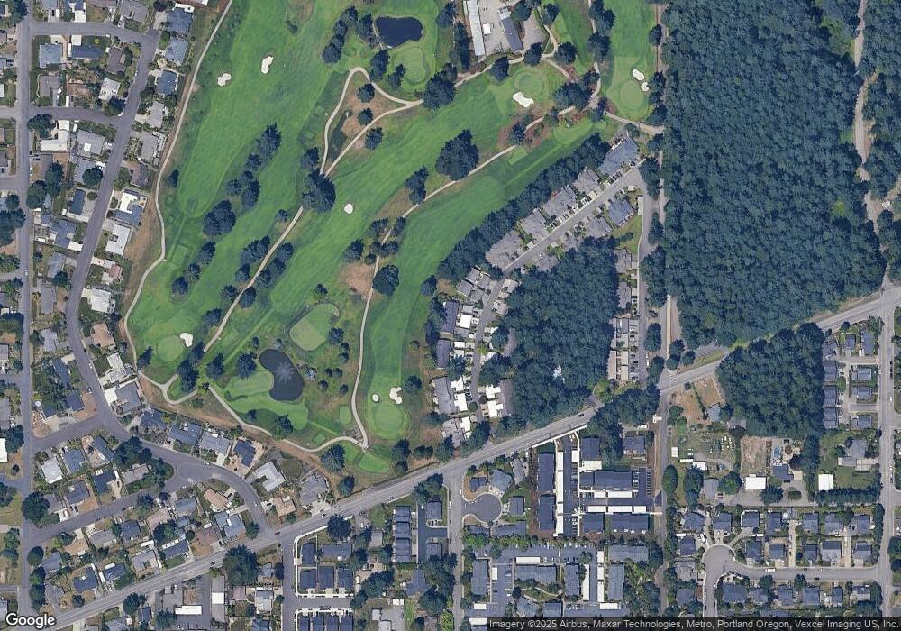
Map
Nearby Homes
- 1200 NE Territorial Rd Unit 93
- 1422 NE 18th Place
- 1750 N Oak St
- 878 NE 17th Ave
- 952 NE 17th Ave
- 1009 NE 17th Ave
- 947 NE 17th Ave
- 844 NE 17th Ave
- 1552 NE 19th Loop
- 838 NE 17th Ave
- 832 NE 17th Ave
- 853 NE 17th Ave
- 660 NE 20th Ave
- 860 NE 14th Ave
- 1620 N Sweetgum St
- 2152 N Laurelwood St
- 1947 NE 21st Ave
- 1751 N Laurelwood Loop
- 312 NE 14th Ave
- 2125 NE Spitz Rd
- 1200 NE Territorial Rd
- 1200 NE Territorial Rd Unit 22
- 1200 NE Territorial Rd Unit 24
- 1200 NE Territorial Rd Unit 75
- 1200 NE Territorial Rd Unit 31
- 1200 NE Territorial Rd Unit 33
- 1200 NE Territorial Rd Unit 12
- 1200 NE Territorial Rd Unit 13
- 1200 NE Territorial Rd Unit 34
- 1200 NE Territorial Rd Unit 94
- 1200 NE Territorial Rd Unit 98
- 1200 NE Territorial Rd Unit 95
- 1200 NE Territorial Rd Unit 63
- 1200 NE Territorial Rd Unit 96
- 1200 NE Territorial Rd Unit 52
- 1200 NE Territorial Rd Unit 62
- 1200 NE Territorial Rd Unit 74
- 1200 NE Territorial Rd Unit 53
- 1200 NE Territorial Rd Unit 23
- 1200 NE Territorial Rd Unit 44