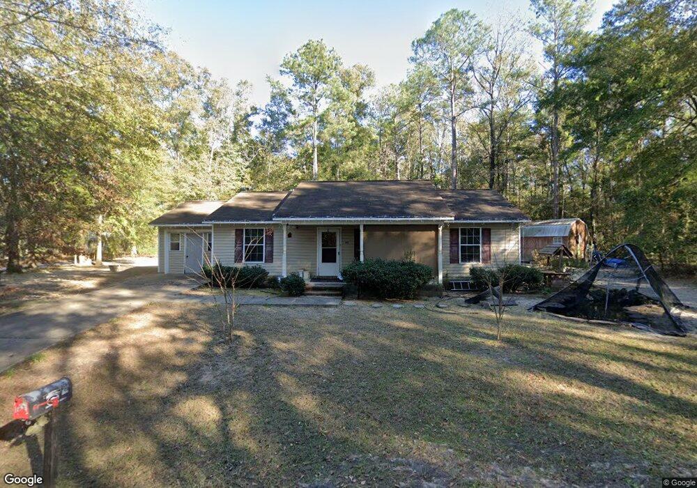
1200 Nussbaum St Bainbridge, GA 39817
Estimated Value: $119,000 - $186,000
--
Bed
1
Bath
1,496
Sq Ft
$108/Sq Ft
Est. Value
About This Home
This home is located at 1200 Nussbaum St, Bainbridge, GA 39817 and is currently estimated at $162,111, approximately $108 per square foot. 1200 Nussbaum St is a home located in Decatur County with nearby schools including Bainbridge High School and Grace Christian Academy.
Ownership History
Date
Name
Owned For
Owner Type
Purchase Details
Closed on
Apr 7, 2006
Sold by
Wiregrass Homebuilders Inc
Bought by
Issac Laquanda L
Current Estimated Value
Home Financials for this Owner
Home Financials are based on the most recent Mortgage that was taken out on this home.
Original Mortgage
$83,100
Outstanding Balance
$54,539
Interest Rate
6.29%
Mortgage Type
New Conventional
Estimated Equity
$107,572
Create a Home Valuation Report for This Property
The Home Valuation Report is an in-depth analysis detailing your home's value as well as a comparison with similar homes in the area
Home Values in the Area
Average Home Value in this Area
Purchase History
| Date | Buyer | Sale Price | Title Company |
|---|---|---|---|
| Issac Laquanda L | $9,000 | -- |
Source: Public Records
Mortgage History
| Date | Status | Borrower | Loan Amount |
|---|---|---|---|
| Open | Issac Laquanda L | $83,100 | |
| Closed | Issac Laquanda L | $10,000 |
Source: Public Records
Tax History Compared to Growth
Tax History
| Year | Tax Paid | Tax Assessment Tax Assessment Total Assessment is a certain percentage of the fair market value that is determined by local assessors to be the total taxable value of land and additions on the property. | Land | Improvement |
|---|---|---|---|---|
| 2024 | $1,727 | $54,643 | $3,600 | $51,043 |
| 2023 | $1,722 | $54,643 | $3,600 | $51,043 |
| 2022 | $1,685 | $54,643 | $3,600 | $51,043 |
| 2021 | $1,574 | $49,699 | $3,600 | $46,099 |
| 2020 | $1,550 | $46,354 | $3,600 | $42,754 |
| 2019 | $1,535 | $44,182 | $3,600 | $40,582 |
| 2018 | $1,518 | $44,182 | $3,600 | $40,582 |
| 2017 | $1,340 | $38,314 | $3,600 | $34,714 |
| 2016 | $1,340 | $38,314 | $3,600 | $34,714 |
| 2015 | $1,378 | $38,314 | $3,600 | $34,714 |
| 2014 | $1,263 | $38,314 | $3,600 | $34,714 |
| 2013 | -- | $37,914 | $3,600 | $34,314 |
Source: Public Records
Map
Nearby Homes
- 927 5th Ave
- 836 Cooper St
- 705 N Lamar St
- 411 Independent St
- 502 Planter St
- 435 E Broughton St
- 1020 E Water St
- 302 E Water St
- 000 E River Rd
- 418 E Broughton St
- Lot 7 Easy Dr
- Dell Rd
- 1204 E Water St
- 640 E Shotwell St
- 632 E Shotwell St
- 423 E Shotwell St
- 1302 Majestic Ave
- 906 E Sharpe St
- 249 Meredith Dr
- 245 Meredith Dr
- 735 Maple Ave
- 809 Maple Ave
- 103 Cherry St
- 1202 Oleander Dr
- 1206 Oleander Dr
- LOT 9 N Cherry St
- 813 Maple Ave
- 105 Cherry St
- 1207 Oleander Dr
- 817 Maple Ave
- 806 Oak Circle Dr
- 812 Oak Circle Dr
- 819 Maple Ave
- 1025 Helen St
- 1110 Cooper St
- 814 Oak Circle Dr
- 821 Maple Ave
- 1217 Oleander Dr
- 1115 Cooper St
- 1214 Orleander Dr