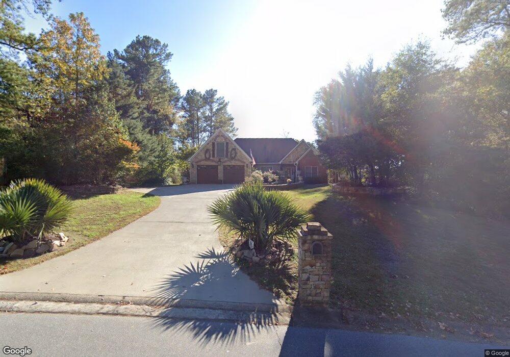
1200 Palm Ridge Trace Canton, GA 30115
Estimated Value: $392,731 - $412,000
3
Beds
2
Baths
1,906
Sq Ft
$211/Sq Ft
Est. Value
About This Home
This home is located at 1200 Palm Ridge Trace, Canton, GA 30115 and is currently estimated at $402,366, approximately $211 per square foot. 1200 Palm Ridge Trace is a home located in Cherokee County with nearby schools including Holly Springs Elementary School, Rusk Middle School, and Sequoyah High School.
Ownership History
Date
Name
Owned For
Owner Type
Purchase Details
Closed on
May 17, 1995
Sold by
Lu Mildred Gail
Bought by
Guisinger Charles L Debra E
Current Estimated Value
Purchase Details
Closed on
Feb 24, 1994
Sold by
Circle H Devel Inc
Bought by
Lu Mildred Gail
Home Financials for this Owner
Home Financials are based on the most recent Mortgage that was taken out on this home.
Original Mortgage
$73,400
Interest Rate
7.04%
Create a Home Valuation Report for This Property
The Home Valuation Report is an in-depth analysis detailing your home's value as well as a comparison with similar homes in the area
Home Values in the Area
Average Home Value in this Area
Purchase History
| Date | Buyer | Sale Price | Title Company |
|---|---|---|---|
| Guisinger Charles L Debra E | $110,900 | -- | |
| Lu Mildred Gail | $101,900 | -- |
Source: Public Records
Mortgage History
| Date | Status | Borrower | Loan Amount |
|---|---|---|---|
| Previous Owner | Lu Mildred Gail | $73,400 |
Source: Public Records
Tax History Compared to Growth
Tax History
| Year | Tax Paid | Tax Assessment Tax Assessment Total Assessment is a certain percentage of the fair market value that is determined by local assessors to be the total taxable value of land and additions on the property. | Land | Improvement |
|---|---|---|---|---|
| 2025 | $3,693 | $145,368 | $30,000 | $115,368 |
| 2024 | $739 | $145,000 | $30,000 | $115,000 |
| 2023 | $669 | $151,388 | $34,000 | $117,388 |
| 2022 | $337 | $121,560 | $25,600 | $95,960 |
| 2021 | $347 | $92,756 | $19,600 | $73,156 |
| 2020 | $351 | $94,312 | $19,000 | $75,312 |
| 2019 | $350 | $88,960 | $18,000 | $70,960 |
| 2018 | $686 | $79,280 | $15,600 | $63,680 |
| 2017 | $2,129 | $163,000 | $11,600 | $53,600 |
| 2016 | $1,615 | $163,400 | $10,400 | $54,960 |
| 2015 | $1,564 | $157,100 | $10,400 | $52,440 |
| 2014 | $1,404 | $141,400 | $10,400 | $46,160 |
Source: Public Records
Map
Nearby Homes
- 1620 Palm St
- 1243 Palm Ridge Trace
- 1414 Palm St
- 203 Brookhaven Place
- 1104 Palm St
- 228 Holly Creek Way
- 234 Holly Creek Way
- 346 Wells Cir
- 214 Valley Brook Dr
- 283 Wells Cir
- 102 Magnolia Springs Ln
- 279 Wells Cir
- 550 Fox Creek Crossing
- 501 Ruths Dr
- 531 Fox Creek Crossing
- 1557 River Park Blvd
- 643 N Rope Mill Rd Unit 634
- 1206 Palm Ridge Trace
- 1201 Palm Ridge Trace
- 1212 Palm Ridge Trace
- 1219 Palm Ridge Trace
- 1218 Palm Ridge Trace
- 1225 Palm Ridge Trace
- 1224 Palm Ridge Trace
- 1690 Palm St Unit 1
- 0 Palm Ridge Trace Unit 7200713
- 1231 Palm Ridge Trace
- 1230 Palm Ridge Trace
- 1237 Palm Ridge Trace
- 1236 Palm Ridge Trace
- 337 Whitetail Cir
- 341 Whitetail Cir
- 1242 Palm Ridge Trace
- 345 Whitetail Cir
- 308 Whitetail Cir
- 360 Whitetail Cir
- 300 Whitetail Cir