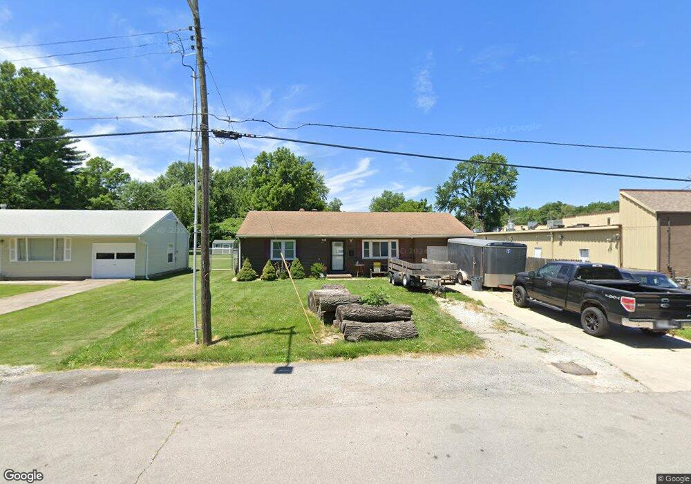
1200 Randall Rd Independence, MO 64055
Hanthorn NeighborhoodEstimated Value: $136,000 - $158,777
3
Beds
1
Bath
942
Sq Ft
$159/Sq Ft
Est. Value
About This Home
This home is located at 1200 Randall Rd, Independence, MO 64055 and is currently estimated at $149,944, approximately $159 per square foot. 1200 Randall Rd is a home located in Jackson County with nearby schools including Sycamore Hills Elementary School, Bridger Middle School, and Pioneer Ridge Middle School.
Ownership History
Date
Name
Owned For
Owner Type
Purchase Details
Closed on
Oct 15, 1996
Sold by
Popp Karen Elizabeth
Bought by
Duley Donald D and Duley Christine M
Current Estimated Value
Home Financials for this Owner
Home Financials are based on the most recent Mortgage that was taken out on this home.
Original Mortgage
$52,965
Outstanding Balance
$4,967
Interest Rate
8.33%
Mortgage Type
FHA
Estimated Equity
$144,977
Create a Home Valuation Report for This Property
The Home Valuation Report is an in-depth analysis detailing your home's value as well as a comparison with similar homes in the area
Home Values in the Area
Average Home Value in this Area
Purchase History
| Date | Buyer | Sale Price | Title Company |
|---|---|---|---|
| Duley Donald D | -- | Realty Title Company |
Source: Public Records
Mortgage History
| Date | Status | Borrower | Loan Amount |
|---|---|---|---|
| Open | Duley Donald D | $52,965 |
Source: Public Records
Tax History Compared to Growth
Tax History
| Year | Tax Paid | Tax Assessment Tax Assessment Total Assessment is a certain percentage of the fair market value that is determined by local assessors to be the total taxable value of land and additions on the property. | Land | Improvement |
|---|---|---|---|---|
| 2025 | $1,540 | $19,599 | $4,760 | $14,839 |
| 2024 | $1,505 | $22,222 | $3,912 | $18,310 |
| 2023 | $1,505 | $22,223 | $2,854 | $19,369 |
| 2022 | $1,095 | $14,820 | $4,030 | $10,790 |
| 2021 | $1,094 | $14,820 | $4,030 | $10,790 |
| 2020 | $1,122 | $14,761 | $4,030 | $10,731 |
| 2019 | $1,104 | $14,761 | $4,030 | $10,731 |
| 2018 | $1,006 | $12,847 | $3,507 | $9,340 |
| 2017 | $1,006 | $12,847 | $3,507 | $9,340 |
| 2016 | $991 | $12,525 | $2,740 | $9,785 |
| 2014 | $941 | $12,160 | $2,660 | $9,500 |
Source: Public Records
Map
Nearby Homes
- 1217 S Crane St
- 1016 E Stone St
- 1106 E 23rd St S
- 1040 E Stone St
- 1126 S Logan Ave
- 1200 E Stone St
- 1410 S Logan Ave
- 1202 E 23rd St S
- 929 S Pope Ave
- 823 S Raymond St
- 610 E Fair St
- 823 S Savage St
- 814 S Saville Ave
- 1312 S Emery St
- 1324 S Emery Ave
- 1109 S Woodbury St
- 1340 S Emery Ave
- 1425 S Kings Hwy
- 913 S Hocker Ave
- 735 E Devon St
- 1202 Randall Rd
- 1003 E 23rd St S
- 1206 Randall Rd
- 1222 Randall Rd
- 1215 Randall Rd
- 1226 Randall Rd
- 919 E 23rd St S
- 917 1/2 E 23rd St S
- 1209 S Crane St
- 1221 Randall Rd
- 1211 S Crane St
- 1230 Randall Rd
- 1213 S Crane St
- 1227 Randall Rd
- 1215 S Crane St
- 1234 Randall Rd
- 1000 E 23rd St S
- 1233 Randall Rd
- 1302 Randall Rd
- 1206 S Crane St