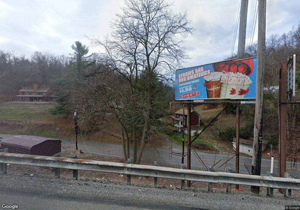
1200 Route 51 Clairton, PA 15025
Estimated Value: $146,000 - $222,000
2
Beds
2
Baths
676
Sq Ft
$278/Sq Ft
Est. Value
About This Home
This home is located at 1200 Route 51, Clairton, PA 15025 and is currently estimated at $187,705, approximately $277 per square foot. 1200 Route 51 is a home located in Allegheny County with nearby schools including Jefferson Hills Intermediate School, Pleasant Hills Middle School, and Thomas Jefferson High School.
Ownership History
Date
Name
Owned For
Owner Type
Purchase Details
Closed on
Aug 15, 2013
Sold by
Baldwin Clint P
Bought by
Harkins Mark V
Current Estimated Value
Home Financials for this Owner
Home Financials are based on the most recent Mortgage that was taken out on this home.
Original Mortgage
$117,727
Outstanding Balance
$87,058
Interest Rate
4.25%
Mortgage Type
FHA
Estimated Equity
$100,647
Purchase Details
Closed on
Oct 6, 2004
Sold by
Hamilton James
Bought by
Baldwin Clint
Home Financials for this Owner
Home Financials are based on the most recent Mortgage that was taken out on this home.
Original Mortgage
$70,000
Interest Rate
5.84%
Mortgage Type
New Conventional
Purchase Details
Closed on
Aug 25, 2003
Sold by
Mitchko Paulette
Bought by
Hamilton James W
Purchase Details
Closed on
Apr 12, 2002
Sold by
Mitchko Andrew J
Bought by
Mitchko Paulette and Ero Linda C
Create a Home Valuation Report for This Property
The Home Valuation Report is an in-depth analysis detailing your home's value as well as a comparison with similar homes in the area
Home Values in the Area
Average Home Value in this Area
Purchase History
| Date | Buyer | Sale Price | Title Company |
|---|---|---|---|
| Harkins Mark V | $119,000 | -- | |
| Baldwin Clint | $87,000 | -- | |
| Hamilton James W | $78,000 | -- | |
| Mitchko Paulette | -- | -- |
Source: Public Records
Mortgage History
| Date | Status | Borrower | Loan Amount |
|---|---|---|---|
| Open | Harkins Mark V | $117,727 | |
| Previous Owner | Hamilton James W | $70,000 |
Source: Public Records
Tax History Compared to Growth
Tax History
| Year | Tax Paid | Tax Assessment Tax Assessment Total Assessment is a certain percentage of the fair market value that is determined by local assessors to be the total taxable value of land and additions on the property. | Land | Improvement |
|---|---|---|---|---|
| 2025 | $2,790 | $83,000 | $39,600 | $43,400 |
| 2024 | $2,790 | $83,000 | $39,600 | $43,400 |
| 2023 | $2,753 | $83,000 | $39,600 | $43,400 |
| 2022 | $2,712 | $83,000 | $39,600 | $43,400 |
| 2021 | $393 | $83,000 | $39,600 | $43,400 |
| 2020 | $2,642 | $83,000 | $39,600 | $43,400 |
| 2019 | $2,592 | $83,000 | $39,600 | $43,400 |
| 2018 | $393 | $83,000 | $39,600 | $43,400 |
| 2017 | $2,491 | $83,000 | $39,600 | $43,400 |
| 2016 | $393 | $83,000 | $39,600 | $43,400 |
| 2015 | $393 | $101,000 | $39,600 | $61,400 |
| 2014 | $2,826 | $60,900 | $39,600 | $21,300 |
Source: Public Records
Map
Nearby Homes
- Lot 8 Old Clairton Rd
- 362 Toura Dr
- 0 Macarthur Rd
- 326 Old Clairton Rd
- 504 Timber Ln
- 216 Wray Large Rd
- 2100 Laurel Ridge Dr
- 2095 Laurel Ridge Dr
- 124 Reed Dr
- 3016 Chestnut Ridge Dr
- 714 Old Clairton Rd
- 228 Meadowfield Ln
- 806 Old Clairton Rd
- 4010 Shenandoah Dr
- 4013 Shenandoah Dr
- 3055 Chestnut Ridge Dr
- 1613 State Route 885
- 4003 Shenandoah Dr
- 4005 Shenandoah Dr
- 463 Coal Valley Rd
- 114 Route 51
- 114 Route 51
- 114 Route 51
- 758 Coal Valley Rd
- 1205 Route 51
- 831 Coal Valley Rd
- 839 Coal Valley Rd
- 759 Coal Valley Rd
- 3000 N Lewis Run Rd
- 832 Coal Valley Rd
- 100 Oakwood Dr
- 101 Oakwood Dr
- 824 Coal Valley Rd
- 840 Coal Valley Rd
- 840 Coal Valley Rd
- 3006 Lewis Run Rd
- 103 Oakwood Dr
- 102 Oakwood Dr
- 105 Oakwood Dr
- 104 Oakwood Dr
