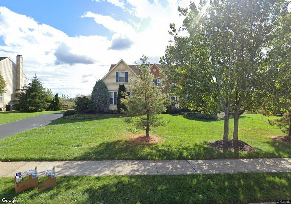
1200 Rupert Rd Pottstown, PA 19464
Estimated Value: $827,000 - $956,000
5
Beds
5
Baths
4,288
Sq Ft
$203/Sq Ft
Est. Value
About This Home
This home is located at 1200 Rupert Rd, Pottstown, PA 19464 and is currently estimated at $871,042, approximately $203 per square foot. 1200 Rupert Rd is a home located in Montgomery County with nearby schools including Lower Pottsgrove Elementary School, Pottsgrove Middle School, and Pottsgrove Senior High School.
Ownership History
Date
Name
Owned For
Owner Type
Purchase Details
Closed on
Sep 30, 2007
Sold by
Ogundipe Bolanle and Ogundipe Olutayo
Bought by
Kent Deanna N and Kent Mark
Current Estimated Value
Home Financials for this Owner
Home Financials are based on the most recent Mortgage that was taken out on this home.
Original Mortgage
$400,000
Outstanding Balance
$252,063
Interest Rate
6.39%
Estimated Equity
$618,979
Purchase Details
Closed on
Aug 31, 2005
Sold by
Heritage At Ravens Claw Lp
Bought by
Ogundipe Olutayo and Ogundipe Bolanle
Home Financials for this Owner
Home Financials are based on the most recent Mortgage that was taken out on this home.
Original Mortgage
$415,000
Interest Rate
5.5%
Mortgage Type
New Conventional
Purchase Details
Closed on
Oct 27, 2004
Sold by
Not Provided
Bought by
Not Provided
Purchase Details
Closed on
Sep 21, 2004
Sold by
Not Provided
Bought by
Not Provided
Create a Home Valuation Report for This Property
The Home Valuation Report is an in-depth analysis detailing your home's value as well as a comparison with similar homes in the area
Home Values in the Area
Average Home Value in this Area
Purchase History
| Date | Buyer | Sale Price | Title Company |
|---|---|---|---|
| Kent Deanna N | $525,000 | None Available | |
| Ogundipe Olutayo | $564,800 | -- | |
| Not Provided | -- | -- | |
| Not Provided | -- | -- |
Source: Public Records
Mortgage History
| Date | Status | Borrower | Loan Amount |
|---|---|---|---|
| Open | Kent Deanna N | $400,000 | |
| Previous Owner | Ogundipe Olutayo | $415,000 |
Source: Public Records
Tax History Compared to Growth
Tax History
| Year | Tax Paid | Tax Assessment Tax Assessment Total Assessment is a certain percentage of the fair market value that is determined by local assessors to be the total taxable value of land and additions on the property. | Land | Improvement |
|---|---|---|---|---|
| 2025 | $13,562 | $275,900 | -- | -- |
| 2024 | $13,562 | $275,900 | -- | -- |
| 2023 | $13,142 | $275,900 | $0 | $0 |
| 2022 | $12,944 | $275,900 | $0 | $0 |
| 2021 | $12,689 | $275,900 | $0 | $0 |
| 2020 | $12,572 | $275,900 | $0 | $0 |
| 2019 | $12,507 | $275,900 | $0 | $0 |
| 2018 | $12,506 | $275,900 | $0 | $0 |
| 2017 | $12,397 | $275,900 | $0 | $0 |
| 2016 | $12,289 | $275,900 | $0 | $0 |
| 2015 | $12,010 | $275,900 | $0 | $0 |
| 2014 | $12,010 | $275,900 | $0 | $0 |
Source: Public Records
Map
Nearby Homes
- 1180 Rupert Rd
- 1060 Oakdale Dr
- 1629 Rupert Rd
- 1687 Rupert Rd
- 20 Bunker Way
- 847 Rivendell Ln
- 2672 Crownview Rd
- 2933 E High St
- 3000 E High St Unit 1
- 0 Industrial Pkwy Unit PAMC2142810
- 90 Kurtz Rd
- 217 S Park Rd
- 2580 Allison Dr Unit 3
- 2126 Deer Ridge Dr
- 2419 Sanatoga Rd
- 2576 Swamp Pike
- 260 Hause Ave
- 3501 Walnut Ridge Estate
- 110 Nelson Ln
- 3603 Walnut Ridge Estate
- 1250 Rupert Rd
- 1225 Rupert Rd
- 1261 Rupert Rd
- 1150 Rupert Rd
- 1290 Rupert Rd
- 1281 Rupert Rd
- 1189 Rupert Rd
- 1153 Rupert Rd
- 1320 Rupert Rd
- 1359 Rupert Rd
- 1120 Rupert Rd
- 1121 Rupert Rd
- 1288 Woodmere Dr
- 1300 Woodmere Dr
- 3102 Woodgate Ln
- 3048 Duckworth Dr
- 1397 Rupert Rd
- 1097 Rupert Rd
- 3101 Woodgate Ln
- 3064 Duckworth Dr