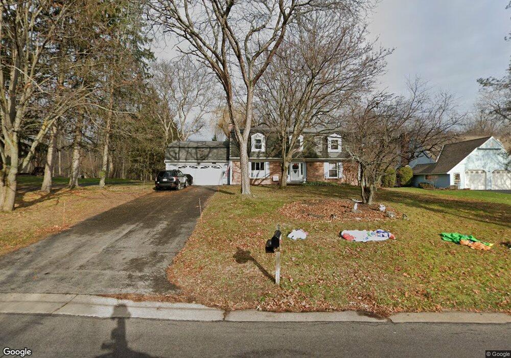
1200 Stockbridge Rd Webster, NY 14580
Estimated Value: $397,000 - $496,000
4
Beds
3
Baths
2,082
Sq Ft
$210/Sq Ft
Est. Value
About This Home
This home is located at 1200 Stockbridge Rd, Webster, NY 14580 and is currently estimated at $437,681, approximately $210 per square foot. 1200 Stockbridge Rd is a home located in Monroe County with nearby schools including Klem Road North Elementary School, Willink Middle School, and Thomas High School.
Ownership History
Date
Name
Owned For
Owner Type
Purchase Details
Closed on
Aug 30, 2016
Sold by
Leader Steven H
Bought by
Murphy Michael R and Murphy Andrea M
Current Estimated Value
Purchase Details
Closed on
Dec 4, 2009
Sold by
Wolcott Jaime C and Wolcott Suzanne L
Bought by
Leader Steven H
Home Financials for this Owner
Home Financials are based on the most recent Mortgage that was taken out on this home.
Original Mortgage
$157,500
Interest Rate
4.92%
Mortgage Type
New Conventional
Purchase Details
Closed on
Jun 27, 2002
Sold by
Alessio Rodney J
Bought by
Wolcott Jaime C
Create a Home Valuation Report for This Property
The Home Valuation Report is an in-depth analysis detailing your home's value as well as a comparison with similar homes in the area
Home Values in the Area
Average Home Value in this Area
Purchase History
| Date | Buyer | Sale Price | Title Company |
|---|---|---|---|
| Murphy Michael R | $263,250 | None Available | |
| Leader Steven H | $175,000 | None Available | |
| Wolcott Jaime C | $180,000 | -- |
Source: Public Records
Mortgage History
| Date | Status | Borrower | Loan Amount |
|---|---|---|---|
| Previous Owner | Leader Steven H | $157,500 |
Source: Public Records
Tax History
| Year | Tax Paid | Tax Assessment Tax Assessment Total Assessment is a certain percentage of the fair market value that is determined by local assessors to be the total taxable value of land and additions on the property. | Land | Improvement |
|---|---|---|---|---|
| 2024 | $8,730 | $183,200 | $33,700 | $149,500 |
| 2023 | $8,478 | $183,200 | $33,700 | $149,500 |
| 2022 | $8,405 | $183,200 | $33,700 | $149,500 |
| 2021 | $8,329 | $183,200 | $33,700 | $149,500 |
| 2020 | $8,197 | $183,200 | $33,700 | $149,500 |
| 2019 | $6,911 | $183,200 | $33,700 | $149,500 |
| 2018 | $7,854 | $183,200 | $33,700 | $149,500 |
| 2017 | $6,852 | $183,200 | $33,700 | $149,500 |
| 2016 | $6,911 | $183,200 | $33,700 | $149,500 |
| 2015 | -- | $183,200 | $33,700 | $149,500 |
| 2014 | -- | $183,200 | $33,700 | $149,500 |
Source: Public Records
Map
Nearby Homes
- 1202 Lake Point Dr
- 362 Webster Rd
- 229 Southshore Place
- 1222 Scenic Cir
- 125 Regatta Dr
- 572 Holt Rd
- 1394 Meadow Breeze Ln
- 611 Maris Run
- 1402 Creeks Edge Dr
- 1404 Creeks Edge Dr
- 1406 Creeks Edge Dr
- 357 Coastal View Dr
- 1055 Klem Rd
- 1164 Woodbridge Ln
- 643 Kayloc Cir
- 480 Alyssa Way
- 1622 Greensboro Dr
- 300 Salt Rd
- 1 Hard Rd
- 497 Pellett Rd
- 1202 Stockbridge Rd
- 1196 Stockbridge Rd
- 1198 Stockbridge Rd
- 1213 Severn Ridge Rd
- 1201 Gerrads Cross
- 1201 Stockbridge Rd
- 1201 Woodhull Rd
- 1199 Gerrads Cross
- 1212 Severn Ridge Rd
- 1211 Severn Ridge Rd
- 1203 Stockbridge Rd
- 1198 Gerrads Cross
- 1194 Woodhull Rd
- 1211 Woodhull Rd
- 1190 Woodhull Rd
- 1207 Gerrads Cross
- 1210 Severn Ridge Rd
- 1200 Gerrads Cross
- 1209 Severn Ridge Rd
- 1202 Gerrads Cross
Your Personal Tour Guide
Ask me questions while you tour the home.