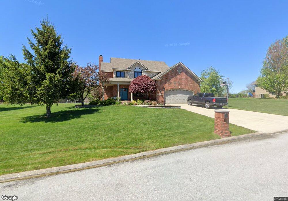
12000 Mount St Crown Point, IN 46307
Estimated Value: $465,000 - $582,000
4
Beds
3
Baths
2,638
Sq Ft
$201/Sq Ft
Est. Value
About This Home
This home is located at 12000 Mount St, Crown Point, IN 46307 and is currently estimated at $530,024, approximately $200 per square foot. 12000 Mount St is a home located in Lake County with nearby schools including Lake Street Elementary School, Robert Taft Middle School, and Crown Point High School.
Ownership History
Date
Name
Owned For
Owner Type
Purchase Details
Closed on
Oct 13, 2025
Sold by
Mark And Deanne Barnes Living Trust
Bought by
Barnes Mark and Barnes Deanne
Current Estimated Value
Purchase Details
Closed on
Dec 9, 2024
Sold by
Barnes Mark and Barnes Deanne
Bought by
Mark And Deanne Barnes Living Trust
Create a Home Valuation Report for This Property
The Home Valuation Report is an in-depth analysis detailing your home's value as well as a comparison with similar homes in the area
Home Values in the Area
Average Home Value in this Area
Purchase History
| Date | Buyer | Sale Price | Title Company |
|---|---|---|---|
| Barnes Mark | -- | None Listed On Document | |
| Mark And Deanne Barnes Living Trust | -- | None Listed On Document |
Source: Public Records
Tax History Compared to Growth
Tax History
| Year | Tax Paid | Tax Assessment Tax Assessment Total Assessment is a certain percentage of the fair market value that is determined by local assessors to be the total taxable value of land and additions on the property. | Land | Improvement |
|---|---|---|---|---|
| 2024 | $10,071 | $508,500 | $70,900 | $437,600 |
| 2023 | $4,694 | $473,900 | $70,900 | $403,000 |
| 2022 | $5,224 | $473,600 | $70,900 | $402,700 |
| 2021 | $4,970 | $472,800 | $56,700 | $416,100 |
| 2020 | $4,982 | $450,700 | $56,700 | $394,000 |
| 2019 | $4,941 | $438,000 | $56,700 | $381,300 |
| 2018 | $5,058 | $424,800 | $56,700 | $368,100 |
| 2017 | $5,207 | $431,600 | $56,700 | $374,900 |
| 2016 | $5,323 | $437,200 | $56,700 | $380,500 |
| 2014 | $5,078 | $442,200 | $57,700 | $384,500 |
| 2013 | $5,039 | $439,700 | $57,700 | $382,000 |
Source: Public Records
Map
Nearby Homes
- 4714 W 121st Ave
- 12120 Burr St
- 1156 Donegal Ln
- 1140 Hyde Park
- 11606 Westvalley Dr
- 1144 Mary Ellen Dr
- 11531 Westvalley Dr
- 1089 George Ade Ct
- 775 Quinlan Ct
- 804 Shannon Dr
- 3709 W 121st Ave
- 11224 Durbin Place
- 908 Mary Ellen Dr
- 11341 Lakewood St
- 11217 Burr Parcel 2 St
- 802 Hayfield Dr
- 12860 Baker Ct
- 12201 Cedar Lake Rd
- 12812 Whitcomb St
- 1575 S Feather Rock Dr
- 11964 Mount St
- 12030 Mount St
- 12017 Mount St
- 11985 Mount St
- 11928 Mount St
- 11961 Mount St
- Lot A Mount St
- Lot A&B Mount St
- 11941 Mount St
- 12051 Mount St
- 12060 Mount St
- 11921 Mount St
- 5224 W 121st Ave
- 5042 W 120th Ave
- 7892 W 120th Ave
- 7876 W 120th Ave
- 7790 W 120th Ave
- 7758 W 120th Ave
- 7778 W 120th Ave
- 7746 W 120th Ave