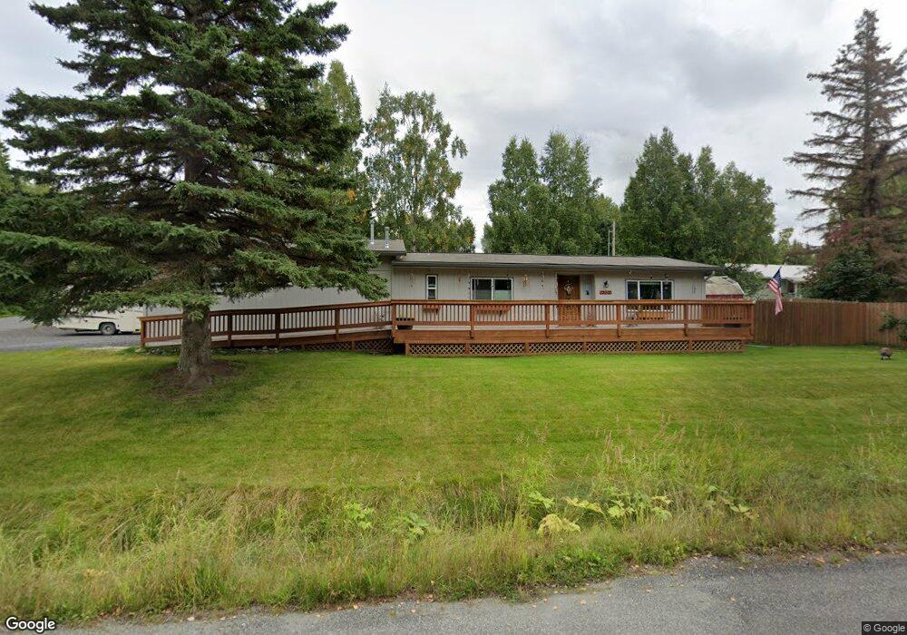
12001 Avion St Anchorage, AK 99516
Huffman-O'Malley NeighborhoodEstimated Value: $204,000 - $484,000
2
Beds
2
Baths
955
Sq Ft
$368/Sq Ft
Est. Value
About This Home
This home is located at 12001 Avion St, Anchorage, AK 99516 and is currently estimated at $351,600, approximately $368 per square foot. 12001 Avion St is a home located in Anchorage Municipality with nearby schools including Huffman Elementary School, Goldenview Middle School, and South Anchorage High School.
Ownership History
Date
Name
Owned For
Owner Type
Purchase Details
Closed on
Dec 6, 2002
Sold by
Bates John S and Bates Nikki J
Bought by
Allenbrand Dallas L and Allenbrand Dee M
Current Estimated Value
Home Financials for this Owner
Home Financials are based on the most recent Mortgage that was taken out on this home.
Original Mortgage
$60,514
Interest Rate
6.28%
Mortgage Type
Seller Take Back
Create a Home Valuation Report for This Property
The Home Valuation Report is an in-depth analysis detailing your home's value as well as a comparison with similar homes in the area
Home Values in the Area
Average Home Value in this Area
Purchase History
| Date | Buyer | Sale Price | Title Company |
|---|---|---|---|
| Allenbrand Dallas L | -- | -- |
Source: Public Records
Mortgage History
| Date | Status | Borrower | Loan Amount |
|---|---|---|---|
| Closed | Allenbrand Dallas L | $60,514 |
Source: Public Records
Tax History Compared to Growth
Tax History
| Year | Tax Paid | Tax Assessment Tax Assessment Total Assessment is a certain percentage of the fair market value that is determined by local assessors to be the total taxable value of land and additions on the property. | Land | Improvement |
|---|---|---|---|---|
| 2025 | $1,581 | $362,400 | $103,000 | $259,400 |
| 2024 | $1,581 | $322,900 | $98,100 | $224,800 |
| 2023 | $5,131 | $301,300 | $94,200 | $207,100 |
| 2022 | $1,570 | $293,200 | $94,200 | $199,000 |
| 2021 | $5,082 | $282,000 | $94,200 | $187,800 |
| 2020 | $1,287 | $276,900 | $94,200 | $182,700 |
| 2019 | $1,170 | $271,500 | $94,200 | $177,300 |
| 2018 | $3,618 | $270,600 | $107,000 | $163,600 |
| 2017 | $3,892 | $268,500 | $107,000 | $161,500 |
| 2016 | $2,946 | $268,700 | $107,000 | $161,700 |
| 2015 | $2,946 | $267,700 | $103,000 | $164,700 |
| 2014 | $2,946 | $237,000 | $67,000 | $170,000 |
Source: Public Records
Map
Nearby Homes
- 12101 Wagner St
- 000 Wagner St
- 3641 E Klatt Rd
- 3025 Huffman Rd
- 12241 Gander St
- 2735 Meadow Wood Cir
- 12283 Timberwood Cir
- 11335 Tulin Park Loop
- 4530 Snowcup Cir
- 11359 Tulin Park Loop
- 2521 Winterchase Cir
- L16 Sky Ridge Dr
- 11097 Sky Ridge Dr
- 2640 E 112th Ave
- 11135 Red Sky Cir
- 2701 Kempton Hills Dr
- 0000 E 113th Ave
- 4715 E 112th Ave
- NHN Elmore #1 L12 B6
- 11721 Wranglers Way
- 3620 Cleo Ave
- 3703 Cleo Ave
- 3701 Cleo Ave
- 3601 E 121st Ave
- 12000 Avion St
- 11941 Avion St
- 3651 E 121st Ave
- 12040 Avion St
- 3641 Cleo Ave
- 3720 Cleo Ave
- 3701 E 121st Ave
- 3740 Cleo Ave
- 3701 Cleo Tract C Ave
- 12145 Avion St
- 3751 E 121st Ave
- 12040 Jerome St
- 12140 Avion St
- 11891 Cange St
- 12041 Cange St
- LA-1D Avion St