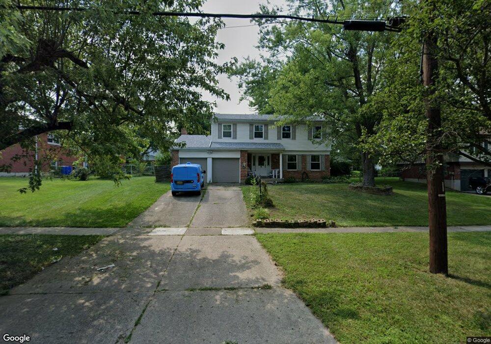
12001 Kenn Rd Cincinnati, OH 45240
Estimated Value: $291,000 - $310,000
4
Beds
3
Baths
1,926
Sq Ft
$156/Sq Ft
Est. Value
About This Home
This home is located at 12001 Kenn Rd, Cincinnati, OH 45240 and is currently estimated at $300,104, approximately $155 per square foot. 12001 Kenn Rd is a home located in Hamilton County with nearby schools including Springdale Elementary School, Princeton Community Middle School, and Princeton High School.
Ownership History
Date
Name
Owned For
Owner Type
Purchase Details
Closed on
Apr 29, 2004
Sold by
Lane Tim B and Lane Kimberly A
Bought by
Holmes Stanley L and Holmes Sarah L
Current Estimated Value
Purchase Details
Closed on
May 15, 1996
Sold by
Mumma Jonathan and Mumma Malia D
Bought by
Lane Tim B
Home Financials for this Owner
Home Financials are based on the most recent Mortgage that was taken out on this home.
Original Mortgage
$88,800
Outstanding Balance
$4,995
Interest Rate
7.86%
Estimated Equity
$295,109
Create a Home Valuation Report for This Property
The Home Valuation Report is an in-depth analysis detailing your home's value as well as a comparison with similar homes in the area
Home Values in the Area
Average Home Value in this Area
Purchase History
| Date | Buyer | Sale Price | Title Company |
|---|---|---|---|
| Holmes Stanley L | $148,400 | -- | |
| Lane Tim B | $111,000 | -- |
Source: Public Records
Mortgage History
| Date | Status | Borrower | Loan Amount |
|---|---|---|---|
| Open | Lane Tim B | $88,800 |
Source: Public Records
Tax History Compared to Growth
Tax History
| Year | Tax Paid | Tax Assessment Tax Assessment Total Assessment is a certain percentage of the fair market value that is determined by local assessors to be the total taxable value of land and additions on the property. | Land | Improvement |
|---|---|---|---|---|
| 2024 | $3,455 | $80,172 | $13,808 | $66,364 |
| 2023 | $3,463 | $80,172 | $13,808 | $66,364 |
| 2022 | $3,054 | $57,509 | $11,568 | $45,941 |
| 2021 | $2,970 | $57,509 | $11,568 | $45,941 |
| 2020 | $3,007 | $57,509 | $11,568 | $45,941 |
| 2019 | $2,782 | $49,155 | $9,888 | $39,267 |
| 2018 | $2,618 | $49,155 | $9,888 | $39,267 |
| 2017 | $2,457 | $49,155 | $9,888 | $39,267 |
| 2016 | $2,320 | $46,060 | $10,325 | $35,735 |
| 2015 | $2,343 | $46,060 | $10,325 | $35,735 |
| 2014 | $2,351 | $46,060 | $10,325 | $35,735 |
| 2013 | $2,445 | $49,000 | $10,983 | $38,017 |
Source: Public Records
Map
Nearby Homes
- 12069 Cantrell Dr
- 12189 Kenn Rd
- 11761 Hanover Rd
- 755 Hanson Dr
- 782 Smiley Ave
- 3323 Devonian Dr
- 11649 Kenn Rd
- 11696 Hinkley Dr
- 21 Aspen Ct
- 780 Fairborn Rd
- 11866 Hitchcock Dr
- 962 Harrogate Ct
- 967 Harrogate Ct
- 11842 Hitchcock Dr
- 19 Caribou Ct
- 659 W Kemper Rd
- 29 Fairgreen Cir Unit 29
- 3745 Mack Rd
- 918 Glasgow Dr
- 3690 Mack Rd
- 12011 Kenn Rd
- 750 Cedarhill Dr
- 12000 Brookston Dr
- 12021 Kenn Rd
- 760 Cedarhill Dr
- 12010 Brookston Dr
- 12020 Brookston Dr
- 12002 Kenn Rd
- 12012 Kenn Rd
- 11992 Kenn Rd
- 11981 Kenn Rd
- 12022 Kenn Rd
- 759 Cedarhill Dr
- 12030 Brookston Dr
- 11995 Brookston Dr
- 767 Cedarhill Dr
- 12015 Brookston Dr
- 12032 Kenn Rd
- 12040 Brookston Dr
- 12001 Chardon Ln