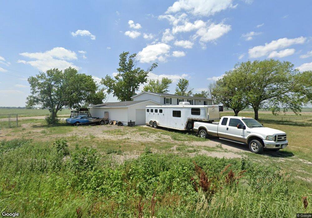
12001 N 162nd St Waverly, NE 68462
Estimated Value: $407,000 - $480,647
3
Beds
2
Baths
2,716
Sq Ft
$165/Sq Ft
Est. Value
About This Home
This home is located at 12001 N 162nd St, Waverly, NE 68462 and is currently estimated at $448,412, approximately $165 per square foot. 12001 N 162nd St is a home located in Lancaster County with nearby schools including Waverly High School.
Ownership History
Date
Name
Owned For
Owner Type
Purchase Details
Closed on
Mar 12, 2025
Sold by
Balvin Sonny and Balvin Tara Jo
Bought by
Schmutzler Skyler
Current Estimated Value
Home Financials for this Owner
Home Financials are based on the most recent Mortgage that was taken out on this home.
Original Mortgage
$119,658
Outstanding Balance
$118,952
Interest Rate
6.95%
Mortgage Type
FHA
Estimated Equity
$329,460
Purchase Details
Closed on
Jun 30, 2011
Sold by
Hansen Lorrinda M
Bought by
Balvin Sheila M
Home Financials for this Owner
Home Financials are based on the most recent Mortgage that was taken out on this home.
Original Mortgage
$56,300
Interest Rate
4.52%
Mortgage Type
New Conventional
Purchase Details
Closed on
Sep 12, 2008
Sold by
Ostmann Walter B and Ostmann Karin
Bought by
Hansen Lorrinda M
Create a Home Valuation Report for This Property
The Home Valuation Report is an in-depth analysis detailing your home's value as well as a comparison with similar homes in the area
Home Values in the Area
Average Home Value in this Area
Purchase History
| Date | Buyer | Sale Price | Title Company |
|---|---|---|---|
| Schmutzler Skyler | $172,000 | Investors Title | |
| Balvin Sheila M | $55,000 | Nlta | |
| Hansen Lorrinda M | $145,000 | Ct |
Source: Public Records
Mortgage History
| Date | Status | Borrower | Loan Amount |
|---|---|---|---|
| Open | Schmutzler Skyler | $119,658 | |
| Previous Owner | Balvin Sheila M | $56,300 |
Source: Public Records
Tax History Compared to Growth
Tax History
| Year | Tax Paid | Tax Assessment Tax Assessment Total Assessment is a certain percentage of the fair market value that is determined by local assessors to be the total taxable value of land and additions on the property. | Land | Improvement |
|---|---|---|---|---|
| 2025 | $3,696 | $360,100 | $114,800 | $245,300 |
| 2024 | $3,696 | $368,100 | $114,800 | $253,300 |
| 2023 | $4,751 | $357,400 | $114,800 | $242,600 |
| 2022 | $4,747 | $287,400 | $60,000 | $227,400 |
| 2021 | $4,438 | $287,400 | $60,000 | $227,400 |
| 2020 | $3,960 | $253,700 | $54,000 | $199,700 |
| 2019 | $3,952 | $253,700 | $54,000 | $199,700 |
| 2018 | $3,112 | $195,600 | $42,000 | $153,600 |
| 2017 | $3,128 | $195,600 | $42,000 | $153,600 |
| 2016 | $2,610 | $163,100 | $18,000 | $145,100 |
| 2015 | $2,591 | $163,100 | $18,000 | $145,100 |
| 2014 | $2,358 | $147,200 | $18,000 | $129,200 |
| 2013 | -- | $147,200 | $18,000 | $129,200 |
Source: Public Records
Map
Nearby Homes
- TBD Block 6 Lot 3
- TBD Block 2 Lot 3
- TBD Block 7 Lot 7
- TBD Block 2 Lot 4
- TBD Block 6 Lot 8
- TBD Block 7 Lot 8
- TBD Block 2 Lot 2
- TBD Block 16 Lot 28
- TBD Block 10 Lot 32
- TBD Block 2 Lot 1
- TBD Block 10 Lot 33
- TBD Block 7 Lot 5
- Mill Road and N 162nd Street Block 1 Lot 1
- TBD Block 6 Lot 7
- TBD Block 10 Lot 23
- TBD Block 10 Lot 31
- TBD Block 10 Lot27
- TBD
- TBD Block 10 Lot 26
- TBD Block 10 Lot 25