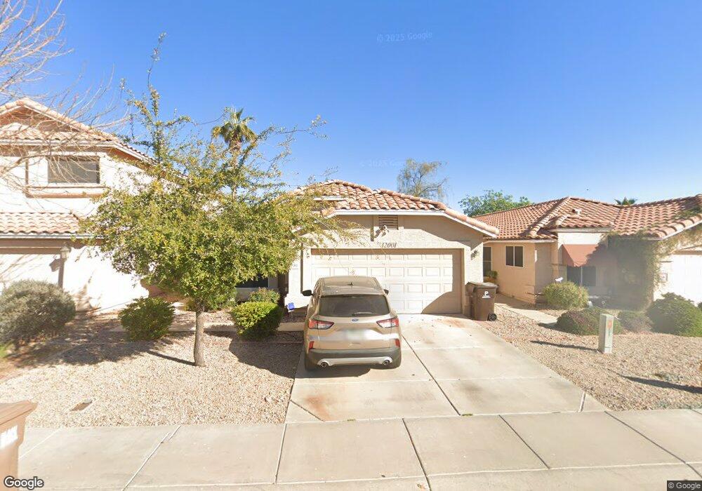
12001 N 79th Dr Peoria, AZ 85345
Estimated Value: $296,559 - $347,000
--
Bed
2
Baths
1,256
Sq Ft
$266/Sq Ft
Est. Value
About This Home
This home is located at 12001 N 79th Dr, Peoria, AZ 85345 and is currently estimated at $333,890, approximately $265 per square foot. 12001 N 79th Dr is a home located in Maricopa County with nearby schools including Cheyenne Elementary School and Peoria High School.
Ownership History
Date
Name
Owned For
Owner Type
Purchase Details
Closed on
Feb 16, 2009
Sold by
Patterson Linda
Bought by
Calvin Joseph Marion and Patterson Linda Marie
Current Estimated Value
Purchase Details
Closed on
Apr 11, 1998
Sold by
Patterson Michael and Patterson Linda M
Bought by
Patterson Linda M
Home Financials for this Owner
Home Financials are based on the most recent Mortgage that was taken out on this home.
Original Mortgage
$27,150
Interest Rate
7.15%
Create a Home Valuation Report for This Property
The Home Valuation Report is an in-depth analysis detailing your home's value as well as a comparison with similar homes in the area
Home Values in the Area
Average Home Value in this Area
Purchase History
| Date | Buyer | Sale Price | Title Company |
|---|---|---|---|
| Calvin Joseph Marion | -- | None Available | |
| Patterson Linda M | -- | Arizona Title Agency |
Source: Public Records
Mortgage History
| Date | Status | Borrower | Loan Amount |
|---|---|---|---|
| Closed | Patterson Linda M | $27,150 |
Source: Public Records
Tax History Compared to Growth
Tax History
| Year | Tax Paid | Tax Assessment Tax Assessment Total Assessment is a certain percentage of the fair market value that is determined by local assessors to be the total taxable value of land and additions on the property. | Land | Improvement |
|---|---|---|---|---|
| 2025 | $876 | $11,571 | -- | -- |
| 2024 | $887 | $11,020 | -- | -- |
| 2023 | $887 | $23,330 | $4,660 | $18,670 |
| 2022 | $869 | $17,820 | $3,560 | $14,260 |
| 2021 | $930 | $15,980 | $3,190 | $12,790 |
| 2020 | $939 | $16,020 | $3,200 | $12,820 |
| 2019 | $908 | $14,280 | $2,850 | $11,430 |
| 2018 | $878 | $13,370 | $2,670 | $10,700 |
| 2017 | $879 | $12,510 | $2,500 | $10,010 |
| 2016 | $870 | $11,820 | $2,360 | $9,460 |
| 2015 | $812 | $10,960 | $2,190 | $8,770 |
Source: Public Records
Map
Nearby Homes
- 11963 N 80th Ave
- 7953 W Kirby St
- 7995 W Kirby St Unit 38A
- 11535 N 79th Dr Unit 2
- 8021 W Charter Oak Rd
- 11507 N 79th Dr
- 7825 W Bloomfield Rd
- 11525 N 81st Ave
- 7920 W Greer Ave
- 7638 W Shaw Butte Dr
- 7583 W Gelding Dr
- 8007 W Corrine Dr
- 11320 N 80th Dr
- 8119 W Corrine Dr Unit 1
- 7545 W Jenan Dr
- 12677 N 77th Dr
- 11221 N 77th Ave
- 8102 W Windrose Dr Unit 1
- 11640 N 74th Dr
- 11891 N 84th Ln
- 12005 N 79th Dr
- 11959 N 79th Dr
- 11955 N 79th Dr
- 12009 N 79th Dr
- 11920 N 79th Ave
- 12013 N 79th Dr
- 11951 N 79th Dr
- 11914 N 79th Ave
- 11926 N 79th Ave
- 7922 W Laurel Ln
- 12002 N 79th Dr
- 12006 N 79th Dr
- 12017 N 79th Dr
- 12010 N 79th Dr
- 11908 N 79th Ave
- 7915 W Laurel Ln
- 12021 N 79th Dr
- 11932 N 79th Ave
- 7930 W Laurel Ln
- 7919 W Laurel Ln