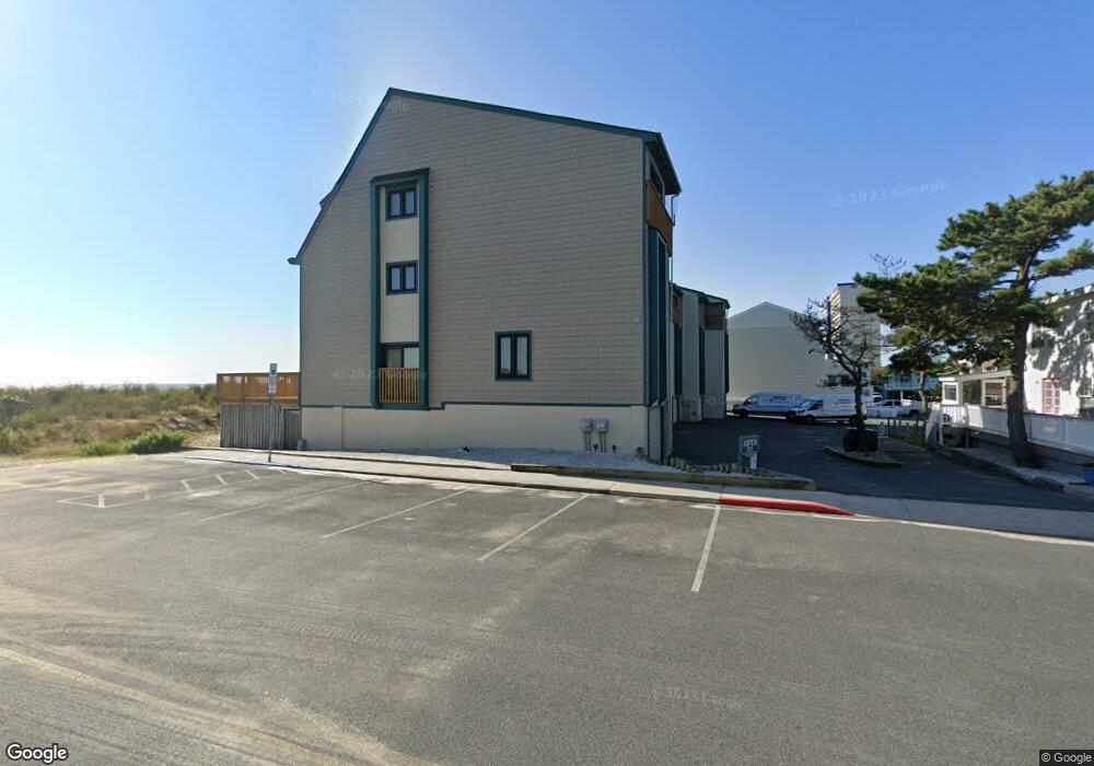
12005 Wight St Unit 5 Ocean City, MD 21842
Estimated Value: $1,045,000 - $1,469,000
4
Beds
4
Baths
1,928
Sq Ft
$643/Sq Ft
Est. Value
About This Home
This home is located at 12005 Wight St Unit 5, Ocean City, MD 21842 and is currently estimated at $1,239,757, approximately $643 per square foot. 12005 Wight St Unit 5 is a home located in Worcester County with nearby schools including Ocean City Elementary School, Stephen Decatur Middle School, and Berlin Intermediate School.
Ownership History
Date
Name
Owned For
Owner Type
Purchase Details
Closed on
Mar 17, 2010
Sold by
Glickfield Louis and Glickfield Marilyn
Bought by
Marilyn Glickfield Dynasty Trust
Current Estimated Value
Purchase Details
Closed on
Apr 8, 1987
Sold by
Sackadorf Leonard and Sackadorf Ruth
Bought by
Glickfield Louis and Glickfield Marilyn
Purchase Details
Closed on
Jul 24, 1984
Sold by
Miller Henry C and Miller Darlene M
Bought by
Sackadorf Leonard and Sackadorf Ruth
Create a Home Valuation Report for This Property
The Home Valuation Report is an in-depth analysis detailing your home's value as well as a comparison with similar homes in the area
Home Values in the Area
Average Home Value in this Area
Purchase History
| Date | Buyer | Sale Price | Title Company |
|---|---|---|---|
| Marilyn Glickfield Dynasty Trust | -- | -- | |
| Glickfield Louis | $310,000 | -- | |
| Sackadorf Leonard | $260,000 | -- |
Source: Public Records
Tax History Compared to Growth
Tax History
| Year | Tax Paid | Tax Assessment Tax Assessment Total Assessment is a certain percentage of the fair market value that is determined by local assessors to be the total taxable value of land and additions on the property. | Land | Improvement |
|---|---|---|---|---|
| 2025 | $14,804 | $1,084,100 | $0 | $0 |
| 2024 | $14,222 | $1,019,200 | $0 | $0 |
| 2023 | $13,412 | $954,300 | $668,000 | $286,300 |
| 2022 | $12,725 | $905,467 | $0 | $0 |
| 2021 | $12,105 | $856,633 | $0 | $0 |
| 2020 | $11,413 | $807,800 | $565,400 | $242,400 |
| 2019 | $10,934 | $768,600 | $0 | $0 |
| 2018 | $10,273 | $729,400 | $0 | $0 |
| 2017 | $9,750 | $690,200 | $0 | $0 |
| 2016 | -- | $667,067 | $0 | $0 |
| 2015 | $8,283 | $643,933 | $0 | $0 |
| 2014 | $8,283 | $620,800 | $0 | $0 |
Source: Public Records
Map
Nearby Homes
- 8 121st St Unit 202
- 12102 Assawoman Dr Unit 207B SEA LOFT
- 12101 Assawoman Dr Unit 203
- 11903 Wight St Unit 202
- 12108 Coastal Hwy Unit 301
- 12108 Coastal Hwy Unit 204
- 12108 Coastal Hwy Unit 404
- 12108 Coastal Hwy Unit 303
- 12201 Wight St Unit 301
- 11900 Coastal Hwy Unit 102
- 12 122nd St Unit 3I
- 12 122nd St Unit 3B
- 114 Georgia Ave
- 4 123rd St
- 12305 Wight St Unit 102
- 12305 Wight St Unit 310
- 103 123rd St
- 103 123rd St
- 11700 Coastal Hwy Unit 1109
- 11700 Coastal Hwy Unit 1805
- 12005 Wight St Unit 3
- 12005 Wight St Unit 4
- 12005 Wight St Unit 2
- 12005 Wight St Unit 1
- 12005 Wight St Unit 6
- 12005 Wight St Unit 7
- 12005 Wight St Unit S
- 12005 Wight St Unit 8
- 12012 Assawoman Dr
- 12010 Assawoman Dr
- 12006 Assawoman Dr Unit 101
- 12006 Assawoman Dr Unit 106
- 12006 Assawoman Dr Unit 10102
- 12006 Assawoman Dr Unit 401
- 12006 Assawoman Dr Unit 301
- 12006 Assawoman Dr Unit 201
- 12006 Assawoman Dr Unit 102
- 12008 Assawoman Dr Unit 1
- 12008 Assawoman Dr Unit 4
- 12008 Assawoman Dr Unit 10502