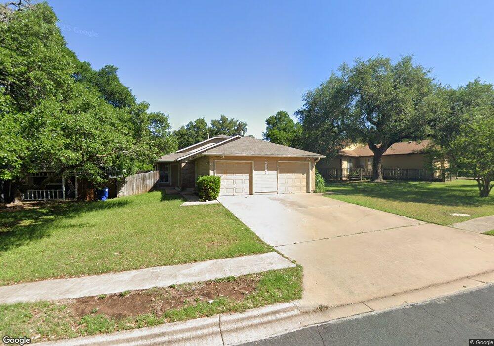
12006 Arrowwood Dr Unit A Austin, TX 78727
Milwood NeighborhoodEstimated Value: $394,000 - $530,075
2
Beds
2
Baths
1,777
Sq Ft
$273/Sq Ft
Est. Value
About This Home
This home is located at 12006 Arrowwood Dr Unit A, Austin, TX 78727 and is currently estimated at $485,519, approximately $273 per square foot. 12006 Arrowwood Dr Unit A is a home located in Travis County with nearby schools including Summitt Elementary School, Murchison Middle School, and Anderson High School.
Ownership History
Date
Name
Owned For
Owner Type
Purchase Details
Closed on
Jul 30, 2014
Sold by
Landry Christopher J
Bought by
Dadfar Kobra
Current Estimated Value
Purchase Details
Closed on
May 25, 2006
Sold by
Tonn Norma and Papke Sandra
Bought by
Landry Christopher J
Home Financials for this Owner
Home Financials are based on the most recent Mortgage that was taken out on this home.
Original Mortgage
$144,000
Interest Rate
6.5%
Mortgage Type
Purchase Money Mortgage
Purchase Details
Closed on
Jan 3, 1996
Sold by
Casden Les and Casden Beatrice
Bought by
Tonn Norma and Papke Sandra
Home Financials for this Owner
Home Financials are based on the most recent Mortgage that was taken out on this home.
Original Mortgage
$108,487
Interest Rate
7.31%
Create a Home Valuation Report for This Property
The Home Valuation Report is an in-depth analysis detailing your home's value as well as a comparison with similar homes in the area
Home Values in the Area
Average Home Value in this Area
Purchase History
| Date | Buyer | Sale Price | Title Company |
|---|---|---|---|
| Dadfar Kobra | -- | Independence Title | |
| Landry Christopher J | -- | North American Title | |
| Tonn Norma | -- | -- |
Source: Public Records
Mortgage History
| Date | Status | Borrower | Loan Amount |
|---|---|---|---|
| Previous Owner | Landry Christopher J | $144,000 | |
| Previous Owner | Tonn Norma | $108,487 |
Source: Public Records
Tax History Compared to Growth
Tax History
| Year | Tax Paid | Tax Assessment Tax Assessment Total Assessment is a certain percentage of the fair market value that is determined by local assessors to be the total taxable value of land and additions on the property. | Land | Improvement |
|---|---|---|---|---|
| 2025 | $10,519 | $480,000 | $262,994 | $217,006 |
| 2023 | $10,105 | $558,535 | $150,000 | $408,535 |
| 2022 | $10,747 | $544,197 | $150,000 | $394,197 |
| 2021 | $8,875 | $407,720 | $150,000 | $257,720 |
| 2020 | $7,306 | $340,642 | $150,000 | $190,642 |
| 2018 | $3,699 | $167,095 | $40,000 | $127,095 |
| 2017 | $3,708 | $166,259 | $40,000 | $126,259 |
| 2016 | $3,708 | $166,259 | $40,000 | $126,259 |
| 2015 | $4,419 | $185,682 | $40,000 | $145,682 |
| 2014 | $4,419 | $185,682 | $40,000 | $145,682 |
Source: Public Records
Map
Nearby Homes
- 12103 Wycliff Ln
- 12203 Arrowwood Dr
- 4400 Switch Willo Unit 21
- 4006 Eton Ln
- 4508 Duval Rd Unit 6602
- 12223 Antoinette Place
- 4812 Pelham Dr
- 12319 Wycliff Ln
- 3901 Skipton Dr
- 11718 Running Fox Trail
- 12005 Mustang Chase
- 11716 Running Fox Trail
- 12404 Sceptre Cove
- 4304 Red Cloud Dr
- 5001 Dull Knife Dr
- 4503 Beaver Creek Dr
- 4605 Beaver Creek Dr
- 4606 Gray Fox Dr
- 4612 Ganymede Dr
- 12302 Havelock Dr
- 12006 Arrowwood Dr Unit B
- 12006 Arrowwood Dr
- 12004 Arrowwood Dr
- 12004 Arrowwood Dr Unit A & B
- 12004 Arrowwood Dr Unit B
- 12004 Arrowwood Dr Unit B
- 12008 Arrowwood Dr
- 4503 Dorsett Oaks Cir Unit B
- 4503 Dorsett Oaks Cir Unit A
- 4503 Dorsett Oaks Cir
- 12100 Arrowwood Dr
- 12100 Arrowwood Dr Unit A
- 12002 Arrowwood Dr Unit B
- 4501 Dorsett Oaks Cir Unit B
- 4501 Dorsett Oaks Cir
- 12009 Arrowwood Dr
- 12007 Arrowwood Dr Unit B
- 12007 Arrowwood Dr
- 4505 Dorsett Oaks Cir
- 12102 Arrowwood Dr Unit A