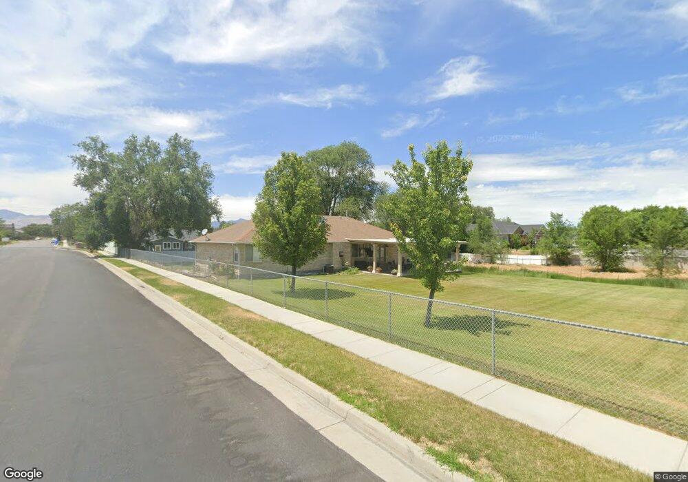
12007 S 1300 W Riverton, UT 84065
Estimated Value: $625,000 - $816,010
6
Beds
3
Baths
4,000
Sq Ft
$190/Sq Ft
Est. Value
About This Home
This home is located at 12007 S 1300 W, Riverton, UT 84065 and is currently estimated at $759,003, approximately $189 per square foot. 12007 S 1300 W is a home located in Salt Lake County with nearby schools including Rosamond Elementary School, Oquirrh Hills Middle School, and Riverton High School.
Ownership History
Date
Name
Owned For
Owner Type
Purchase Details
Closed on
Mar 8, 2016
Sold by
Maynard Raymond J and Maynard Wendy J
Bought by
Maynard Raymond J and Maynard Wendy J
Current Estimated Value
Purchase Details
Closed on
Nov 18, 2003
Sold by
Schow Mark H
Bought by
City Of Riverton
Purchase Details
Closed on
May 1, 2003
Sold by
Household Finance Corp Iii
Bought by
Schow Mark H
Home Financials for this Owner
Home Financials are based on the most recent Mortgage that was taken out on this home.
Original Mortgage
$207,000
Interest Rate
5.72%
Purchase Details
Closed on
Jul 1, 1998
Sold by
Nebeker Blair William and Birch Frederick D
Bought by
Maynard Raymond and Maynard Wendy
Home Financials for this Owner
Home Financials are based on the most recent Mortgage that was taken out on this home.
Original Mortgage
$212,100
Interest Rate
7%
Create a Home Valuation Report for This Property
The Home Valuation Report is an in-depth analysis detailing your home's value as well as a comparison with similar homes in the area
Home Values in the Area
Average Home Value in this Area
Purchase History
| Date | Buyer | Sale Price | Title Company |
|---|---|---|---|
| Maynard Raymond J | -- | None Available | |
| City Of Riverton | -- | -- | |
| Schow Mark H | -- | Equity Title | |
| Maynard Raymond | -- | -- |
Source: Public Records
Mortgage History
| Date | Status | Borrower | Loan Amount |
|---|---|---|---|
| Previous Owner | Schow Mark H | $207,000 | |
| Previous Owner | Maynard Raymond | $212,100 |
Source: Public Records
Tax History Compared to Growth
Tax History
| Year | Tax Paid | Tax Assessment Tax Assessment Total Assessment is a certain percentage of the fair market value that is determined by local assessors to be the total taxable value of land and additions on the property. | Land | Improvement |
|---|---|---|---|---|
| 2025 | -- | $722,000 | $319,200 | $402,800 |
| 2024 | -- | $694,700 | $310,100 | $384,600 |
| 2023 | $1,410 | $669,000 | $304,000 | $365,000 |
| 2022 | $1,410 | $680,700 | $298,000 | $382,700 |
| 2021 | $728 | $519,600 | $252,700 | $266,900 |
| 2020 | $3,725 | $448,700 | $251,400 | $197,300 |
| 2019 | $348 | $426,100 | $247,500 | $178,600 |
| 2018 | $348 | $395,000 | $157,800 | $237,200 |
| 2017 | $347 | $373,400 | $157,800 | $215,600 |
| 2016 | $1,799 | $349,300 | $157,800 | $191,500 |
| 2015 | $1,792 | $335,000 | $180,800 | $154,200 |
| 2014 | $1,683 | $309,500 | $169,200 | $140,300 |
Source: Public Records
Map
Nearby Homes
- 1184 W Margaret Rose Dr
- 1182 River Hills Dr
- 11860 S Alysum Cir
- 1337 Natasha Cir
- 12091 S Lampton View Dr
- 1410 W 12115 S
- 12216 S 1300 W
- 11784 Stone Ridge Ct
- 12294 S 1490 W
- 12392 S 1300 W
- 11711 Stone Crest Cir
- 11664 S Lampton View Dr
- 11694 Stone Crest Cir
- 1611 W Laurel Chase Dr
- 11622 S Halcom Dr Unit 601
- 1661 W Madison View Dr
- 11606 S Halcom Dr
- 1182 Country Ridge Dr
- 12566 S Tithing Hill Dr
- 1172 Country Ridge Dr
- 11692 S 1270 W Unit 2
- 11677 S 1270 W Unit 7
- 11676 S 1270 W Unit 1
- 1269 Sirmingo Way
- 12009 S 1300 W
- 1246 Sirmingo Way
- 1251 High River Cir
- 1278 High River Cir
- 1278 W High River Cir
- 11981 S 1300 W
- 1241 W Sirmingo Way
- 1241 Sirmingo Way
- 1289 Sirmingo Way
- 1289 W Sirmingo Way
- 11979 S 1300 W
- 12066 Moonwalk Cir
- 1281 Sirmingo Way
- 1237 High River Cir
- 12063 Moonwalk Cir
- 12063 S Moonwalk Cir