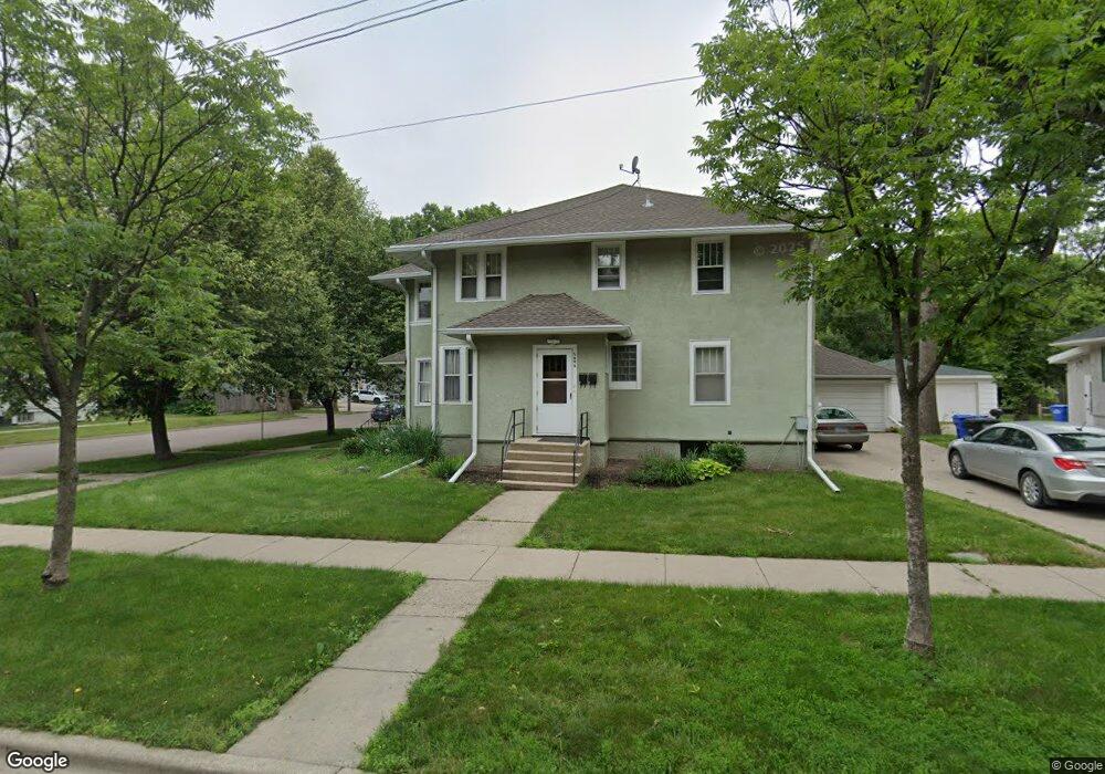
1201 10th Ave N Fargo, ND 58102
Roosevelt NeighborhoodEstimated Value: $257,000 - $317,000
--
Bed
--
Bath
1,200
Sq Ft
$241/Sq Ft
Est. Value
About This Home
This home is located at 1201 10th Ave N, Fargo, ND 58102 and is currently estimated at $288,667, approximately $240 per square foot. 1201 10th Ave N is a home located in Cass County with nearby schools including Horace Mann Roosevelt Elementary School, Ben Franklin Middle School, and North High School.
Ownership History
Date
Name
Owned For
Owner Type
Purchase Details
Closed on
Jan 28, 2016
Sold by
Elfstrum Kenneth E and Elfstrum Karlene K
Bought by
Elfstrum Properties Llc
Current Estimated Value
Purchase Details
Closed on
Feb 19, 2015
Sold by
Sizemore Lisa S and Sizemore Terry B
Bought by
Elfstrum Kenneth and Elfstrum Karlene
Create a Home Valuation Report for This Property
The Home Valuation Report is an in-depth analysis detailing your home's value as well as a comparison with similar homes in the area
Home Values in the Area
Average Home Value in this Area
Purchase History
| Date | Buyer | Sale Price | Title Company |
|---|---|---|---|
| Elfstrum Properties Llc | -- | None Available | |
| Elfstrum Kenneth | -- | None Available |
Source: Public Records
Tax History Compared to Growth
Tax History
| Year | Tax Paid | Tax Assessment Tax Assessment Total Assessment is a certain percentage of the fair market value that is determined by local assessors to be the total taxable value of land and additions on the property. | Land | Improvement |
|---|---|---|---|---|
| 2024 | $3,951 | $126,200 | $21,550 | $104,650 |
| 2023 | $3,773 | $120,200 | $21,550 | $98,650 |
| 2022 | $3,412 | $112,350 | $21,550 | $90,800 |
| 2021 | $3,024 | $99,850 | $21,550 | $78,300 |
| 2020 | $2,989 | $99,850 | $21,550 | $78,300 |
| 2019 | $2,353 | $75,650 | $10,000 | $65,650 |
| 2018 | $2,327 | $75,650 | $10,000 | $65,650 |
| 2017 | $1,944 | $72,050 | $10,000 | $62,050 |
| 2016 | $1,727 | $69,950 | $10,000 | $59,950 |
| 2015 | $2,219 | $85,150 | $8,450 | $76,700 |
| 2014 | $1,987 | $74,050 | $8,450 | $65,600 |
| 2013 | $1,960 | $74,050 | $8,450 | $65,600 |
Source: Public Records
Map
Nearby Homes
- 1012 12th St N
- 1015 12th St N
- 1036 12th St N
- 1010 University Dr N
- 1026 University Dr N
- 1001 9th Ave N
- 1109 10th St N
- 824 9th St N
- 735 14th St N
- 729 14th St N
- 1115 9th St N
- 1116 7th St N
- 1037 8th St N
- 722 11th Ave N
- 911 8th St N
- 717 9th St N
- 703 & 705 10th Ave N
- 806 7th St N
- 804 7th St N
- 624 10th Ave N
- 1215 10th Ave N
- 1006 12th St N
- 1217 10th Ave N
- 914 12th St N
- 1119 10th Ave N
- 1005 12th St N
- 1005 12th St N Unit 1007
- 1208 10th Ave N
- 1016 12th St N
- 1005 University Dr N
- 1005 University Dr N Unit 1007
- 910 12th St N
- 1117 10th Ave N
- 1009 12th St N
- 1221 10th Ave N Unit 5
- 1221 10th Ave N Unit 2
- 1221 10th Ave N Unit 9
- 1221 10th Ave N Unit 10
- 1221 10th Ave N Unit 6
- 1221 10th Ave N Unit 3