Estimated Value: $280,000 - $416,000
Studio
3
Baths
2,254
Sq Ft
$147/Sq Ft
Est. Value
About This Home
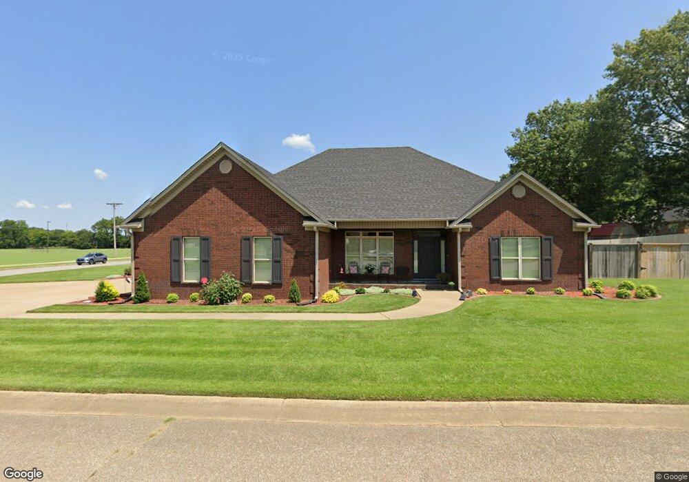
This home is located at 1201 Blake, Wynne, AR 72396 and is currently estimated at $332,281, approximately $147 per square foot. 1201 Blake is a home located in Cross County with nearby schools including Wynne Intermediate School, Wynne Primary School, and Wynne Junior High School.
Ownership History
Date
Name
Owned For
Owner Type
Purchase Details
Closed on
Jun 5, 2019
Sold by
Cooper Living Trust
Bought by
Machen Lee S and Machen Laura Denton
Current Estimated Value
Home Financials for this Owner
Home Financials are based on the most recent Mortgage that was taken out on this home.
Original Mortgage
$192,000
Outstanding Balance
$168,112
Interest Rate
4.1%
Mortgage Type
New Conventional
Estimated Equity
$164,169
Purchase Details
Closed on
Feb 23, 2005
Sold by
Roberts Patsy B and Haralson Jerry D
Bought by
Cooper Ann Hayes and Ann Hayes Cooper Living Trust
Purchase Details
Closed on
Jul 9, 2004
Bought by
Roberts Patsy B
Create a Home Valuation Report for This Property
The Home Valuation Report is an in-depth analysis detailing your home's value as well as a comparison with similar homes in the area
Purchase History
| Date | Buyer | Sale Price | Title Company |
|---|---|---|---|
| Machen Lee S | $240,000 | Cowling Title | |
| Cooper Ann Hayes | $200,000 | None Available | |
| Roberts Patsy B | $23,500 | -- |
Source: Public Records
Mortgage History
| Date | Status | Borrower | Loan Amount |
|---|---|---|---|
| Open | Machen Lee S | $192,000 |
Source: Public Records
Tax History
| Year | Tax Paid | Tax Assessment Tax Assessment Total Assessment is a certain percentage of the fair market value that is determined by local assessors to be the total taxable value of land and additions on the property. | Land | Improvement |
|---|---|---|---|---|
| 2025 | $1,784 | $70,800 | $7,170 | $63,630 |
| 2024 | $1,884 | $48,250 | $5,240 | $43,010 |
| 2023 | $1,963 | $48,250 | $5,240 | $43,010 |
| 2022 | $2,013 | $48,250 | $5,240 | $43,010 |
| 2021 | $2,013 | $48,250 | $5,240 | $43,010 |
| 2020 | $1,618 | $43,230 | $5,240 | $37,990 |
| 2019 | $1,954 | $39,470 | $4,240 | $35,230 |
| 2018 | $1,530 | $39,150 | $3,920 | $35,230 |
| 2017 | $1,530 | $39,170 | $3,940 | $35,230 |
| 2016 | $1,530 | $39,170 | $3,940 | $35,230 |
| 2015 | $1,530 | $39,170 | $3,940 | $35,230 |
| 2014 | $1,530 | $37,970 | $4,690 | $33,280 |
Source: Public Records
Map
Nearby Homes
- 1308 Killough Rd N
- 1201 Peterson Dr
- 1404 Airpark Rd
- 1406 Airpark Rd
- 909 Killough Rd N
- 1011 Hilltop Dr
- 1310 Forrest Ave E
- 1405 Peterson Rd
- 226 Nathan Dr E
- 1204 Forrest Ave E
- 2092 N Killough Rd
- 108 Nathan Dr E
- 109 Nathan Dr E
- 594 Malone St N
- 39 Morningside Dr
- 916 Forrest Ave E
- 621 Lemons St N
- 1106 Marion Dr
- 1420 Hamilton Ave E
- 1104 Hamilton Ave E
- 1304 Killough Rd N
- 1209 Blake
- 1204 Killough Rd N
- 1200 Blake
- 1213 Blake
- 1320 Killough Rd N
- 1204 Blake
- 1200 Killough Rd N
- 1348 Killough Rd N
- 1208 Blake
- 1304 Bridges Ave E
- 1212 Blake
- 1224 Blake
- 1376 Killough Rd N
- 1205 Peterson Rd
- 1215 Peterson Rd
- 1380 Killough Rd N
- 1010 Killough Rd N
- 1310 Bridges Ave E
- 1007 Killough Rd N
Your Personal Tour Guide
Ask me questions while you tour the home.