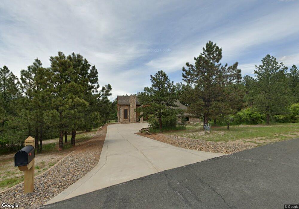
1201 Buttermilk Rd Larkspur, CO 80118
Estimated Value: $1,233,000 - $1,362,339
2
Beds
3
Baths
3,599
Sq Ft
$363/Sq Ft
Est. Value
About This Home
This home is located at 1201 Buttermilk Rd, Larkspur, CO 80118 and is currently estimated at $1,307,780, approximately $363 per square foot. 1201 Buttermilk Rd is a home located in Douglas County with nearby schools including Larkspur Elementary School, Castle Rock Middle School, and Castle View High School.
Ownership History
Date
Name
Owned For
Owner Type
Purchase Details
Closed on
Oct 14, 1994
Sold by
Richardson John G
Bought by
Bissener Christopher John and Hammer Laurel A
Current Estimated Value
Purchase Details
Closed on
Aug 17, 1994
Sold by
Richardson John G
Bought by
Broyles Cecil D
Purchase Details
Closed on
Jun 9, 1993
Sold by
Douglas County Treasurer
Bought by
Richardson John G
Purchase Details
Closed on
Aug 26, 1983
Sold by
Mentz John W and Mentz Janice B
Bought by
Broyles Cecil D
Create a Home Valuation Report for This Property
The Home Valuation Report is an in-depth analysis detailing your home's value as well as a comparison with similar homes in the area
Home Values in the Area
Average Home Value in this Area
Purchase History
| Date | Buyer | Sale Price | Title Company |
|---|---|---|---|
| Bissener Christopher John | $46,500 | -- | |
| Broyles Cecil D | -- | -- | |
| Richardson John G | -- | -- | |
| Broyles Cecil D | $22,500 | -- |
Source: Public Records
Tax History Compared to Growth
Tax History
| Year | Tax Paid | Tax Assessment Tax Assessment Total Assessment is a certain percentage of the fair market value that is determined by local assessors to be the total taxable value of land and additions on the property. | Land | Improvement |
|---|---|---|---|---|
| 2024 | $8,084 | $86,630 | $36,390 | $50,240 |
| 2023 | $8,165 | $86,630 | $36,390 | $50,240 |
| 2022 | $6,670 | $70,410 | $24,820 | $45,590 |
| 2021 | $6,903 | $70,410 | $24,820 | $45,590 |
| 2020 | $6,466 | $67,310 | $20,670 | $46,640 |
| 2019 | $6,487 | $67,310 | $20,670 | $46,640 |
| 2018 | $5,737 | $58,480 | $16,880 | $41,600 |
| 2017 | $5,392 | $58,480 | $16,880 | $41,600 |
| 2016 | $5,356 | $57,130 | $13,210 | $43,920 |
| 2015 | $2,619 | $57,130 | $13,210 | $43,920 |
| 2014 | $2,663 | $54,470 | $15,920 | $38,550 |
Source: Public Records
Map
Nearby Homes
- Lot 3 Silverheels Dr
- 1038 Tenderfoot Dr
- 950 Tenderfoot Dr
- 1025 Tenderfoot Dr
- 7994 Monarch Rd
- 929 Tenderfoot Dr
- 691 Cumberland Rd
- 0 E Cherry Creek Rd Unit 2541327
- 0 E Cherry Creek Rd Unit REC1786246
- 7596 Rollins Dr
- 2143 Perry Park Ave
- 1600 Independence Dr Unit 50
- 7737 Taylor Cir
- 1065 Independence Dr
- 670 Independence Dr
- 233 Perry Park Ave
- 1935 Poncha Ct
- 9273 Curtis Rd
- 7317 Fremont Place
- 1653 Gore Dr
- 1150 Buttermilk Rd
- 1283 Buttermilk Rd
- 1056 Buttermilk Rd
- 1065 Buttermilk Rd
- 1295 Silverheels Dr
- 1802 Silverheels Dr
- 3 Silverheels Dr
- 1 Silverheels Dr
- 1100 Silverheels Dr
- Lot 4 Silverheels Dr
- 1098 Silverheels Dr
- 1023 Buttermilk Rd
- 1149 Silverheels Dr
- 1321 Buttermilk Rd
- 1382 Quartz Mountain Rd
- 1282 Quartz Mountain Rd
- 1248 Silverheels Dr
- 1194 Silverheels Dr
- 1400 Quartz Mountain Dr
- 1350 Buttermilk Rd