Estimated Value: $143,000 - $169,000
3
Beds
2
Baths
884
Sq Ft
$181/Sq Ft
Est. Value
About This Home
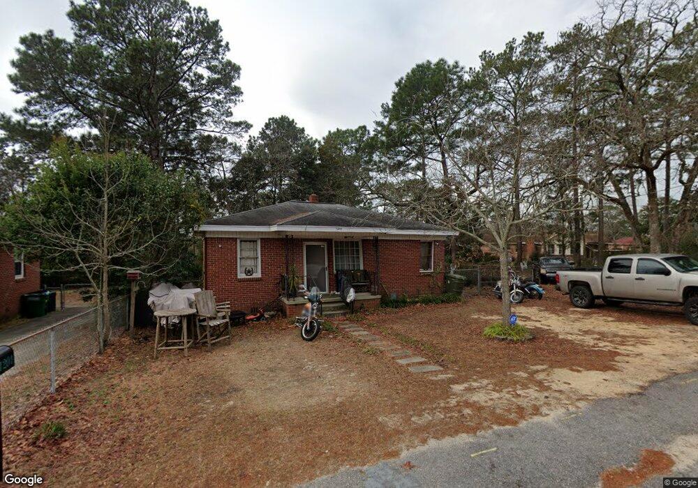
This home is located at 1201 Decatur St, Cayce, SC 29033 and is currently estimated at $159,754, approximately $180 per square foot. 1201 Decatur St is a home located in Lexington County with nearby schools including Cayce Elementary, Cyril B. Busbee Creative Arts Academy, and Brookland-Cayce High School.
Ownership History
Date
Name
Owned For
Owner Type
Purchase Details
Closed on
Oct 12, 2023
Sold by
Hemard Edward J and Colton Susan Hemard
Bought by
Rivas Tracy Cecilia
Current Estimated Value
Purchase Details
Closed on
Jun 10, 2010
Sold by
Estate Of Clare Brady Hemard and Hemard Edward J
Bought by
Hemard Edward J and Colton Susan Hemard
Purchase Details
Closed on
Nov 9, 2009
Sold by
Estate Of Dorothy Helen Bell and Colton Susan H
Bought by
Hemard Claire Brady
Create a Home Valuation Report for This Property
The Home Valuation Report is an in-depth analysis detailing your home's value as well as a comparison with similar homes in the area
Home Values in the Area
Average Home Value in this Area
Purchase History
| Date | Buyer | Sale Price | Title Company |
|---|---|---|---|
| Rivas Tracy Cecilia | -- | None Listed On Document | |
| Hemard Edward J | -- | -- | |
| Hemard Claire Brady | -- | -- |
Source: Public Records
Tax History
| Year | Tax Paid | Tax Assessment Tax Assessment Total Assessment is a certain percentage of the fair market value that is determined by local assessors to be the total taxable value of land and additions on the property. | Land | Improvement |
|---|---|---|---|---|
| 2024 | $739 | $4,000 | $800 | $3,200 |
| 2023 | $722 | $3,387 | $1,080 | $2,307 |
| 2022 | $1,218 | $3,387 | $1,080 | $2,307 |
| 2020 | $1,278 | $3,387 | $1,080 | $2,307 |
| 2019 | $1,085 | $3,040 | $1,080 | $1,960 |
| 2018 | $1,032 | $3,040 | $1,080 | $1,960 |
| 2017 | $1,016 | $3,040 | $1,080 | $1,960 |
| 2016 | $1,022 | $3,039 | $1,080 | $1,959 |
| 2014 | $961 | $3,329 | $1,080 | $2,249 |
| 2013 | -- | $3,330 | $1,080 | $2,250 |
Source: Public Records
Map
Nearby Homes
- 300 Dale Ln
- 1855 Evelyn St
- 940 Glenn St Unit 303
- 629 Westside Dr
- 2024 Platt Springs Rd
- 1832 Wadsworth Dr
- 170 Whiteside Cir
- 157 Cavendish Dr
- 313 Ocala Dr
- 307 Ocala Dr
- 401 Ocala Dr
- 315 Ocala Dr
- 305 Ocala Dr
- 151 Cavendish Dr
- 147 Cavendish Dr
- 1805 Chadsworth Dr
- 153 Cavendish Dr
- 117 Bonnie St
- 1414 Hazel St
- 309 Hammond Ave
- 1134 Price Cir
- 1130 Price Cir
- 1206 Decatur St
- 1208 Decatur St
- 1205 Decatur St
- 1140 Price Cir
- 1204 Decatur St
- 1126 Price Cir
- 1207 Decatur St
- 1212 Decatur St
- 1124 Decatur St
- 1209 Decatur St
- 2021 Carroll Dr
- 2204 Carroll Dr
- 1125 Decatur St
- 1000 Brookwood Cir
- 1216 Decatur St
- 1122 Decatur St
- 1016 Brookwood Cir
- 1026 Brookwood Cir
Your Personal Tour Guide
Ask me questions while you tour the home.