Estimated Value: $267,486 - $347,000
Studio
--
Bath
--
Sq Ft
47,916
Sq Ft Lot
About This Home
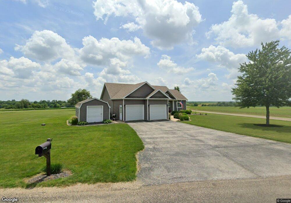
This home is located at 1201 Kramer Rd, Avon, IL 61415 and is currently estimated at $319,162. 1201 Kramer Rd is a home with nearby schools including Avon Elementary School, Hedding Grade School, and Abingdon-Avon Middle School.
Ownership History
Date
Name
Owned For
Owner Type
Purchase Details
Closed on
Nov 19, 2010
Sold by
Dunlap R Brett and Dunlap Melissa J
Bought by
Landon Gregory J and Landon Brenda M
Current Estimated Value
Home Financials for this Owner
Home Financials are based on the most recent Mortgage that was taken out on this home.
Original Mortgage
$160,000
Outstanding Balance
$105,566
Interest Rate
4.27%
Mortgage Type
New Conventional
Estimated Equity
$213,596
Purchase Details
Closed on
Aug 18, 2008
Sold by
Westfall Kemper David and Westfall Wendi M
Bought by
Dunlap R Brett and Dunlap Melissa J
Home Financials for this Owner
Home Financials are based on the most recent Mortgage that was taken out on this home.
Original Mortgage
$167,003
Interest Rate
6.66%
Mortgage Type
New Conventional
Create a Home Valuation Report for This Property
The Home Valuation Report is an in-depth analysis detailing your home's value as well as a comparison with similar homes in the area
Purchase History
| Date | Buyer | Sale Price | Title Company |
|---|---|---|---|
| Landon Gregory J | $200,000 | None Available | |
| Dunlap R Brett | $169,000 | None Available |
Source: Public Records
Mortgage History
| Date | Status | Borrower | Loan Amount |
|---|---|---|---|
| Open | Landon Gregory J | $160,000 | |
| Previous Owner | Dunlap R Brett | $167,003 |
Source: Public Records
Tax History
| Year | Tax Paid | Tax Assessment Tax Assessment Total Assessment is a certain percentage of the fair market value that is determined by local assessors to be the total taxable value of land and additions on the property. | Land | Improvement |
|---|---|---|---|---|
| 2024 | $5,783 | $81,940 | $2,010 | $79,930 |
| 2023 | $5,783 | $77,490 | $1,900 | $75,590 |
| 2022 | $5,225 | $72,050 | $1,770 | $70,280 |
| 2021 | $5,047 | $69,880 | $1,720 | $68,160 |
| 2020 | $5,269 | $69,880 | $1,720 | $68,160 |
| 2019 | $5,129 | $68,500 | $1,690 | $66,810 |
| 2018 | $5,150 | $62,860 | $1,570 | $61,290 |
| 2017 | $5,046 | $67,500 | $1,540 | $65,960 |
| 2016 | $4,910 | $65,940 | $1,500 | $64,440 |
| 2015 | -- | $63,460 | $1,440 | $62,020 |
| 2014 | -- | $62,570 | $1,420 | $61,150 |
| 2013 | -- | $64,030 | $1,450 | $62,580 |
Source: Public Records
Map
Nearby Homes
- Lot 437 Horseshoe Dr
- 495 Kramer Rd
- 21 Bricker Cir
- 140 Palemino Dr
- Lot 14 Bricker Cir
- 35 Shady Ln
- 897 20th Ave
- 20620 N 2300 Rd
- 15315 N 2200th Rd
- 235 N Smith St
- 306 S Main St
- 203 E Washington St
- 108 E Grant St
- 307 E Clinton
- 190 W Gossett St
- 390 S Jefferson St
- 180 E Penn Ave
- 230 S Main St
- 305 N Chamberlain St
- 130 E Maple St
- 1211 Kramer Rd
- 349 Mcgrew Dr
- 423 Mcgrew Dr
- 409 Mcgrew Dr
- 351 Mcgrew Dr
- 372 Mcgrew Dr
- 382 Mcgrew Dr
- 373 Mcgrew Dr
- 352 Mcgrew Dr
- 353 Mcgrew Dr
- 418 Mcgrew Dr
- 443 Horseshoe Dr
- 417 Mcgrew Dr
- See Aerial Map Attached To Listing
- 425 Horseshoe Dr
- 434 Horseshoe Dr
- 439 Horseshoe Dr
- 436 Horseshoe Dr
- 484 Mockingbird Trail
- 479 Mockingbird Trail
Your Personal Tour Guide
Ask me questions while you tour the home.