Estimated Value: $296,456 - $550,000
Studio
--
Bath
--
Sq Ft
5,184
Sq Ft Lot
About This Home
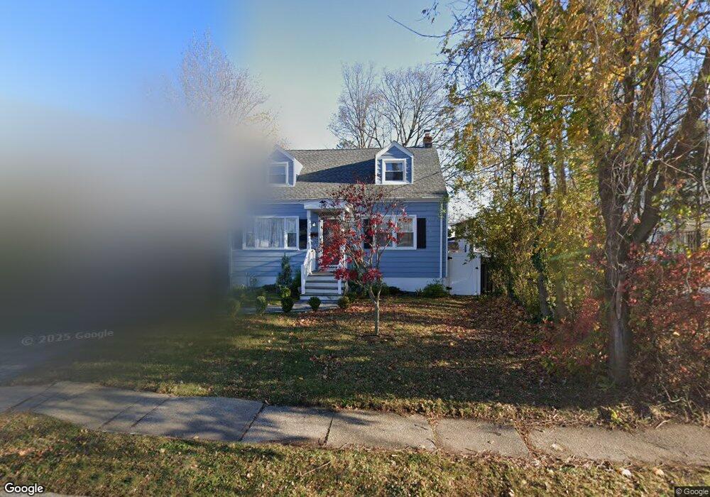
This home is located at 1201 Liberty Ave, Union, NJ 07083 and is currently estimated at $444,364. 1201 Liberty Ave is a home located in Union County with nearby schools including Abram P. Morris-Saybrook Elementary School, Hurden Looker School, and Ola Edwards Community School.
Ownership History
Date
Name
Owned For
Owner Type
Purchase Details
Closed on
Oct 8, 2004
Sold by
Mentell Bruce
Bought by
Syed Hussein
Current Estimated Value
Home Financials for this Owner
Home Financials are based on the most recent Mortgage that was taken out on this home.
Original Mortgage
$176,000
Outstanding Balance
$87,573
Interest Rate
5.84%
Estimated Equity
$356,791
Purchase Details
Closed on
Jun 11, 1998
Sold by
Urban Joseph J
Bought by
Svitak Joseph
Create a Home Valuation Report for This Property
The Home Valuation Report is an in-depth analysis detailing your home's value as well as a comparison with similar homes in the area
Home Values in the Area
Average Home Value in this Area
Purchase History
| Date | Buyer | Sale Price | Title Company |
|---|---|---|---|
| Syed Hussein | $220,000 | -- | |
| Svitak Joseph | $53,500 | -- |
Source: Public Records
Mortgage History
| Date | Status | Borrower | Loan Amount |
|---|---|---|---|
| Open | Syed Hussein | $176,000 |
Source: Public Records
Tax History
| Year | Tax Paid | Tax Assessment Tax Assessment Total Assessment is a certain percentage of the fair market value that is determined by local assessors to be the total taxable value of land and additions on the property. | Land | Improvement |
|---|---|---|---|---|
| 2025 | $8,829 | $39,500 | $20,400 | $19,100 |
| 2024 | $8,559 | $39,500 | $20,400 | $19,100 |
| 2023 | $8,559 | $39,500 | $20,400 | $19,100 |
| 2022 | $8,262 | $39,500 | $20,400 | $19,100 |
| 2021 | $8,062 | $39,500 | $20,400 | $19,100 |
| 2020 | $7,901 | $39,500 | $20,400 | $19,100 |
| 2019 | $7,795 | $39,500 | $20,400 | $19,100 |
| 2018 | $7,662 | $39,500 | $20,400 | $19,100 |
| 2017 | $7,548 | $39,500 | $20,400 | $19,100 |
| 2016 | $7,364 | $39,500 | $20,400 | $19,100 |
| 2015 | $7,242 | $39,500 | $20,400 | $19,100 |
| 2014 | $7,080 | $39,500 | $20,400 | $19,100 |
Source: Public Records
Map
Nearby Homes
- 260 Millard Ave
- 222 Boston Ave
- 359 Harvard Ave
- 386 Yale Ave
- 149 Baltimore Ave
- 525 Us Highway 22
- 1393 Cornell Place
- 537 Us Highway 22
- 128 Baltimore Ave
- 1318 State St
- 564 Chapman St
- 130 Valley View Rd
- 339 Hillside Ave
- 339 Hillside Ave Unit 2
- 420 Hollywood Ave
- 1426 Franklin St
- 1414 Boa Place Unit 2
- 1442 Highland Ave
- 345 Sanford Ave
- 1406 Maple Ave
- 1201B Liberty Ave
- 1201 Liberty Ave Unit A
- 1201 Liberty Ave
- 1205A Liberty Ave
- 1203A Liberty Ave Unit 1203A
- 1203B Liberty Ave Unit 1203B
- 1199B Liberty Ave Unit 1199B
- 1201A Liberty Ave
- 1205B Liberty Ave
- 1197B Liberty Ave
- 1199A Liberty Ave
- 1197A Liberty Ave Unit 1197A
- 1195B Liberty Ave
- 1195A Liberty Ave
- 103 Liberty Ct
- 1204 Liberty Ave
- 107 Liberty Ct Unit 107
- 1200 Liberty Ave
- 109 Liberty Ct Unit 109
- 1191 Liberty Ave
Your Personal Tour Guide
Ask me questions while you tour the home.