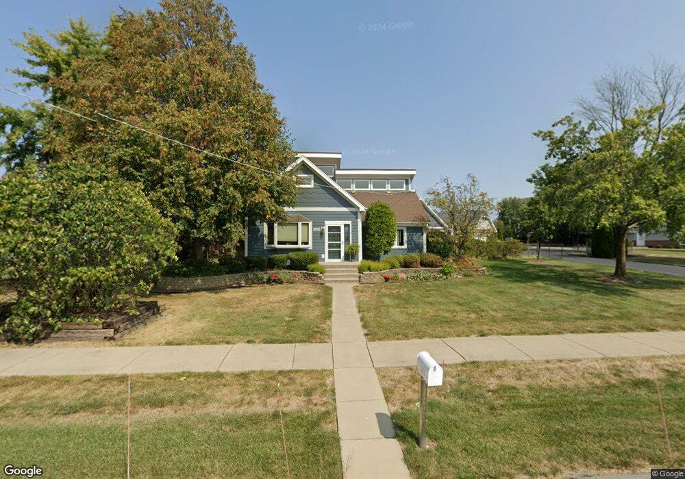
1201 Mccarthy Rd Lemont, IL 60439
Northeast Lemont NeighborhoodEstimated Value: $326,000 - $512,000
3
Beds
2
Baths
1,476
Sq Ft
$298/Sq Ft
Est. Value
About This Home
This home is located at 1201 Mccarthy Rd, Lemont, IL 60439 and is currently estimated at $440,334, approximately $298 per square foot. 1201 Mccarthy Rd is a home located in Cook County with nearby schools including Oakwood School, River Valley School, and Old Quarry Middle School.
Ownership History
Date
Name
Owned For
Owner Type
Purchase Details
Closed on
Aug 18, 1995
Sold by
Gibson James R and Gibson Debra K
Bought by
Mathias Glenn S and Mathias Lori A
Current Estimated Value
Home Financials for this Owner
Home Financials are based on the most recent Mortgage that was taken out on this home.
Original Mortgage
$140,000
Interest Rate
7.81%
Create a Home Valuation Report for This Property
The Home Valuation Report is an in-depth analysis detailing your home's value as well as a comparison with similar homes in the area
Home Values in the Area
Average Home Value in this Area
Purchase History
| Date | Buyer | Sale Price | Title Company |
|---|---|---|---|
| Mathias Glenn S | $180,000 | -- |
Source: Public Records
Mortgage History
| Date | Status | Borrower | Loan Amount |
|---|---|---|---|
| Closed | Mathias Glenn S | $140,000 |
Source: Public Records
Tax History
| Year | Tax Paid | Tax Assessment Tax Assessment Total Assessment is a certain percentage of the fair market value that is determined by local assessors to be the total taxable value of land and additions on the property. | Land | Improvement |
|---|---|---|---|---|
| 2025 | $8,417 | $30,964 | $15,464 | $15,500 |
| 2024 | $8,417 | $30,964 | $15,464 | $15,500 |
| 2023 | $4,211 | $43,814 | $28,314 | $15,500 |
| 2022 | $4,211 | $20,767 | $10,890 | $9,877 |
| 2021 | $4,104 | $20,767 | $10,890 | $9,877 |
| 2020 | $4,201 | $20,767 | $10,890 | $9,877 |
| 2019 | $3,985 | $20,658 | $10,890 | $9,768 |
| 2018 | $3,918 | $20,658 | $10,890 | $9,768 |
| 2017 | $3,873 | $20,658 | $10,890 | $9,768 |
| 2016 | $3,247 | $16,252 | $8,712 | $7,540 |
| 2015 | $3,266 | $16,252 | $8,712 | $7,540 |
| 2014 | $3,310 | $16,252 | $8,712 | $7,540 |
| 2013 | $3,833 | $19,493 | $8,712 | $10,781 |
Source: Public Records
Map
Nearby Homes
- 525 Senon Dr
- 14517 Albany Ave
- 1297 Mccarthy Rd
- 1343 Camelot Ln
- 441 Wheeler Dr
- 1268 Durham Ln
- 120 Apple Ave
- 1004 Saddle Ln
- 14277 Lacey Dr
- 11174 Tuscany Ln
- 1396 Notre Dame Dr
- 14825 Steven Ct
- 614 Czacki St
- 700 Czacki St
- 12183 Morandi Ct
- 12185 Morandi Ct
- 12444 Killarney Dr
- 400 Mccarthy Rd Unit 419
- 400 Mccarthy Rd Unit 421
- 1139 Gillian St
- 1187 Mccarthy Rd
- 1209 Janas Ln
- 1205 Mccarthy Rd
- 1213 Janas Ln
- 1205 Janas Ln
- 1189 Mccarthy Rd
- 1217 Janas Ln
- 761 Kromray Rd
- 1221 Janas Ln
- 1022 Wild Oak Dr
- 771 Kromray Rd
- 730 Woodcrest Ln
- 1225 Janas Ln
- 740 Woodcrest Ln
- 720 Woodcrest Ln
- 750 Woodcrest Ln
- 710 Woodcrest Ln
- 1208 Janas Ln
- 1216 Janas Ln
- 1229 Janas Ln
Your Personal Tour Guide
Ask me questions while you tour the home.