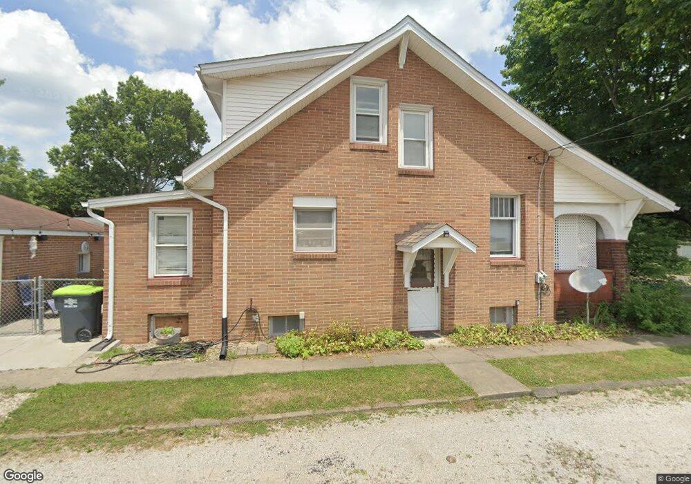
1201 N Chapel St Louisville, OH 44641
Estimated Value: $164,000 - $200,000
3
Beds
2
Baths
1,392
Sq Ft
$132/Sq Ft
Est. Value
About This Home
This home is located at 1201 N Chapel St, Louisville, OH 44641 and is currently estimated at $183,767, approximately $132 per square foot. 1201 N Chapel St is a home located in Stark County with nearby schools including Louisville High School and St. Thomas Aquinas High School & Middle School.
Ownership History
Date
Name
Owned For
Owner Type
Purchase Details
Closed on
Nov 25, 2016
Sold by
Breedlove Claudia J and Musser Linnea A
Bought by
Woods Brian K
Current Estimated Value
Home Financials for this Owner
Home Financials are based on the most recent Mortgage that was taken out on this home.
Original Mortgage
$80,808
Outstanding Balance
$65,150
Interest Rate
3.47%
Mortgage Type
New Conventional
Estimated Equity
$118,617
Purchase Details
Closed on
Feb 8, 2002
Sold by
Upperman Donald J and Upperman Doris M
Bought by
Upperman Donald J and Upperman Doris M
Create a Home Valuation Report for This Property
The Home Valuation Report is an in-depth analysis detailing your home's value as well as a comparison with similar homes in the area
Home Values in the Area
Average Home Value in this Area
Purchase History
| Date | Buyer | Sale Price | Title Company |
|---|---|---|---|
| Woods Brian K | $80,000 | None Available | |
| Upperman Donald J | -- | -- |
Source: Public Records
Mortgage History
| Date | Status | Borrower | Loan Amount |
|---|---|---|---|
| Open | Woods Brian K | $80,808 |
Source: Public Records
Tax History Compared to Growth
Tax History
| Year | Tax Paid | Tax Assessment Tax Assessment Total Assessment is a certain percentage of the fair market value that is determined by local assessors to be the total taxable value of land and additions on the property. | Land | Improvement |
|---|---|---|---|---|
| 2025 | -- | $51,810 | $9,700 | $42,110 |
| 2024 | -- | $51,810 | $9,700 | $42,110 |
| 2023 | $1,469 | $34,170 | $8,020 | $26,150 |
| 2022 | $1,474 | $34,170 | $8,020 | $26,150 |
| 2021 | $1,478 | $34,170 | $8,020 | $26,150 |
| 2020 | $1,233 | $30,940 | $7,210 | $23,730 |
| 2019 | $1,238 | $30,180 | $6,690 | $23,490 |
| 2018 | $1,203 | $30,180 | $6,690 | $23,490 |
| 2017 | $1,107 | $26,780 | $5,600 | $21,180 |
| 2016 | $1,183 | $27,270 | $5,600 | $21,670 |
| 2015 | $1,244 | $27,270 | $5,600 | $21,670 |
| 2014 | $1,131 | $24,160 | $4,970 | $19,190 |
| 2013 | $569 | $24,160 | $4,970 | $19,190 |
Source: Public Records
Map
Nearby Homes
- 428 Honeycrisp Dr NE
- 3047 Mcintosh Dr NE
- 432 Honeycrisp Dr NE
- 2962 Mcintosh Dr NE
- 2963 Mcintosh Dr NE
- 430 Honeycrisp Dr NE
- 2957 Mcintosh Dr NE
- 300 Kennedy St
- 316 E Reno Dr
- 614 Reno Dr
- 524 Glenbar St
- 910 Crosswyck Cir
- 5474 Ravenna Ave
- 1170 Winding Ridge Ave
- 325 Lincoln Ave
- 0 Glenbar St
- 0 Brookridge Ave
- 1149 Sturbridge Dr
- 1175 Sturbridge Dr
- 3580 Brookridge Ave Lot 15
- 1207 N Chapel St
- 1213 N Chapel St
- 1151 N Chapel St
- 203 Devinney Ave
- 114 Devinney Ave
- 1219 N Chapel St
- 205 Devinney Ave
- 441 Honeycrisp Dr NE
- 445 Honeycrisp Dr NE
- 425 Honeycrisp Dr NE
- 423 Honeycrisp Dr NE
- 421 Honeycrisp Dr NE
- 369 Jonagold Dr NE
- 381 Jonagold Dr NE
- 375 Jonagold Dr NE
- 3047 Mcintosh Dr NE
- 443 Honeycrisp Dr NE Unit 2585132-11474
- 3041 Mcintosh Dr NE
- 435 Honeycrisp Dr NE
- 3059 Mcintosh Dr NE