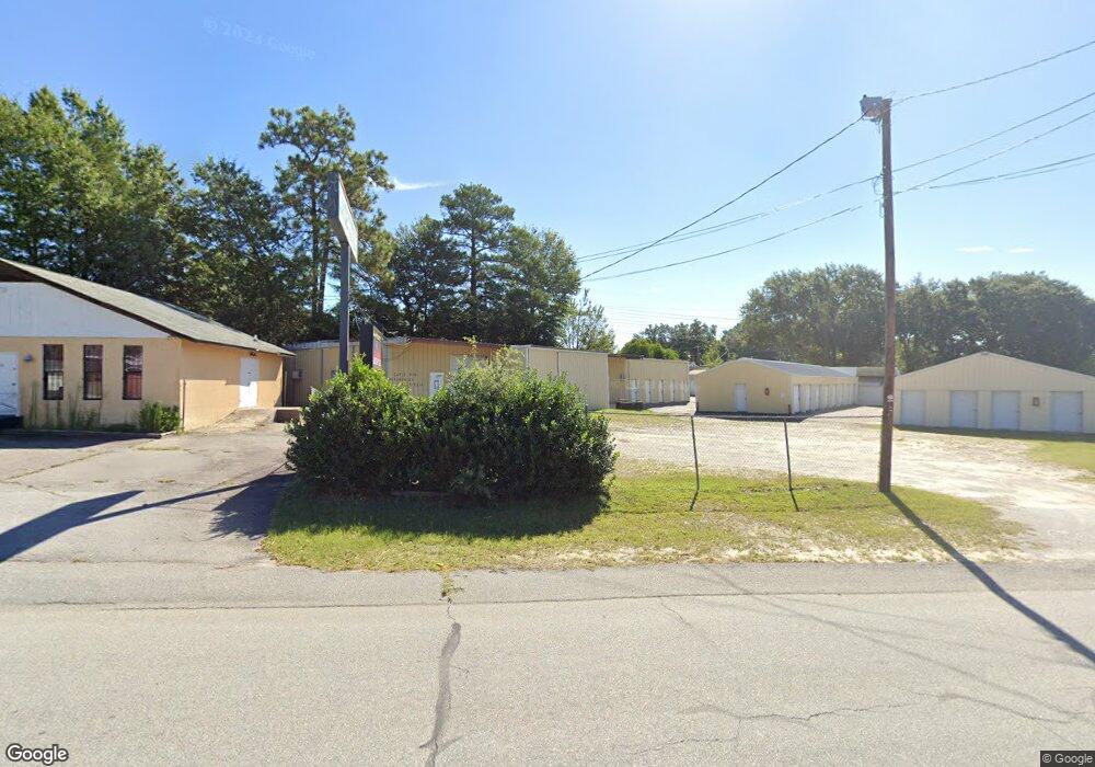
1201 Sox St West Columbia, SC 29169
Estimated Value: $903,962
Studio
--
Bath
4,000
Sq Ft
$226/Sq Ft
Est. Value
About This Home
This home is located at 1201 Sox St, West Columbia, SC 29169 and is currently estimated at $903,962, approximately $225 per square foot. 1201 Sox St is a home located in Lexington County with nearby schools including Cayce Elementary, Cyril B. Busbee Creative Arts Academy, and Brookland-Cayce High School.
Ownership History
Date
Name
Owned For
Owner Type
Purchase Details
Closed on
Aug 16, 2022
Sold by
H2z Llc
Bought by
Empire Storage Solutions Llc
Current Estimated Value
Home Financials for this Owner
Home Financials are based on the most recent Mortgage that was taken out on this home.
Original Mortgage
$250,500
Interest Rate
4.85%
Purchase Details
Closed on
Feb 17, 2021
Sold by
Smith Adrianna G
Bought by
H2z Llc
Home Financials for this Owner
Home Financials are based on the most recent Mortgage that was taken out on this home.
Original Mortgage
$270,000
Interest Rate
2.65%
Mortgage Type
Seller Take Back
Purchase Details
Closed on
Dec 31, 2002
Sold by
Gardner Leslie Adrian
Bought by
Smith Adrianna G
Create a Home Valuation Report for This Property
The Home Valuation Report is an in-depth analysis detailing your home's value as well as a comparison with similar homes in the area
Home Values in the Area
Average Home Value in this Area
Purchase History
We collect this data history from publicly available records. To have your information removed, we recommend requesting removal directly through your county’s website.
| Date | Buyer | Sale Price | Title Company |
|---|---|---|---|
| Empire Storage Solutions Llc | $800,000 | None Listed On Document | |
| H2z Llc | $360,000 | None Available | |
| Smith Adrianna G | $200,000 | -- |
Source: Public Records
Mortgage History
We collect this data history from publicly available records. To have your information removed, we recommend requesting removal directly through your county’s website.
| Date | Status | Borrower | Loan Amount |
|---|---|---|---|
| Closed | Empire Storage Solutions Llc | $250,500 | |
| Open | Empire Storage Solutions Llc | $417,500 | |
| Previous Owner | H2z Llc | $270,000 |
Source: Public Records
Tax History
| Year | Tax Paid | Tax Assessment Tax Assessment Total Assessment is a certain percentage of the fair market value that is determined by local assessors to be the total taxable value of land and additions on the property. | Land | Improvement |
|---|---|---|---|---|
| 2024 | $15,060 | $36,000 | $4,500 | $31,500 |
| 2023 | $13,826 | $21,600 | $3,000 | $18,600 |
| 2022 | $7,757 | $21,600 | $3,000 | $18,600 |
| 2020 | $3,089 | $9,005 | $2,040 | $6,965 |
| 2019 | $4,209 | $12,147 | $6,365 | $5,782 |
| 2018 | $4,125 | $12,147 | $6,365 | $5,782 |
| 2017 | $4,062 | $12,147 | $6,365 | $5,782 |
| 2016 | $4,084 | $12,143 | $6,364 | $5,779 |
| 2014 | $3,048 | $10,560 | $4,688 | $5,872 |
| 2013 | -- | $10,560 | $4,690 | $5,870 |
Source: Public Records
Map
Nearby Homes
- 300 Dale Ln
- 940 Glenn St Unit 303
- 1830 Cupstid St
- 1915 Toole St
- 826 Jefferson St
- 1903 Platt Springs Rd
- 1217 Hazel St
- 2024 Platt Springs Rd
- 476 Brooks Ave
- 1117 Tarrytown Ln
- 629 Westside Dr
- 1414 Hazel St
- 1134 Blakely Ct
- 417 Ocala Dr
- 457 Ocala Dr
- 313 Ocala Dr
- 307 Ocala Dr
- 403 Ocala Dr
- 459 Ocala Dr
- 411 Ocala Dr
- 1754 Airport Blvd
- 1140 Sox St
- 1140 Sox St
- 1136 Sox St
- 1230 Memorial Dr
- 1228 Decatur St
- 1230 Decatur St
- 1226 Decatur St
- 1224 Decatur St
- 1123 Sox St
- 1222 Decatur St
- 1120 Sox St
- 0 Airport Blvd Unit 225090
- 2005 Carroll Dr
- 1119 Sox St
- 1218 Decatur St
- 2007 Carroll Dr
- 1223 Decatur St
- 1225 Decatur St
- 1221 Decatur St
Your Personal Tour Guide
Ask me questions while you tour the home.