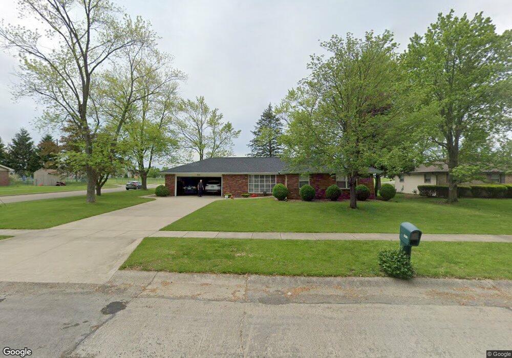
1201 Stinson Ave Mattoon, IL 61938
Estimated Value: $164,738 - $227,000
3
Beds
2
Baths
1,423
Sq Ft
$139/Sq Ft
Est. Value
About This Home
This home is located at 1201 Stinson Ave, Mattoon, IL 61938 and is currently estimated at $197,185, approximately $138 per square foot. 1201 Stinson Ave is a home located in Coles County with nearby schools including Mattoon High School, St Mary School, and St. John's Lutheran School.
Ownership History
Date
Name
Owned For
Owner Type
Purchase Details
Closed on
Jul 7, 2011
Sold by
Edgar Jane S
Bought by
Edgar Timothy C
Current Estimated Value
Purchase Details
Closed on
May 20, 2005
Sold by
White Michael W and Usinger Deann L
Bought by
Edgar Timothy C and Edgar Jane S
Home Financials for this Owner
Home Financials are based on the most recent Mortgage that was taken out on this home.
Original Mortgage
$11,000
Interest Rate
6.05%
Mortgage Type
New Conventional
Create a Home Valuation Report for This Property
The Home Valuation Report is an in-depth analysis detailing your home's value as well as a comparison with similar homes in the area
Home Values in the Area
Average Home Value in this Area
Purchase History
| Date | Buyer | Sale Price | Title Company |
|---|---|---|---|
| Edgar Timothy C | -- | None Available | |
| Edgar Timothy C | $110,000 | None Available |
Source: Public Records
Mortgage History
| Date | Status | Borrower | Loan Amount |
|---|---|---|---|
| Previous Owner | Edgar Timothy C | $11,000 |
Source: Public Records
Tax History Compared to Growth
Tax History
| Year | Tax Paid | Tax Assessment Tax Assessment Total Assessment is a certain percentage of the fair market value that is determined by local assessors to be the total taxable value of land and additions on the property. | Land | Improvement |
|---|---|---|---|---|
| 2024 | $3,199 | $48,637 | $7,420 | $41,217 |
| 2023 | $2,867 | $43,426 | $6,625 | $36,801 |
| 2022 | $2,774 | $42,709 | $6,516 | $36,193 |
| 2021 | $2,742 | $39,229 | $10,130 | $29,099 |
| 2020 | $2,704 | $40,645 | $10,496 | $30,149 |
| 2019 | $2,624 | $39,229 | $10,130 | $29,099 |
| 2018 | $2,580 | $39,229 | $10,130 | $29,099 |
| 2017 | $2,572 | $39,229 | $10,130 | $29,099 |
| 2016 | $2,520 | $39,229 | $10,130 | $29,099 |
| 2015 | $2,578 | $39,229 | $10,130 | $29,099 |
| 2014 | $2,578 | $39,229 | $10,130 | $29,099 |
| 2013 | $2,578 | $39,229 | $10,130 | $29,099 |
Source: Public Records
Map
Nearby Homes
- 1604 S 9th St
- 1208 S 12th St
- 1404 S 6th St
- 1017 S 14th St
- 1009 S 14th St
- 237 Woodlawn Ave
- LOT 37 Broadmoor Edgewater
- 217 Woodlawn Ave
- 307 Illinois Ave
- 1821 Dakota Ave
- 309 Essex Ave
- 1305 Marshall Ave
- 705 Marion Ave
- 1100 Marshall Ave
- 1613 Marshall Ave
- 613 S 7th St
- 1701 Marshall Ave
- 1616 Marshall Ave
- 905 S 23rd St
- 1509 Lafayette Ave
- 1200 Stinson Ave
- 1211 Stinson Ave
- 1117 Stinson Ave
- 1210 Stinson Ave
- 1116 Stinson Ave
- 1221 Stinson Ave
- 1113 Stinson Ave
- 1220 Stinson Ave
- 1112 Stinson Ave
- 1207 Annis Ave
- 1117 Annis Ave
- 1201 Annis Ave
- 1301 Stinson Ave
- 1213 Annis Ave
- 1300 Stinson Ave
- 1108 Stinson Ave
- 1113 Annis Ave
- 1221 Annis Ave
- 1311 Stinson Ave
- 1109 Annis Ave