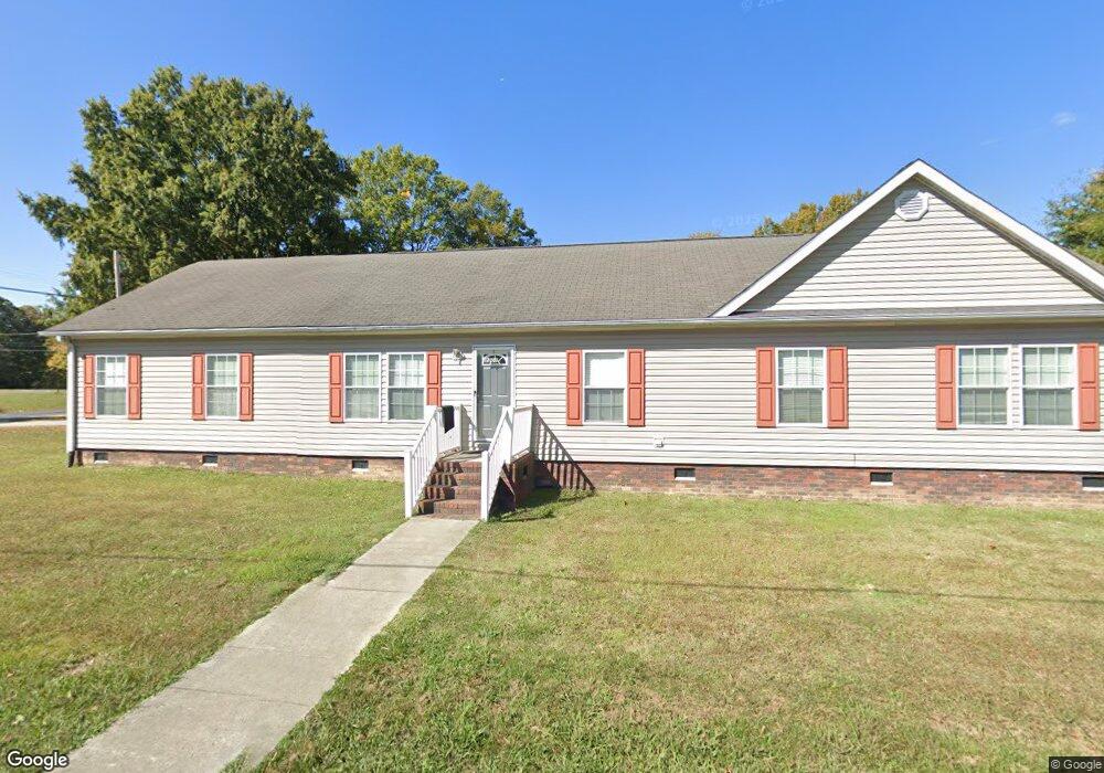
1201 Stone St Kannapolis, NC 28083
Estimated Value: $243,000 - $282,000
4
Beds
2
Baths
2,356
Sq Ft
$111/Sq Ft
Est. Value
About This Home
This home is located at 1201 Stone St, Kannapolis, NC 28083 and is currently estimated at $262,500, approximately $111 per square foot. 1201 Stone St is a home located in Rowan County with nearby schools including Jackson Park Elementary School, Kannapolis Middle, and A.L. Brown High School.
Ownership History
Date
Name
Owned For
Owner Type
Purchase Details
Closed on
Oct 15, 2014
Bought by
Arturo Sanchez-Hernandez
Current Estimated Value
Purchase Details
Closed on
Dec 5, 2013
Sold by
Propst Gregory A and Propst Patricia L
Bought by
Us Bank Na
Purchase Details
Closed on
Mar 3, 2005
Sold by
Lowe James Edward
Bought by
Propst Gregory A and Propst Patricia L
Home Financials for this Owner
Home Financials are based on the most recent Mortgage that was taken out on this home.
Original Mortgage
$154,800
Interest Rate
5.6%
Mortgage Type
Purchase Money Mortgage
Create a Home Valuation Report for This Property
The Home Valuation Report is an in-depth analysis detailing your home's value as well as a comparison with similar homes in the area
Home Values in the Area
Average Home Value in this Area
Purchase History
| Date | Buyer | Sale Price | Title Company |
|---|---|---|---|
| Arturo Sanchez-Hernandez | $58,000 | -- | |
| Us Bank Na | $117,750 | None Available | |
| Propst Gregory A | $19,500 | -- |
Source: Public Records
Mortgage History
| Date | Status | Borrower | Loan Amount |
|---|---|---|---|
| Previous Owner | Propst Gregory A | $154,800 |
Source: Public Records
Tax History
| Year | Tax Paid | Tax Assessment Tax Assessment Total Assessment is a certain percentage of the fair market value that is determined by local assessors to be the total taxable value of land and additions on the property. | Land | Improvement |
|---|---|---|---|---|
| 2025 | $3,535 | $292,127 | $21,053 | $271,074 |
| 2024 | $3,535 | $292,127 | $21,053 | $271,074 |
| 2023 | $3,535 | $292,127 | $21,053 | $271,074 |
| 2022 | $2,253 | $175,010 | $17,544 | $157,466 |
| 2021 | $2,253 | $175,010 | $17,544 | $157,466 |
| 2020 | $2,253 | $175,010 | $17,544 | $157,466 |
| 2019 | $2,172 | $168,709 | $17,544 | $151,165 |
| 2018 | $1,850 | $145,346 | $17,544 | $127,802 |
| 2017 | $1,850 | $145,346 | $17,544 | $127,802 |
| 2016 | $1,850 | $145,346 | $17,544 | $127,802 |
| 2015 | $1,879 | $145,346 | $17,544 | $127,802 |
| 2014 | $1,836 | $146,905 | $17,544 | $129,361 |
Source: Public Records
Map
Nearby Homes
- 2136 Moose Rd
- 1305 Winged Way Unit 1
- 1325 Winged Way Unit 3
- 1335 Winged Way Unit 4
- 3000 Swallowtail Ln Unit 40
- 1301 Mount Vernon Ave
- 3005 Swallowtail Ln Unit 41
- 1500 Nectar Way Unit 32
- 2105 Fowler St
- 3045 Swallowtail Ln
- 2105 Woodlawn St
- 1362 Poplar Glen Dr
- 2001 Lane St
- 914 Carolyn Ave
- 2137 Lane St
- 545 Collins St
- 807 Carolyn Ave
- 1905 Clay St
- 2420 Lane St
- 1409 Venus St
- 2115 Moose Rd
- 1202 Stone St
- Lot 10 Creek Stone Dr
- 1205 Stone St
- 100 Shady Oaks Cir
- 1207 Stone Ave
- 1212 Arlington Ave
- 2117 Moose Rd
- 2119 Moose Rd
- 1201 Arlington Ave
- 2110 Moose Rd
- 1205 Arlington Ave
- 1208 Stone Ave
- 1208 Stone Ave Unit parcel 0000001
- 2121 Moose Rd
- 2111 Moose Rd
- 126 Shady Oaks Cir
- 0 Stone Ridge Ct Unit 6
- 00 Stone St Unit lots 1 and 2
- 2123 Moose Rd
Your Personal Tour Guide
Ask me questions while you tour the home.