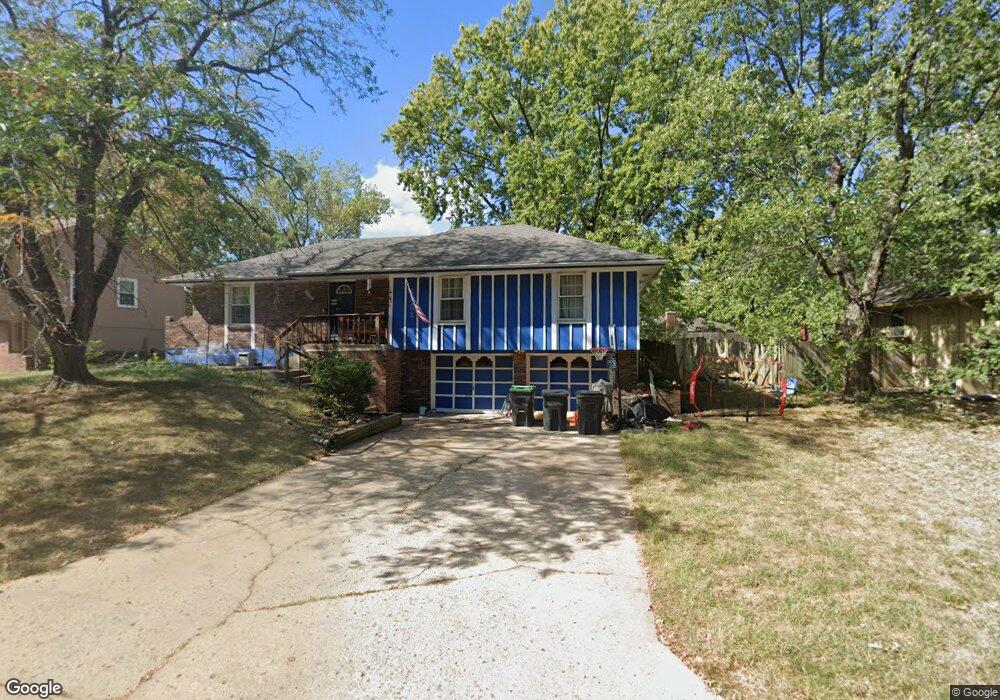
1201 SW 20th St Blue Springs, MO 64015
Estimated Value: $282,000 - $294,000
4
Beds
3
Baths
1,408
Sq Ft
$205/Sq Ft
Est. Value
About This Home
This home is located at 1201 SW 20th St, Blue Springs, MO 64015 and is currently estimated at $288,548, approximately $204 per square foot. 1201 SW 20th St is a home located in Jackson County with nearby schools including Franklin Smith Elementary School, Moreland Ridge Middle School, and Blue Springs South High School.
Ownership History
Date
Name
Owned For
Owner Type
Purchase Details
Closed on
Nov 16, 2021
Sold by
Dennis Jason and Dennis Alicia
Bought by
Dennis Jason and Dennis Alicia
Current Estimated Value
Home Financials for this Owner
Home Financials are based on the most recent Mortgage that was taken out on this home.
Original Mortgage
$120,500
Outstanding Balance
$110,417
Interest Rate
2.99%
Mortgage Type
New Conventional
Estimated Equity
$178,131
Purchase Details
Closed on
Nov 20, 2009
Sold by
Edelinski Thomas D and Edelinski Mei Chu
Bought by
Dennis Jason
Purchase Details
Closed on
Apr 14, 2009
Sold by
Tomei Enterprises Inc
Bought by
Edelinski Thomas D and Edelinski Mei Chu
Purchase Details
Closed on
Oct 30, 2008
Sold by
Edelinsky Thomas D and Edelinsky Mei Chu
Bought by
Tomei Enterprises Inc
Purchase Details
Closed on
Jan 13, 2006
Sold by
Bellah Cody
Bought by
Edelinsky Thomas and Edelinsky Mei Chu
Home Financials for this Owner
Home Financials are based on the most recent Mortgage that was taken out on this home.
Original Mortgage
$136,000
Interest Rate
6.25%
Mortgage Type
Fannie Mae Freddie Mac
Purchase Details
Closed on
Apr 10, 2002
Sold by
Valet Brian P and Hankins Jody M
Bought by
Bellah Cody
Home Financials for this Owner
Home Financials are based on the most recent Mortgage that was taken out on this home.
Original Mortgage
$144,400
Interest Rate
6.83%
Mortgage Type
Purchase Money Mortgage
Purchase Details
Closed on
Apr 27, 2000
Sold by
Macfarlane James E and Macfarlane Dawn C
Bought by
Valet Brian P and Hankins Jody M
Home Financials for this Owner
Home Financials are based on the most recent Mortgage that was taken out on this home.
Original Mortgage
$109,250
Interest Rate
8.17%
Mortgage Type
Purchase Money Mortgage
Purchase Details
Closed on
Mar 18, 1998
Sold by
Keister Jerry D and Keister Pamela S
Bought by
Macfarlane James E and Mcfarlane Dawn C
Home Financials for this Owner
Home Financials are based on the most recent Mortgage that was taken out on this home.
Original Mortgage
$105,317
Interest Rate
7.12%
Mortgage Type
FHA
Create a Home Valuation Report for This Property
The Home Valuation Report is an in-depth analysis detailing your home's value as well as a comparison with similar homes in the area
Home Values in the Area
Average Home Value in this Area
Purchase History
| Date | Buyer | Sale Price | Title Company |
|---|---|---|---|
| Dennis Jason | -- | Orange Coast Lender Services | |
| Dennis Jason | -- | Accurate Title Company Llc | |
| Edelinski Thomas D | -- | None Available | |
| Tomei Enterprises Inc | -- | None Available | |
| Edelinsky Thomas | -- | Parkway Title Inc | |
| Bellah Cody | -- | National Equity Title Compan | |
| Valet Brian P | -- | Security Land Title Co | |
| Macfarlane James E | -- | -- |
Source: Public Records
Mortgage History
| Date | Status | Borrower | Loan Amount |
|---|---|---|---|
| Open | Dennis Jason | $120,500 | |
| Previous Owner | Edelinsky Thomas | $136,000 | |
| Previous Owner | Bellah Cody | $144,400 | |
| Previous Owner | Valet Brian P | $109,250 | |
| Previous Owner | Macfarlane James E | $105,317 |
Source: Public Records
Tax History Compared to Growth
Tax History
| Year | Tax Paid | Tax Assessment Tax Assessment Total Assessment is a certain percentage of the fair market value that is determined by local assessors to be the total taxable value of land and additions on the property. | Land | Improvement |
|---|---|---|---|---|
| 2025 | $2,945 | $38,696 | $7,469 | $31,227 |
| 2024 | $2,889 | $36,100 | $5,691 | $30,409 |
| 2023 | $2,889 | $36,101 | $5,691 | $30,410 |
| 2022 | $2,649 | $29,260 | $5,567 | $23,693 |
| 2021 | $2,647 | $29,260 | $5,567 | $23,693 |
| 2020 | $2,470 | $27,774 | $5,567 | $22,207 |
| 2019 | $2,388 | $27,774 | $5,567 | $22,207 |
| 2018 | $2,146 | $24,022 | $2,926 | $21,096 |
| 2017 | $2,005 | $24,022 | $2,926 | $21,096 |
| 2016 | $2,005 | $22,506 | $4,208 | $18,298 |
| 2014 | $1,953 | $21,850 | $4,085 | $17,765 |
Source: Public Records
Map
Nearby Homes
- 1001 SW 18th St
- 1008 SW 17th St
- 1005 SW 23rd St
- 1311 SW 25th St
- 1203 SW 26th St
- 1604 SW 21st St
- 1504 SW Sunset St
- 1331 SW Horizon Dr
- 1301 SW Sunrise Dr
- 1604 SW 18th Street Ct
- 1718 SW 24th St
- 1201 SW Hopi St
- 1804 SW Cherokee Strip
- 1004 SW Twilight Ln
- 701 SW 17th St
- 1900 SW Cherokee Strip
- 1104 SW Mic-O-say Dr
- 1700 SW Mc Arthur St
- 505 SW 18th St
- 514 SW 15 St
- 1113 SW 20th St
- 1204 SW 21st St
- 1200 SW 21st St
- 1109 SW 20th St
- 1200 SW 20th St
- 1108 SW 20th St
- 2001 SW Morningside Dr
- 2020 SW Morningside Dr
- 1116 SW 21st St
- 1105 SW 20th St
- 1204 SW 20th St
- 1112 SW 21st St
- 1104 SW 19th Street Terrace
- 1100 SW 20th St
- 1903 SW Morningside Dr
- 1205 SW 21st St
- 1101 SW 20th St
- 2101 SW Morningside Dr
- 1100 SW 19th Street Terrace
- 1213 SW 20th St