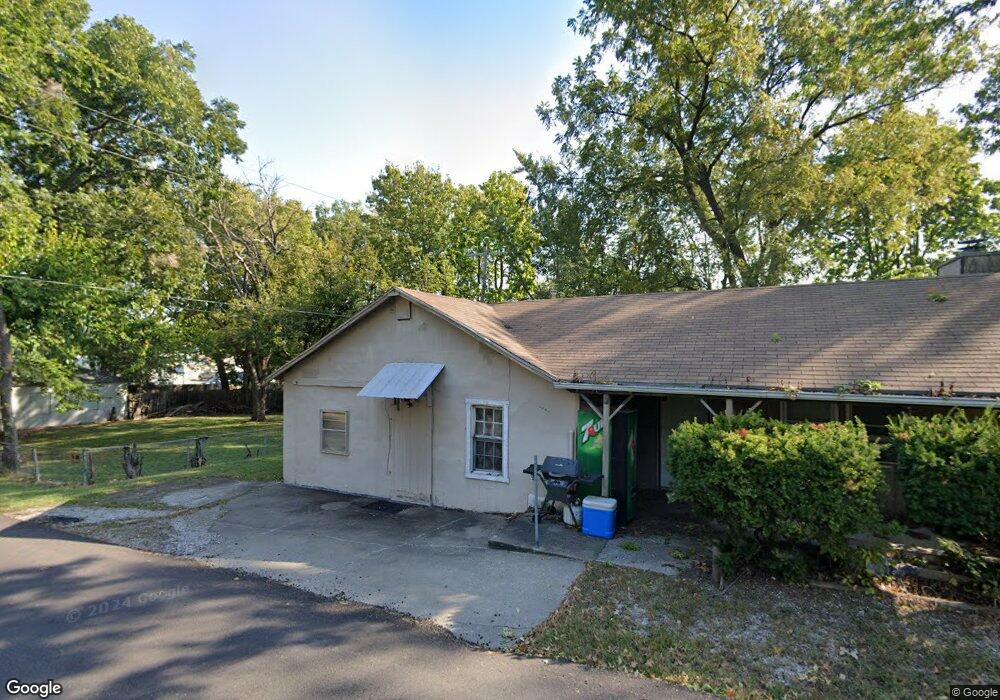
1201 SW Mitchell St Oak Grove, MO 64075
Estimated Value: $174,475 - $205,000
2
Beds
1
Bath
1,040
Sq Ft
$186/Sq Ft
Est. Value
About This Home
This home is located at 1201 SW Mitchell St, Oak Grove, MO 64075 and is currently estimated at $193,369, approximately $185 per square foot. 1201 SW Mitchell St is a home located in Jackson County with nearby schools including Oak Grove Primary School, Oak Grove Elementary School, and Oak Grove Middle School.
Ownership History
Date
Name
Owned For
Owner Type
Purchase Details
Closed on
May 21, 2008
Sold by
Amor Eddie C
Bought by
Amor Hope E
Current Estimated Value
Purchase Details
Closed on
Jun 9, 1998
Sold by
Whitehead Lipari Dona L and Whitehead Kevin T
Bought by
Amor Eddie C and Amor Hope E
Home Financials for this Owner
Home Financials are based on the most recent Mortgage that was taken out on this home.
Original Mortgage
$24,000
Interest Rate
7.27%
Mortgage Type
Purchase Money Mortgage
Create a Home Valuation Report for This Property
The Home Valuation Report is an in-depth analysis detailing your home's value as well as a comparison with similar homes in the area
Home Values in the Area
Average Home Value in this Area
Purchase History
| Date | Buyer | Sale Price | Title Company |
|---|---|---|---|
| Amor Hope E | -- | None Available | |
| Amor Eddie C | -- | Stewart Title |
Source: Public Records
Mortgage History
| Date | Status | Borrower | Loan Amount |
|---|---|---|---|
| Previous Owner | Amor Eddie C | $24,000 |
Source: Public Records
Tax History
| Year | Tax Paid | Tax Assessment Tax Assessment Total Assessment is a certain percentage of the fair market value that is determined by local assessors to be the total taxable value of land and additions on the property. | Land | Improvement |
|---|---|---|---|---|
| 2025 | $1,532 | $22,685 | $6,601 | $16,084 |
| 2024 | $1,518 | $19,726 | $4,454 | $15,272 |
| 2023 | $1,518 | $19,725 | $4,077 | $15,648 |
| 2022 | $1,506 | $17,860 | $2,489 | $15,371 |
| 2021 | $1,473 | $17,860 | $2,489 | $15,371 |
| 2020 | $1,447 | $17,095 | $2,489 | $14,606 |
| 2019 | $1,377 | $17,095 | $2,489 | $14,606 |
| 2018 | $904 | $11,777 | $1,843 | $9,934 |
| 2017 | $904 | $11,777 | $1,843 | $9,934 |
| 2016 | $811 | $10,241 | $836 | $9,405 |
Source: Public Records
Map
Nearby Homes
- 1705 Locust St
- 1308 S Broadway
- 902 SW Locust St
- 1606 SW Stonewall Dr
- 200 SE 8th St
- 200 SW 7th St
- 303 SW 17th St
- 305 SW 17th St
- 503 SW 6th St
- 502 SW Clinton St
- 1807 SW Cemetery Rd
- TBD SW 5th St
- 1103 SW 10th Terrace
- 1104 SW 10th Terrace
- 1112 SW 10th Terrace
- 400 SE 21st St
- 406 SE 21st St
- 1703 Hawes Ln
- 804 SE 16th Terrace
- 1204 SW 5th St
- 208 SW 13th St
- 206 SW 13th St
- 300 SW 13th St
- 1300 SW Mitchell St
- 204 SW 13th St
- 209 SW 12th St
- 205 SW 12th St
- 301 SW 13th St
- 302 SW 13th St
- 202 SW 13th St
- 301 SW 12th St
- 203 SW 12th St
- 304 SW 13th St
- 303 SW 13th St
- 200 SW 13th St
- 1202 SW No Address Assigned By City St
- 1301 SW Mitchell St
- 1303 SW Mitchell St
- 305 SW 13th St
- 1304 SW Mitchell St
Your Personal Tour Guide
Ask me questions while you tour the home.