Estimated Value: $266,000 - $289,000
3
Beds
2
Baths
1,350
Sq Ft
$205/Sq Ft
Est. Value
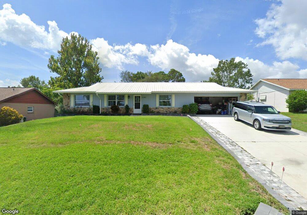
About This Home
This home is located at 1201 Vineland St, Cocoa, FL 32927 and is currently estimated at $276,282, approximately $204 per square foot. 1201 Vineland St is a home located in Brevard County with nearby schools including Atlantis Elementary School, Space Coast Junior/Senior High School, and East Atlantic Prep of Brevard County.
Ownership History
Date
Name
Owned For
Owner Type
Purchase Details
Closed on
Mar 18, 2020
Sold by
Champagne Robert R and Champagne Lorraine C
Bought by
Champagne Robert R and Champagne Lorraine C
Current Estimated Value
Home Financials for this Owner
Home Financials are based on the most recent Mortgage that was taken out on this home.
Original Mortgage
$25,000
Interest Rate
3.4%
Mortgage Type
Credit Line Revolving
Create a Home Valuation Report for This Property
The Home Valuation Report is an in-depth analysis detailing your home's value as well as a comparison with similar homes in the area
Home Values in the Area
Average Home Value in this Area
Purchase History
| Date | Buyer | Sale Price | Title Company |
|---|---|---|---|
| Champagne Robert R | -- | Title365 |
Source: Public Records
Mortgage History
| Date | Status | Borrower | Loan Amount |
|---|---|---|---|
| Closed | Champagne Robert R | $25,000 |
Source: Public Records
Tax History Compared to Growth
Tax History
| Year | Tax Paid | Tax Assessment Tax Assessment Total Assessment is a certain percentage of the fair market value that is determined by local assessors to be the total taxable value of land and additions on the property. | Land | Improvement |
|---|---|---|---|---|
| 2025 | $943 | $61,470 | -- | -- |
| 2024 | $925 | $59,740 | -- | -- |
| 2023 | $925 | $58,000 | $0 | $0 |
| 2022 | $882 | $56,320 | $0 | $0 |
| 2021 | $882 | $54,680 | $0 | $0 |
| 2020 | $836 | $53,930 | $0 | $0 |
| 2019 | $784 | $52,720 | $0 | $0 |
| 2018 | $783 | $51,740 | $0 | $0 |
| 2017 | $783 | $50,680 | $0 | $0 |
| 2016 | $784 | $49,640 | $18,000 | $31,640 |
| 2015 | $784 | $49,300 | $15,000 | $34,300 |
| 2014 | $784 | $48,910 | $11,000 | $37,910 |
Source: Public Records
Map
Nearby Homes
- 1164 Aron St
- 1108 Vineland St
- 522 Clearview Dr
- 672 Altura Dr
- 6340 U S Route 1
- 6340 N Highway 1
- 641 Lindsay Ave
- 780 Alcazar Ave
- 6900 N Highway 1 Unit 6307
- 0 Fay Blvd Unit 1011912
- 6575 Dallas Ave
- 1015 Hibiscus St
- 453 Camel Cir
- 7000 N Highway 1 Unit 104
- 7000 N Highway 1 Unit Gg-205
- 7000 N Highway 1 Unit GG103
- 7020 U S 1 Unit Ee-202
- 995 Barclay Dr
- 7030 N Highway 1 Unit 101
- 7030 N Highway 1 Unit DD102
- 1211 Vineland St
- 1197 Vineland St
- 1200 Vineland St
- 1188 Vineland St
- 1180 Vineland St
- 1221 Vineland St
- 1189 Vineland St
- 1210 Vineland St
- 1220 Vineland St
- 1231 Vineland St
- 1189 Aron
- 1172 Vineland St
- 1230 Vineland St
- 1173 Vineland St
- 1221 Aron St
- 1241 Vineland St
- 1173 Aron St
- 1164 Vineland St
- 1201 Aron St
- 1165 Aron St