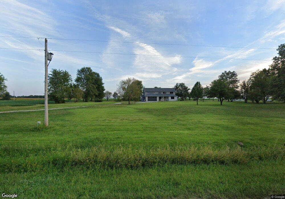
1201 W Apple St Freeburg, IL 62243
Estimated Value: $291,000 - $399,663
--
Bed
--
Bath
1,707
Sq Ft
$211/Sq Ft
Est. Value
About This Home
This home is located at 1201 W Apple St, Freeburg, IL 62243 and is currently estimated at $359,416, approximately $210 per square foot. 1201 W Apple St is a home located in St. Clair County with nearby schools including Freeburg Elementary School, Freeburg Community High School, and St. Joseph Catholic School.
Ownership History
Date
Name
Owned For
Owner Type
Purchase Details
Closed on
Mar 15, 2002
Sold by
Miller Dale H
Bought by
Schmidt Rick L and Schmidt Terri L
Current Estimated Value
Home Financials for this Owner
Home Financials are based on the most recent Mortgage that was taken out on this home.
Original Mortgage
$196,215
Interest Rate
7.11%
Mortgage Type
VA
Purchase Details
Closed on
Oct 12, 2001
Sold by
Miller Deborah T
Bought by
Miller Dale H
Create a Home Valuation Report for This Property
The Home Valuation Report is an in-depth analysis detailing your home's value as well as a comparison with similar homes in the area
Home Values in the Area
Average Home Value in this Area
Purchase History
| Date | Buyer | Sale Price | Title Company |
|---|---|---|---|
| Schmidt Rick L | $190,500 | -- | |
| Miller Dale H | -- | -- |
Source: Public Records
Mortgage History
| Date | Status | Borrower | Loan Amount |
|---|---|---|---|
| Closed | Schmidt Rick L | $196,215 |
Source: Public Records
Tax History Compared to Growth
Tax History
| Year | Tax Paid | Tax Assessment Tax Assessment Total Assessment is a certain percentage of the fair market value that is determined by local assessors to be the total taxable value of land and additions on the property. | Land | Improvement |
|---|---|---|---|---|
| 2024 | $8,083 | $109,824 | $21,670 | $88,154 |
| 2023 | $7,586 | $102,076 | $20,141 | $81,935 |
| 2022 | $7,089 | $93,682 | $18,485 | $75,197 |
| 2021 | $6,781 | $88,213 | $17,406 | $70,807 |
| 2020 | $6,129 | $77,405 | $16,794 | $60,611 |
| 2019 | $5,935 | $77,405 | $16,794 | $60,611 |
| 2018 | $5,703 | $74,694 | $16,206 | $58,488 |
| 2017 | $5,225 | $71,233 | $15,455 | $55,778 |
| 2016 | $4,988 | $63,857 | $7,186 | $56,671 |
| 2014 | $4,280 | $62,839 | $7,071 | $55,768 |
| 2013 | $3,294 | $64,207 | $7,225 | $56,982 |
Source: Public Records
Map
Nearby Homes
- 227 Alamosa Dr
- 222 Alamosa Dr
- 304 Torrington Ln
- 359 Sleeping Indian Dr
- 363 Sleeping Indian Dr
- 420 Foxtail Dr
- 433 Foxtail Dr
- 440 Foxtail Dr
- TBB Kraft Rd
- 5433 Kraft Rd
- 302 N Railroad St
- 312 W Phillips St
- 206 N Main St
- 207 N Edison St
- 106 S Vine St
- 401 N Edison St
- 520 N Edison St
- 3 Park St
- 103 Draco Dr
- 0 Hickory Dr
- 1151 W Apple St
- 7121 Holcomb School Rd
- 1139 W Apple St
- 1211 W Apple St
- 1127 W Apple St
- 1225 W Apple St
- 201 Alamosa Dr
- 5420 Willow Springs Ln
- 7125 Holcomb School Rd
- 1237 W Apple St
- 203 Alamosa Dr
- 0 Silverthorne Dr Unit 16069857
- 1115 W Apple St
- 200 Alamosa Dr
- 202 Alamosa Dr
- 201 Silverthorne Dr Unit 203
- 203 Silverthorne Dr
- 205 Alamosa Dr
- 200 Silverthorne Dr
- 207 Alamosa Dr