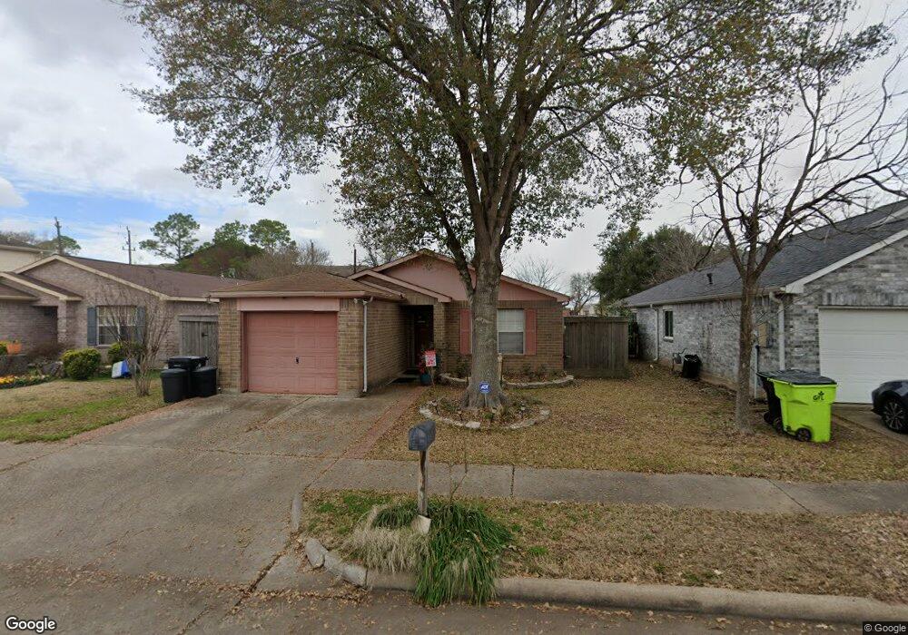
1201 Wilson Dr Rosenberg, TX 77471
Estimated Value: $205,567 - $217,000
3
Beds
2
Baths
1,298
Sq Ft
$164/Sq Ft
Est. Value
About This Home
This home is located at 1201 Wilson Dr, Rosenberg, TX 77471 and is currently estimated at $212,642, approximately $163 per square foot. 1201 Wilson Dr is a home located in Fort Bend County with nearby schools including Smith Elementary School, Lamar Junior High School, and Lamar Consolidated High School.
Ownership History
Date
Name
Owned For
Owner Type
Purchase Details
Closed on
Jan 15, 1997
Sold by
Hometown Concepts Inc
Bought by
Mata Cecilia
Current Estimated Value
Home Financials for this Owner
Home Financials are based on the most recent Mortgage that was taken out on this home.
Original Mortgage
$63,850
Outstanding Balance
$6,821
Interest Rate
7.57%
Mortgage Type
FHA
Estimated Equity
$205,821
Create a Home Valuation Report for This Property
The Home Valuation Report is an in-depth analysis detailing your home's value as well as a comparison with similar homes in the area
Home Values in the Area
Average Home Value in this Area
Purchase History
| Date | Buyer | Sale Price | Title Company |
|---|---|---|---|
| Mata Cecilia | -- | Texas American Title Company |
Source: Public Records
Mortgage History
| Date | Status | Borrower | Loan Amount |
|---|---|---|---|
| Open | Mata Cecilia | $63,850 |
Source: Public Records
Tax History
| Year | Tax Paid | Tax Assessment Tax Assessment Total Assessment is a certain percentage of the fair market value that is determined by local assessors to be the total taxable value of land and additions on the property. | Land | Improvement |
|---|---|---|---|---|
| 2025 | $1,455 | $164,446 | $21,840 | $196,239 |
| 2024 | $1,455 | $149,496 | -- | $162,958 |
| 2023 | $1,262 | $135,905 | $0 | $170,662 |
| 2022 | $1,835 | $123,550 | $0 | $154,840 |
| 2021 | $2,330 | $112,320 | $16,800 | $95,520 |
| 2020 | $2,333 | $109,920 | $14,000 | $95,920 |
| 2019 | $2,521 | $110,390 | $14,000 | $96,390 |
| 2018 | $2,432 | $104,790 | $14,000 | $90,790 |
| 2017 | $2,368 | $101,450 | $14,000 | $87,450 |
| 2016 | $2,487 | $106,540 | $14,000 | $92,540 |
| 2015 | $1,816 | $97,270 | $14,000 | $83,270 |
| 2014 | $1,802 | $89,410 | $14,000 | $75,410 |
Source: Public Records
Map
Nearby Homes
- 1704 Mulberry Dr
- 4602 Avenue H
- 5130 Riverwood Dr
- 1215 Main St
- 512 and 514 Travis St
- 6219 Deep Gulch Dr
- 4426 Misty Woods Trail
- 2005 Lamar Dr
- 3414 Riverside Glen Ln
- 5303 Rivers Edge Dr
- 4618 Compass Ave
- 4534 Castor Dr
- 5015 Green Gate Trail
- 1905 Dowling Dr
- 2100 Crestwood Dr
- 606 Fannin St
- 206 Collins Rd
- TBD Preston St
- 221 Rochelle St
- 800 Jackson St
- 1121 Wilson Dr
- 1121 Wilson Dr
- 1205 Wilson Dr
- 1301 Bridle Path
- 1115 Wilson Dr
- 1211 Wilson Dr
- 1305 Bridle Path
- 1200 Wilson Dr
- 1204 Wilson Dr
- 1120 Wilson Dr
- 1208 Wilson Dr
- 1109 Wilson Dr
- 1116 Wilson Dr
- 1116 Wilson Dr
- 1212 Wilson Dr
- 1212 Wilson Dr
- 1309 Bridle Path
- 1303 Wilson Dr
- 1112 Wilson Dr
- 1108 Wilson Dr
Your Personal Tour Guide
Ask me questions while you tour the home.