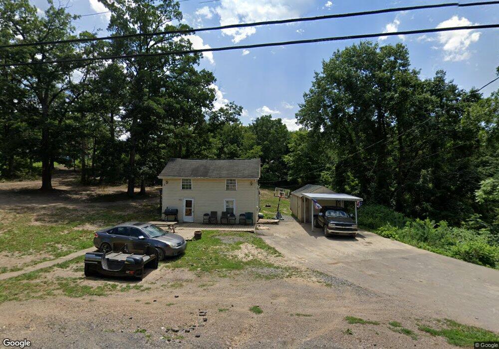
12014 Amherst Ave NE Cumberland, MD 21502
Estimated Value: $82,000 - $112,000
--
Bed
1
Bath
792
Sq Ft
$126/Sq Ft
Est. Value
About This Home
This home is located at 12014 Amherst Ave NE, Cumberland, MD 21502 and is currently estimated at $99,979, approximately $126 per square foot. 12014 Amherst Ave NE is a home located in Allegany County with nearby schools including Northeast Elementary School, Washington Middle School, and Fort Hill High School.
Ownership History
Date
Name
Owned For
Owner Type
Purchase Details
Closed on
May 13, 2016
Sold by
Wetzel Michael M and Wetzel Christopher J
Bought by
Wetzel Christopher J
Current Estimated Value
Purchase Details
Closed on
Jun 11, 2015
Sold by
Wetzel Michael M
Bought by
Wetzel Michael M and Wetzel Christopher J
Purchase Details
Closed on
Sep 30, 2011
Sold by
Lantz Barbara Jean
Bought by
Wetzel Michael and Wetzel Sherry
Home Financials for this Owner
Home Financials are based on the most recent Mortgage that was taken out on this home.
Original Mortgage
$48,000
Interest Rate
4.11%
Mortgage Type
New Conventional
Purchase Details
Closed on
Apr 9, 1997
Sold by
Hershiser John W and Hershiser Patty A
Bought by
Wetzel Michael and Wetzel Sherry
Create a Home Valuation Report for This Property
The Home Valuation Report is an in-depth analysis detailing your home's value as well as a comparison with similar homes in the area
Home Values in the Area
Average Home Value in this Area
Purchase History
| Date | Buyer | Sale Price | Title Company |
|---|---|---|---|
| Wetzel Christopher J | -- | Allegheny Highlands Title & | |
| Wetzel Michael M | -- | None Available | |
| Wetzel Michael | $30,000 | Allegheny Highlands Title & | |
| Wetzel Michael | $12,000 | -- |
Source: Public Records
Mortgage History
| Date | Status | Borrower | Loan Amount |
|---|---|---|---|
| Previous Owner | Wetzel Michael | $48,000 |
Source: Public Records
Tax History Compared to Growth
Tax History
| Year | Tax Paid | Tax Assessment Tax Assessment Total Assessment is a certain percentage of the fair market value that is determined by local assessors to be the total taxable value of land and additions on the property. | Land | Improvement |
|---|---|---|---|---|
| 2025 | $728 | $61,333 | $0 | $0 |
| 2024 | $651 | $54,867 | $0 | $0 |
| 2023 | $526 | $48,400 | $6,100 | $42,300 |
| 2022 | $549 | $46,267 | $0 | $0 |
| 2021 | $519 | $44,133 | $0 | $0 |
| 2020 | $499 | $42,000 | $6,100 | $35,900 |
| 2019 | $499 | $42,000 | $6,100 | $35,900 |
| 2018 | $499 | $42,000 | $6,100 | $35,900 |
| 2017 | $532 | $44,800 | $0 | $0 |
| 2016 | $523 | $43,933 | $0 | $0 |
| 2015 | $503 | $43,067 | $0 | $0 |
| 2014 | $503 | $42,200 | $0 | $0 |
Source: Public Records
Map
Nearby Homes
- 11829 Valley Rd NE
- 12413 Shadoe Hollow Rd NE
- 11813 Bedford Rd NE
- 11915 Bedford Rd NE
- 11816 Bedford Rd NE Unit REAR
- 12507 Lisa Dr NE
- 519 Forester Ave
- 1806 Holland St
- 512 Schlund Ave
- 0 Shades Rr Unit MDAL2012350
- 12507 Thornfield Cir NE
- 1105 Holland St
- 714 Lincoln St
- 703 Bedford St
- 816 Elmwood Ln
- 606 Hill St
- 611 Bedford St
- 617 Frederick St
- 615 Frederick St
- 511 Franklin St
- 12021 Amherst Ave NE
- 12006 Amherst Ave NE
- 12011 Amherst Ave NE
- 12009 Amherst Ave NE
- 12105 Amherst Ave NE
- 12010 Clinton St NE
- 12106 Amherst Ave NE
- 11311 Brown Hill Rd NE
- 11912 Clinton St NE
- 11922 Amherst Ave NE
- 12015 Denton Ln
- 12003 Amherst Ave NE
- 11217 Brown Hill Rd NE
- 11918 Amherst Ave NE
- 11216 Brown Hill Rd NE
- 11923 Amherst Ave NE
- 11923 Amherst Ave NE
- 11923 Amherst Ave NE
- 11923 Amherst Ave NE
- 11215 Brown Hill Rd NE