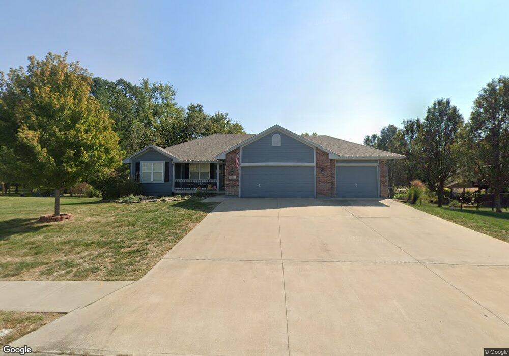
1202 Buckeye Ln Pleasant Hill, MO 64080
Estimated Value: $407,112 - $514,000
3
Beds
2
Baths
1,558
Sq Ft
$285/Sq Ft
Est. Value
About This Home
This home is located at 1202 Buckeye Ln, Pleasant Hill, MO 64080 and is currently estimated at $444,778, approximately $285 per square foot. 1202 Buckeye Ln is a home located in Cass County with nearby schools including Pleasant Hill Primary School, Pleasant Hill Elementary School, and Pleasant Hill Middle School.
Ownership History
Date
Name
Owned For
Owner Type
Purchase Details
Closed on
Aug 15, 2005
Sold by
Uncle George Investment Inc
Bought by
Smith Phillip S and Smith Suzan K
Current Estimated Value
Home Financials for this Owner
Home Financials are based on the most recent Mortgage that was taken out on this home.
Original Mortgage
$203,511
Outstanding Balance
$106,838
Interest Rate
5.65%
Mortgage Type
FHA
Estimated Equity
$337,940
Purchase Details
Closed on
Jan 18, 2005
Sold by
Redwine Properties Llc
Bought by
Uncle George Investments Inc
Create a Home Valuation Report for This Property
The Home Valuation Report is an in-depth analysis detailing your home's value as well as a comparison with similar homes in the area
Home Values in the Area
Average Home Value in this Area
Purchase History
| Date | Buyer | Sale Price | Title Company |
|---|---|---|---|
| Smith Phillip S | -- | -- | |
| Uncle George Investments Inc | -- | -- |
Source: Public Records
Mortgage History
| Date | Status | Borrower | Loan Amount |
|---|---|---|---|
| Open | Smith Phillip S | $203,511 |
Source: Public Records
Tax History Compared to Growth
Tax History
| Year | Tax Paid | Tax Assessment Tax Assessment Total Assessment is a certain percentage of the fair market value that is determined by local assessors to be the total taxable value of land and additions on the property. | Land | Improvement |
|---|---|---|---|---|
| 2024 | $3,370 | $46,730 | $7,520 | $39,210 |
| 2023 | $3,346 | $46,730 | $7,520 | $39,210 |
| 2022 | $2,977 | $40,810 | $7,520 | $33,290 |
| 2021 | $2,836 | $39,970 | $7,520 | $32,450 |
| 2020 | $2,711 | $39,130 | $7,520 | $31,610 |
| 2019 | $2,674 | $39,130 | $7,520 | $31,610 |
| 2018 | $2,415 | $34,850 | $6,430 | $28,420 |
| 2017 | $2,331 | $34,850 | $6,430 | $28,420 |
| 2016 | $2,331 | $33,510 | $6,430 | $27,080 |
| 2015 | $2,361 | $33,510 | $6,430 | $27,080 |
| 2014 | $2,371 | $33,510 | $6,430 | $27,080 |
| 2013 | -- | $33,510 | $6,430 | $27,080 |
Source: Public Records
Map
Nearby Homes
- 902 Buckeye Ln
- 1809 Alpine Dr
- 1504 Hawthorne Cir
- 1507 Trail Ridge Dr
- Lot 6 Snyder Rd
- Lot 5 Snyder Rd
- Lot 7 Snyder Rd
- Lot 4 Snyder Rd
- 1003 Truman St
- Lot 8 Snyder Rd
- 601 Hillcrest St
- 1307 Deena St
- 17806 Red Bud Cir
- Lot 9 Snyder Rd
- 1215 Maple Ln
- Lot 10 Snyder Rd
- 1512 Country Club Dr
- 1413 Country Club Dr
- 1002 Lexington Rd
- 1521 Lexington Rd
- 1204 Buckeye Ln
- 1203 Buckeye Ln
- 1205 Buckeye Ln
- 1206 Buckeye Ln
- 1200 Mulberry St
- 1100 Buckeye Ln
- 1301 Buckeye Ln
- 1201 Mulberry St
- 1300 Buckeye Ln
- 1303 Buckeye Ln
- 909 Buckeye Ln
- 1207 Lauren Ln
- 1305 Buckeye Ln
- 1302 Buckeye Ln
- 906 Buckeye Ln
- 907 Buckeye Ln
- 1209 Lauren Ln
- 1307 Buckeye Ln
- 1304 Buckeye Ln
- 1200 Papaw Ln