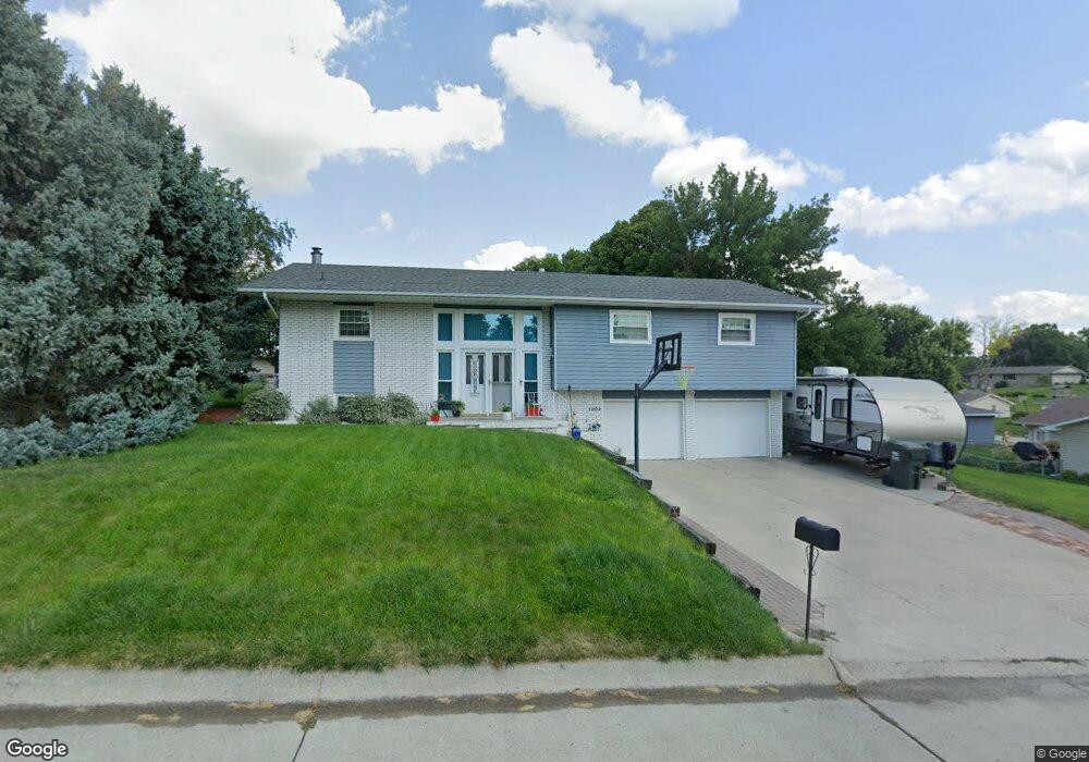
1202 Fieldcrest Dr Norfolk, NE 68701
Estimated Value: $278,993 - $326,000
3
Beds
3
Baths
1,508
Sq Ft
$202/Sq Ft
Est. Value
About This Home
This home is located at 1202 Fieldcrest Dr, Norfolk, NE 68701 and is currently estimated at $305,248, approximately $202 per square foot. 1202 Fieldcrest Dr is a home located in Madison County with nearby schools including Norfolk Senior High School, St. Paul's Lutheran School, and Norfolk Catholic School.
Ownership History
Date
Name
Owned For
Owner Type
Purchase Details
Closed on
Jul 19, 2005
Sold by
Kathol Lyle J and Kathol Lea A
Bought by
Ritter Randall C
Current Estimated Value
Home Financials for this Owner
Home Financials are based on the most recent Mortgage that was taken out on this home.
Original Mortgage
$128,250
Outstanding Balance
$66,569
Interest Rate
5.87%
Mortgage Type
Adjustable Rate Mortgage/ARM
Estimated Equity
$238,679
Create a Home Valuation Report for This Property
The Home Valuation Report is an in-depth analysis detailing your home's value as well as a comparison with similar homes in the area
Home Values in the Area
Average Home Value in this Area
Purchase History
| Date | Buyer | Sale Price | Title Company |
|---|---|---|---|
| Ritter Randall C | $135,000 | -- | |
| Ritter Randall C | $135,000 | American Title Co |
Source: Public Records
Mortgage History
| Date | Status | Borrower | Loan Amount |
|---|---|---|---|
| Open | Ritter Randall C | $128,250 |
Source: Public Records
Tax History
| Year | Tax Paid | Tax Assessment Tax Assessment Total Assessment is a certain percentage of the fair market value that is determined by local assessors to be the total taxable value of land and additions on the property. | Land | Improvement |
|---|---|---|---|---|
| 2025 | $2,997 | $257,989 | $31,312 | $226,677 |
| 2024 | $4,148 | $241,713 | $31,312 | $210,401 |
| 2023 | $4,148 | $224,340 | $31,312 | $193,028 |
| 2022 | $3,775 | $203,658 | $31,312 | $172,346 |
| 2021 | $3,505 | $189,428 | $31,312 | $158,116 |
| 2020 | $3,494 | $189,428 | $31,312 | $158,116 |
| 2019 | $3,369 | $176,373 | $31,312 | $145,061 |
| 2018 | $3,209 | $170,843 | $31,312 | $139,531 |
| 2017 | $3,005 | $159,793 | $31,312 | $128,481 |
| 2016 | $3,011 | $159,793 | $31,312 | $128,481 |
| 2015 | $3,012 | $159,793 | $31,312 | $128,481 |
| 2014 | $2,659 | $136,981 | $21,888 | $115,093 |
| 2013 | $2,594 | $129,452 | $21,888 | $107,564 |
Source: Public Records
Map
Nearby Homes
- 1706 Bel Air Rd
- 1705 Clark St
- 1303 N 19th St
- 1102 Angus Dr
- 1208 Grant Ave
- 1000 Darrus Dr
- 1109 Longhorn Dr
- 1604 Longhorn Dr
- 1327 Elm Ave
- 1807 Sheridan Dr
- 906 Harrison Ave
- 507 N 13th St
- 907 Ferguson Dr
- 1408 W Prospect Ave
- 1203 Bel Ridge Rd
- 1202 N 9th St
- 1304 W Prospect Ave
- 1606 Valli hi Rd
- 1223 W Prospect Ave
- 201 N 18th St
- 1204 Fieldcrest Dr
- 1606 Bel Air Rd
- 1201 Greenlawn Dr
- 1206 Fieldcrest Dr
- 1700 Bel Air Rd
- 1203 Fieldcrest Dr
- 1600 Bel Air Rd
- 1205 Greenlawn Dr
- 1205 Fieldcrest Dr
- 1702 Bel Air Rd
- 1208 Fieldcrest Dr
- 1605 Bel Air Rd
- 1601 Bel Air Rd
- 1603 Bel Air Rd
- 1202 Greenlawn Dr
- 1607 Bel Air Rd
- 1207 Fieldcrest Dr
- 1207 Greenlawn Dr
- 1502 Bel Air Rd
- 1204 Greenlawn Dr
Your Personal Tour Guide
Ask me questions while you tour the home.