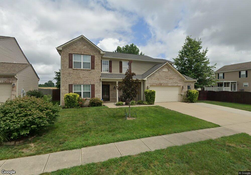
1202 Harvest Ridge Cir Franklin, IN 46131
Estimated Value: $329,586 - $344,000
4
Beds
3
Baths
2,510
Sq Ft
$134/Sq Ft
Est. Value
About This Home
This home is located at 1202 Harvest Ridge Cir, Franklin, IN 46131 and is currently estimated at $336,647, approximately $134 per square foot. 1202 Harvest Ridge Cir is a home located in Johnson County with nearby schools including Northwood Elementary School, Franklin Community Middle School, and Custer Baker Intermediate School.
Ownership History
Date
Name
Owned For
Owner Type
Purchase Details
Closed on
Jan 19, 2024
Sold by
Solenberg Brigette
Bought by
Mcknight Brigette Lynne
Current Estimated Value
Purchase Details
Closed on
Apr 9, 2020
Sold by
Solenberg Brigette
Bought by
Solenberg Brigette and Woods Jordan
Purchase Details
Closed on
May 7, 2009
Sold by
Fuller Chris
Bought by
Cameron Robert A and Mcknight Cameron Brigette
Home Financials for this Owner
Home Financials are based on the most recent Mortgage that was taken out on this home.
Original Mortgage
$149,737
Interest Rate
4.9%
Mortgage Type
FHA
Purchase Details
Closed on
Mar 14, 2006
Sold by
Arbor Homes Llc
Bought by
Fuller Chris
Home Financials for this Owner
Home Financials are based on the most recent Mortgage that was taken out on this home.
Original Mortgage
$121,484
Interest Rate
6.62%
Mortgage Type
Adjustable Rate Mortgage/ARM
Create a Home Valuation Report for This Property
The Home Valuation Report is an in-depth analysis detailing your home's value as well as a comparison with similar homes in the area
Home Values in the Area
Average Home Value in this Area
Purchase History
| Date | Buyer | Sale Price | Title Company |
|---|---|---|---|
| Mcknight Brigette Lynne | -- | None Listed On Document | |
| Solenberg Brigette | -- | None Available | |
| Cameron Robert A | -- | None Available | |
| Fuller Chris | -- | None Available |
Source: Public Records
Mortgage History
| Date | Status | Borrower | Loan Amount |
|---|---|---|---|
| Previous Owner | Cameron Robert A | $149,737 | |
| Previous Owner | Fuller Chris | $121,484 |
Source: Public Records
Tax History Compared to Growth
Tax History
| Year | Tax Paid | Tax Assessment Tax Assessment Total Assessment is a certain percentage of the fair market value that is determined by local assessors to be the total taxable value of land and additions on the property. | Land | Improvement |
|---|---|---|---|---|
| 2025 | $3,188 | $305,000 | $25,500 | $279,500 |
| 2024 | $3,188 | $287,100 | $25,500 | $261,600 |
| 2023 | $3,039 | $272,700 | $25,500 | $247,200 |
| 2022 | $2,919 | $260,800 | $25,500 | $235,300 |
| 2021 | $2,402 | $215,800 | $16,600 | $199,200 |
| 2020 | $2,148 | $193,700 | $16,600 | $177,100 |
| 2019 | $2,064 | $186,000 | $14,600 | $171,400 |
| 2018 | $1,698 | $177,700 | $14,600 | $163,100 |
| 2017 | $1,619 | $161,900 | $14,600 | $147,300 |
| 2016 | $1,552 | $165,200 | $14,600 | $150,600 |
| 2014 | $1,525 | $152,500 | $27,200 | $125,300 |
| 2013 | $1,525 | $153,900 | $27,200 | $126,700 |
Source: Public Records
Map
Nearby Homes
- 1181 Harvest Ridge Cir
- 1134 Spring Meadow Ct
- 1942 Turning Leaf Dr
- 2087 Mach Ln
- 1081 Country Meadow Ct
- 1115 Cobra Dr
- 1278 Northcraft Ct
- 1664 Woodside Cir
- 1804 Acorn Rd
- 1195 S Aberdeen Dr
- 1618 Woodside Cir
- 1213 Greenbriar Way
- 1283 Crabapple Rd
- 1343 Crabapple Rd
- 1151 N Aberdeen Dr
- Norway Plan at Westwind at Cumberland
- Bradford Plan at Westwind at Cumberland
- Juniper Plan at Westwind at Cumberland
- Aspen II Plan at Westwind at Cumberland
- Empress Plan at Westwind at Cumberland
- 1208 Harvest Ridge Cir
- 2156 Turning Leaf Dr
- 2162 Turning Leaf Dr
- 1214 Harvest Ridge Cir
- 2164 Turning Leaf Dr
- 1201 Yellowstone Way
- 2168 Turning Leaf Dr
- 1220 Harvest Ridge Cir
- 1205 Yellowstone Way
- 2170 Turning Leaf Dr
- 1198 Harvest Ridge Cir
- 2144 Turning Leaf Dr
- 1226 Harvest Ridge Cir
- 1211 Yellowstone Way
- 1197 Sunkiss Ct
- 1200 Yellowstone Way
- 1204 Yellowstone Way
- 2174 Turning Leaf Dr
- 1199 Harvest Ridge Cir