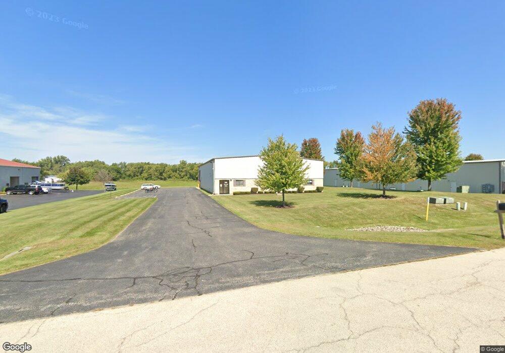
1202 Rail Dr Wood Stock, IL 60098
--
Bed
--
Bath
--
Sq Ft
1.05
Acres
About This Home
This home is located at 1202 Rail Dr, Wood Stock, IL 60098. 1202 Rail Dr is a home located in McHenry County with nearby schools including Westwood Elementary School, Northwood Middle School, and Woodstock North High School.
Ownership History
Date
Name
Owned For
Owner Type
Purchase Details
Closed on
Jun 1, 2018
Sold by
Callahan Kathleen M
Bought by
W And M Hughes Llc
Purchase Details
Closed on
Jan 21, 2014
Sold by
Callahan Kathleen M
Bought by
W & M Hughes Llc
Purchase Details
Closed on
Dec 31, 2012
Sold by
Woodstock Venture Llc
Bought by
Kathleen M Callahan Revocable Trust
Purchase Details
Closed on
Jul 15, 2004
Sold by
Ariola James J
Bought by
Woodstock Venture Llc
Purchase Details
Closed on
Jun 26, 2003
Sold by
Home State Bank Na
Bought by
Ariola James J and James J Ariola 1997 Declaration Of Trust
Create a Home Valuation Report for This Property
The Home Valuation Report is an in-depth analysis detailing your home's value as well as a comparison with similar homes in the area
Home Values in the Area
Average Home Value in this Area
Purchase History
| Date | Buyer | Sale Price | Title Company |
|---|---|---|---|
| W And M Hughes Llc | $305,000 | Fidelity National Title | |
| W & M Hughes Llc | -- | None Available | |
| Kathleen M Callahan Revocable Trust | -- | None Available | |
| Woodstock Venture Llc | -- | -- | |
| Ariola James J | $55,838 | Heritage Title Company |
Source: Public Records
Tax History Compared to Growth
Tax History
| Year | Tax Paid | Tax Assessment Tax Assessment Total Assessment is a certain percentage of the fair market value that is determined by local assessors to be the total taxable value of land and additions on the property. | Land | Improvement |
|---|---|---|---|---|
| 2024 | $7,628 | $97,428 | $27,093 | $70,335 |
| 2023 | $7,573 | $89,887 | $24,996 | $64,891 |
| 2022 | $7,213 | $81,177 | $22,574 | $58,603 |
| 2021 | $6,715 | $72,824 | $20,251 | $52,573 |
| 2020 | $6,723 | $71,166 | $19,790 | $51,376 |
| 2019 | $6,754 | $70,163 | $19,511 | $50,652 |
| 2018 | $6,599 | $68,159 | $18,954 | $49,205 |
| 2017 | $6,658 | $65,519 | $18,220 | $47,299 |
| 2016 | $6,905 | $63,023 | $17,526 | $45,497 |
| 2013 | -- | $59,341 | $16,502 | $42,839 |
Source: Public Records
Map
Nearby Homes
- 1106 Rail Dr
- Route 14 N Rose Farm Rd
- 704 N Rose Farm Rd
- 0 N Rose Farm Rd Unit 18628646
- 705 Indian Trace
- 13808 Washington St
- 0 Rt 47 & Lucas Rd Unit MRD12293021
- 920 Pleasant St
- 824 Washington St
- 814 Robert Dr
- 708 S Rose Farm Rd
- 4244 Meadowridge Rd
- 4224 Meadowridge Rd
- 4265 Meadowridge Rd
- 4240 Meadowridge Rd
- 4104 Meadowridge Rd
- 1301 Longwood Dr E
- 0 Rt 47 & Hercules Rd Hwy Unit MRD12103853
- Block 153 Joseph St
- 740 Victoria Dr
- 1118 Rail Dr Unit A-B
- 1206 Rail Dr Unit D-E
- 1206 Rail Dr Unit E
- 1206 Rail Dr Unit D
- 1206 Rail Dr Unit A
- 1206 Rail Dr
- 1114 Rail Dr Unit A
- 1011 Trakk Ln
- Lot A Rail Dr
- 1102 Rail Dr
- 1007 Trakk Ln
- 1258 N Rose Farm Rd Unit 1-2
- 1258 N Rose Farm Rd Unit 5
- 1258 N Rose Farm Rd Unit 4
- 1258 N Rose Farm Rd Unit 3
- 1258 N Rose Farm Rd
- 1258 N Rose Farm Rd Unit 13
- 1004 Trakk Ln
- 1003 Trakk Ln
- 0 Rail Dr