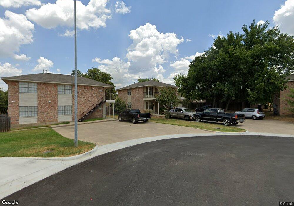
1202 Vinyard Ct Unit A College Station, TX 77840
Estimated Value: $324,000 - $349,000
4
Beds
4
Baths
2,070
Sq Ft
$163/Sq Ft
Est. Value
About This Home
This home is located at 1202 Vinyard Ct Unit A, College Station, TX 77840 and is currently estimated at $336,575, approximately $162 per square foot. 1202 Vinyard Ct Unit A is a home located in Brazos County with nearby schools including College Hills Elementary School, A&M Consolidated Middle School, and Oakwood Intermediate School.
Ownership History
Date
Name
Owned For
Owner Type
Purchase Details
Closed on
Aug 13, 2021
Sold by
Tomasini Deborah L
Bought by
Moonsammy Brent Adam
Current Estimated Value
Home Financials for this Owner
Home Financials are based on the most recent Mortgage that was taken out on this home.
Original Mortgage
$233,689
Outstanding Balance
$212,496
Interest Rate
2.9%
Mortgage Type
Purchase Money Mortgage
Estimated Equity
$124,079
Purchase Details
Closed on
Aug 20, 2005
Sold by
Daniel Arul and Selvaraj Miriam
Bought by
Tomasini Deborah L
Home Financials for this Owner
Home Financials are based on the most recent Mortgage that was taken out on this home.
Original Mortgage
$90,860
Interest Rate
5.61%
Mortgage Type
New Conventional
Create a Home Valuation Report for This Property
The Home Valuation Report is an in-depth analysis detailing your home's value as well as a comparison with similar homes in the area
Home Values in the Area
Average Home Value in this Area
Purchase History
| Date | Buyer | Sale Price | Title Company |
|---|---|---|---|
| Moonsammy Brent Adam | -- | Aggieland Title Company | |
| Tomasini Deborah L | -- | University Title Company |
Source: Public Records
Mortgage History
| Date | Status | Borrower | Loan Amount |
|---|---|---|---|
| Open | Moonsammy Brent Adam | $233,689 | |
| Previous Owner | Tomasini Deborah L | $90,860 |
Source: Public Records
Tax History Compared to Growth
Tax History
| Year | Tax Paid | Tax Assessment Tax Assessment Total Assessment is a certain percentage of the fair market value that is determined by local assessors to be the total taxable value of land and additions on the property. | Land | Improvement |
|---|---|---|---|---|
| 2025 | $5,459 | $367,355 | $62,000 | $305,355 |
| 2024 | $5,459 | $286,456 | $61,000 | $225,456 |
| 2023 | $5,459 | $306,650 | $60,500 | $246,150 |
| 2022 | $5,358 | $251,292 | $55,000 | $196,292 |
| 2021 | $5,360 | $237,332 | $55,000 | $182,332 |
| 2020 | $5,445 | $239,762 | $55,000 | $184,762 |
| 2019 | $5,203 | $220,200 | $55,000 | $165,200 |
| 2018 | $5,225 | $219,480 | $50,000 | $169,480 |
| 2017 | $5,216 | $221,630 | $50,000 | $171,630 |
| 2016 | $4,118 | $174,970 | $50,000 | $124,970 |
| 2015 | $3,985 | $170,500 | $50,000 | $120,500 |
| 2014 | $3,985 | $171,970 | $50,000 | $121,970 |
Source: Public Records
Map
Nearby Homes
- 1202 Vinyard Ct Unit AB
- 1221 April Bloom Unit AB
- 130 Forest Dr
- 1000 Spring Loop Unit 1806
- 1000 Spring Loop Unit 1607
- 328 Forest Drive Loop Unit 328
- 324 Forest Dr
- 410 Forest Dr
- 902 Grand Oaks Cir
- 1026 Rose Cir
- 612 Summerglen Dr
- 4513 Carter Creek Pkwy Unit 10
- 208 Tarrow St
- 1002 Shady Dr
- 3705 Old Oaks Dr
- 1403 Post Oak Cir
- 705 Summerglen Dr
- 3814 Valley Oaks Dr
- 908 Munson Ave
- 417 Chimney Hill Dr
- 1204 & 1206 Vinyard Ct
- 1205 April Bloom Unit AB
- 1203 April Bloom Unit AB
- 1200 Vinyard Ct Unit AB
- 1206 Vinyard Ct Unit A-B
- 1207 April Bloom Unit AB
- 1207 April Bloom Unit B
- 1207 April Bloom Unit A
- 1205 Vinyard Ct Unit AB
- 1205 Vinyard Ct Unit 1205 Vinyard Ct. Uni
- 1205 Vinyard Ct Unit B
- 1205 Vinyard Ct Unit A
- 1200 April Bloom Unit AB
- 1200 April Bloom Unit A
- 1202 April Bloom Unit AB
- 1202 April Bloom Unit A
- 1209 April Bloom Unit AB
- 1209 April Bloom Unit B
- 1203 Vinyard Ct Unit AB
- 1204 April Bloom Unit AB