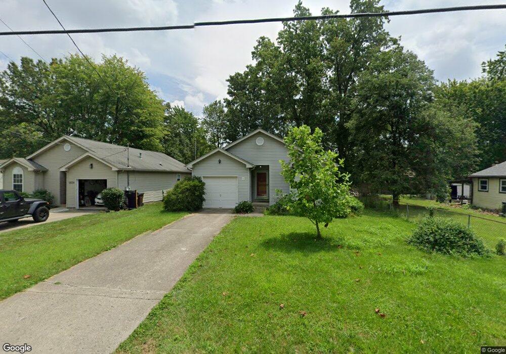
12020 7th Ave Cincinnati, OH 45249
Highpoint NeighborhoodEstimated Value: $139,606 - $204,000
3
Beds
2
Baths
1,197
Sq Ft
$145/Sq Ft
Est. Value
About This Home
This home is located at 12020 7th Ave, Cincinnati, OH 45249 and is currently estimated at $173,652, approximately $145 per square foot. 12020 7th Ave is a home located in Hamilton County with nearby schools including Stewart Elementary School, Princeton Community Middle School, and Princeton High School.
Ownership History
Date
Name
Owned For
Owner Type
Purchase Details
Closed on
Mar 8, 2023
Sold by
Kelley Bradley
Bought by
Kelley Edith M
Current Estimated Value
Purchase Details
Closed on
Jan 8, 2021
Sold by
Kelley Edith M
Bought by
Kelley Bradley
Purchase Details
Closed on
Jul 28, 2011
Sold by
Friesenborg Jennifer M and Rhoads Jennifer M
Bought by
Kelley Edith M
Home Financials for this Owner
Home Financials are based on the most recent Mortgage that was taken out on this home.
Original Mortgage
$87,718
Interest Rate
4.53%
Mortgage Type
FHA
Purchase Details
Closed on
Jan 7, 2004
Sold by
Rhoads John M
Bought by
Rhoads Jennifer M
Purchase Details
Closed on
Jun 27, 2002
Sold by
Bales Edwin E
Bought by
Rhoads Jennifer M
Create a Home Valuation Report for This Property
The Home Valuation Report is an in-depth analysis detailing your home's value as well as a comparison with similar homes in the area
Home Values in the Area
Average Home Value in this Area
Purchase History
| Date | Buyer | Sale Price | Title Company |
|---|---|---|---|
| Kelley Edith M | $500 | None Listed On Document | |
| Kelley Edith M | $500 | None Listed On Document | |
| Kelley Bradley | -- | None Available | |
| Kelley Edith M | $90,000 | Attorney | |
| Rhoads Jennifer M | -- | -- | |
| Rhoads Jennifer M | $92,200 | -- |
Source: Public Records
Mortgage History
| Date | Status | Borrower | Loan Amount |
|---|---|---|---|
| Previous Owner | Kelley Edith M | $87,718 |
Source: Public Records
Tax History Compared to Growth
Tax History
| Year | Tax Paid | Tax Assessment Tax Assessment Total Assessment is a certain percentage of the fair market value that is determined by local assessors to be the total taxable value of land and additions on the property. | Land | Improvement |
|---|---|---|---|---|
| 2024 | $939 | $30,937 | $3,150 | $27,787 |
| 2023 | $980 | $30,937 | $3,150 | $27,787 |
| 2022 | $1,126 | $28,872 | $3,143 | $25,729 |
| 2021 | $1,084 | $28,872 | $3,143 | $25,729 |
| 2020 | $1,112 | $28,872 | $3,143 | $25,729 |
| 2019 | $996 | $25,326 | $2,758 | $22,568 |
| 2018 | $941 | $25,326 | $2,758 | $22,568 |
| 2017 | $879 | $25,326 | $2,758 | $22,568 |
| 2016 | $1,165 | $30,524 | $2,678 | $27,846 |
| 2015 | $1,185 | $30,524 | $2,678 | $27,846 |
| 2014 | $1,189 | $30,524 | $2,678 | $27,846 |
| 2013 | $1,136 | $29,925 | $2,625 | $27,300 |
Source: Public Records
Map
Nearby Homes
- 12105 4th Ave
- 12121 3rd Ave
- 11863 Whittington Ln
- 12152 3rd Ave
- 9729 Old Stable Ct
- 9731 Montclaire Dr
- 9669 Old Stable Ct
- 9609 Cedar Knoll Dr
- 11934 Snider Rd
- 6712 Hummingbird Dr
- 7199 Fieldstone Ct
- 8372 Heritage Dr
- 12102 Paulmeadows Dr
- 9787 Snider Rd
- 9743 Snider Rd
- 6424 Camp Superior Dr
- 6520 Lewis Clark Trail
- 5857 Fawn Run Dr
- 5852 Fawn Run Dr
- 9867 Kensington Ln
- 12024 7th Ave
- 12008 7th Ave
- 12026 7th Ave
- 12006 7th Ave
- 7946 Fawncreek Dr
- 7941 Fawncreek Dr
- 12009 7th Ave
- 7893 Cincinnati Ave
- 12000 7th Ave
- 12031 7th Ave
- 11992 7th Ave
- 7950 Fawncreek Dr
- 7947 Bearcreek Dr
- 7945 Fawncreek Dr
- 12010 6th Ave
- 11993 7th Ave
- 7893 Columbia Ave
- 11984 7th Ave
- 12002 6th Ave
- 7956 Fawncreek Dr