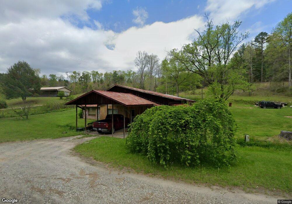
12020 Highway 294 Murphy, NC 28906
Estimated Value: $72,091
3
Beds
2
Baths
2,756
Sq Ft
$26/Sq Ft
Est. Value
About This Home
This home is located at 12020 Highway 294, Murphy, NC 28906 and is currently estimated at $72,091, approximately $26 per square foot. 12020 Highway 294 is a home located in Cherokee County with nearby schools including Hiwassee Dam Elementary/Middle School and Hiwassee Dam High School.
Ownership History
Date
Name
Owned For
Owner Type
Purchase Details
Closed on
Feb 5, 2018
Sold by
Core Capital Properties Llc
Bought by
Goforth Lora Ann
Current Estimated Value
Purchase Details
Closed on
May 18, 2017
Sold by
United Community Bank
Bought by
Core Capital Properties Llc
Purchase Details
Closed on
Feb 15, 2011
Sold by
Smith Timothy N and Smith Stephaine M
Bought by
Smith Atephaine M
Purchase Details
Closed on
Jan 21, 2005
Sold by
Chastain Larry J and Chastain Rebecca A
Bought by
Smith Timothy N and Smith Stephanie M
Home Financials for this Owner
Home Financials are based on the most recent Mortgage that was taken out on this home.
Original Mortgage
$138,506
Interest Rate
5.62%
Mortgage Type
Commercial
Create a Home Valuation Report for This Property
The Home Valuation Report is an in-depth analysis detailing your home's value as well as a comparison with similar homes in the area
Home Values in the Area
Average Home Value in this Area
Purchase History
| Date | Buyer | Sale Price | Title Company |
|---|---|---|---|
| Goforth Lora Ann | $38,000 | None Available | |
| Core Capital Properties Llc | $55,000 | None Available | |
| Smith Atephaine M | -- | None Available | |
| Smith Timothy N | $135,000 | -- |
Source: Public Records
Mortgage History
| Date | Status | Borrower | Loan Amount |
|---|---|---|---|
| Previous Owner | Smith Timothy N | $138,506 |
Source: Public Records
Tax History
| Year | Tax Paid | Tax Assessment Tax Assessment Total Assessment is a certain percentage of the fair market value that is determined by local assessors to be the total taxable value of land and additions on the property. | Land | Improvement |
|---|---|---|---|---|
| 2025 | $359 | $38,840 | $0 | $0 |
| 2024 | $337 | $38,840 | $0 | $0 |
| 2023 | $337 | $38,840 | $0 | $0 |
| 2022 | $0 | $38,840 | $0 | $0 |
| 2021 | $0 | $38,840 | $26,390 | $12,450 |
| 2020 | $591 | $38,840 | $0 | $0 |
| 2019 | $453 | $66,220 | $0 | $0 |
| 2018 | $453 | $66,220 | $0 | $0 |
| 2017 | $0 | $66,220 | $0 | $0 |
| 2016 | $591 | $66,220 | $0 | $0 |
| 2015 | $591 | $90,420 | $71,000 | $19,420 |
| 2012 | -- | $90,420 | $71,000 | $19,420 |
Source: Public Records
Map
Nearby Homes
- 922 Liberty Cir
- 12625 N Carolina 294
- 105 Liberty Rd
- 00 Nature Valley Trail
- 000 Nature Valley Trail
- 1.81 ac Nature Valley Trail
- 1.03 ac Guy Eller Rd
- 3.45 ac Guy Eller Rd
- 265 Iron Stone Ln
- 00 Sol Ln
- TBD Camp Creek Rd
- 5981 Candy Mountain Rd
- 1156 Liberty Rd
- Lot #29 Liberty Rd
- 67 Liberty Rd
- 00 Laurel Branch Rd
- 0 Maegans Dr Unit LotWP001 23098892
- 286 Kates Dr
- LT 9 Timberline Rd
- Lot 15 Timberlane Estate
- 12020 Highway 294
- 12020 Highway 294
- 12050 Highway 294
- 11985 N Carolina 294
- 37 Liberty Cir
- 43 Liberty Cir
- 3.76 ac Crooked Creek Rd
- 143 Crooked Creek Rd
- 143 Crooked Creek Rd
- 181 Liberty Cir
- 825 W Pine Ridge Rd
- 00000 W Pine Ridge Rd
- East W Pine Ridge Rd
- 13 Liberty Cir
- 007 Liberty Cir
- 3.9AC Liberty Cir
- LOTS Liberty Cir
- 0 Liberty Cir
- Lt 33&34 Liberty Cir
- 00 Liberty Cir
Your Personal Tour Guide
Ask me questions while you tour the home.