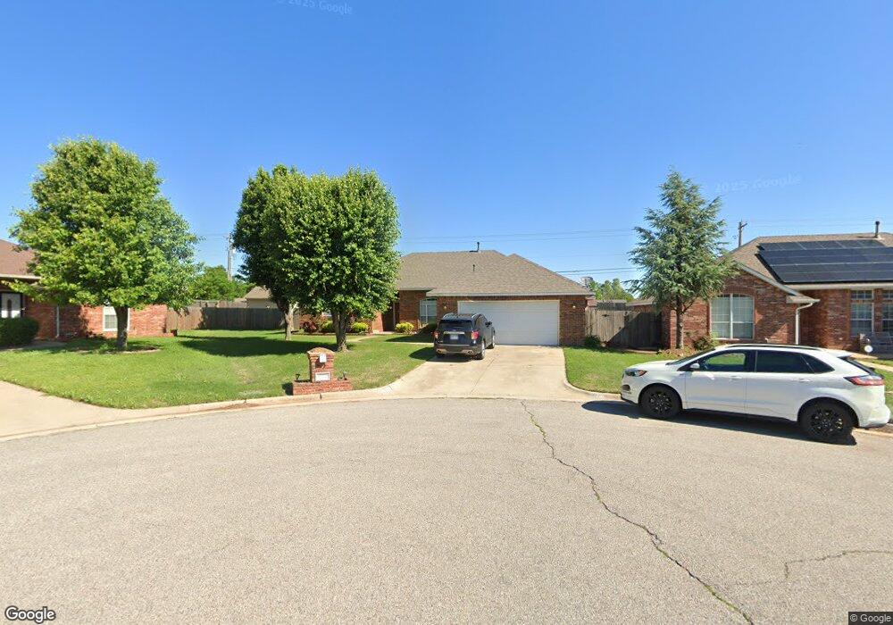
12023 SW 1st St Yukon, OK 73099
West Watch NeighborhoodEstimated Value: $264,638 - $299,000
3
Beds
2
Baths
2,166
Sq Ft
$130/Sq Ft
Est. Value
About This Home
This home is located at 12023 SW 1st St, Yukon, OK 73099 and is currently estimated at $280,910, approximately $129 per square foot. 12023 SW 1st St is a home located in Canadian County with nearby schools including Mustang Creek Elementary School, Meadow Brook Intermediate School, and Mustang Central Middle School.
Ownership History
Date
Name
Owned For
Owner Type
Purchase Details
Closed on
Feb 20, 2009
Sold by
Heikes Paul R and Heikes Wytonia E
Bought by
White Bernice and White George A
Current Estimated Value
Purchase Details
Closed on
Nov 26, 2002
Sold by
Beall Lonnie and Beall Bernice
Home Financials for this Owner
Home Financials are based on the most recent Mortgage that was taken out on this home.
Original Mortgage
$125,600
Interest Rate
6.05%
Purchase Details
Closed on
Jul 8, 2002
Sold by
Weed Family Ltd Ptnrshp~The
Purchase Details
Closed on
Jul 15, 1996
Sold by
Weed Billy L
Purchase Details
Closed on
Jul 12, 1996
Sold by
Weed Forest A and Weed Joy
Purchase Details
Closed on
Jul 11, 1996
Sold by
Weed Gary A
Purchase Details
Closed on
Dec 14, 1995
Sold by
Weed Billy and Weed Opal
Create a Home Valuation Report for This Property
The Home Valuation Report is an in-depth analysis detailing your home's value as well as a comparison with similar homes in the area
Home Values in the Area
Average Home Value in this Area
Purchase History
| Date | Buyer | Sale Price | Title Company |
|---|---|---|---|
| White Bernice | $188,000 | None Available | |
| -- | $126,000 | -- | |
| -- | $25,000 | -- | |
| -- | -- | -- | |
| -- | -- | -- | |
| -- | -- | -- | |
| -- | -- | -- |
Source: Public Records
Mortgage History
| Date | Status | Borrower | Loan Amount |
|---|---|---|---|
| Previous Owner | -- | $125,600 |
Source: Public Records
Tax History Compared to Growth
Tax History
| Year | Tax Paid | Tax Assessment Tax Assessment Total Assessment is a certain percentage of the fair market value that is determined by local assessors to be the total taxable value of land and additions on the property. | Land | Improvement |
|---|---|---|---|---|
| 2024 | $2,800 | $25,963 | $1,680 | $24,283 |
| 2023 | $2,800 | $24,726 | $1,680 | $23,046 |
| 2022 | $2,707 | $23,549 | $1,680 | $21,869 |
| 2021 | $2,568 | $22,428 | $1,680 | $20,748 |
| 2020 | $2,623 | $22,678 | $1,680 | $20,998 |
| 2019 | $2,638 | $22,830 | $1,680 | $21,150 |
| 2018 | $2,559 | $21,743 | $1,680 | $20,063 |
| 2017 | $2,419 | $20,820 | $1,680 | $19,140 |
| 2016 | $2,304 | $20,876 | $1,680 | $19,196 |
| 2015 | $2,106 | $18,936 | $1,680 | $17,256 |
| 2014 | $2,106 | $18,034 | $1,680 | $16,354 |
Source: Public Records
Map
Nearby Homes
- 311 Tumbleweed Rd
- 418 Palo Verde Dr
- 624 Caladium Dr
- 12127 SW 4th St
- 521 Apache Gate Dr
- 708 Cactus Ct
- 12325 SW 6th St
- 108 N Eastgate Dr
- 12177 Hollyrock Dr
- 517 Cherokee Gate Dr
- 11817 Hollyrock Dr
- 12400 Newgate Dr
- 12401 SW 7th St
- 904 Norway Ave
- 309 Glen Dr
- 1000 Redwood Creek Dr
- 1004 Redwood Creek Dr
- 1008 Redwood Creek Dr
- 213 Harrogate Dr
- 1012 Redwood Creek Dr
- 12017 SW 1st St
- 201 Tumbleweed Rd
- 12013 SW 1st St
- 205 Tumbleweed Rd
- 200 Tumbleweed Rd
- 12009 SW 1st St
- 12020 Sagamore Dr
- 12024 Sagamore Dr
- 12028 Sagamore Dr
- 12032 Sagamore Dr
- 204 Tumbleweed Rd
- 201 Sage Brush Rd
- 12005 SW 1st St
- 12036 Sagamore Dr
- 213 Tumbleweed Rd
- 205 Sage Brush Rd
- 208 Tumbleweed Rd
- 12012 Sagamore Dr
- 12001 SW 1st St
- 301 Tumbleweed Rd