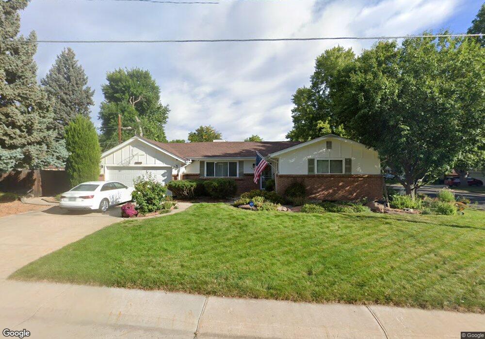
12025 W 61st Ave Arvada, CO 80004
Allendale NeighborhoodEstimated Value: $590,000 - $704,000
4
Beds
5
Baths
1,639
Sq Ft
$385/Sq Ft
Est. Value
About This Home
This home is located at 12025 W 61st Ave, Arvada, CO 80004 and is currently estimated at $631,321, approximately $385 per square foot. 12025 W 61st Ave is a home located in Jefferson County with nearby schools including Vanderhoof Elementary School, Drake Junior High School, and Arvada West High School.
Create a Home Valuation Report for This Property
The Home Valuation Report is an in-depth analysis detailing your home's value as well as a comparison with similar homes in the area
Home Values in the Area
Average Home Value in this Area
Tax History Compared to Growth
Tax History
| Year | Tax Paid | Tax Assessment Tax Assessment Total Assessment is a certain percentage of the fair market value that is determined by local assessors to be the total taxable value of land and additions on the property. | Land | Improvement |
|---|---|---|---|---|
| 2024 | $3,707 | $38,222 | $14,276 | $23,946 |
| 2023 | $3,707 | $38,222 | $14,276 | $23,946 |
| 2022 | $3,189 | $32,567 | $10,971 | $21,596 |
| 2021 | $3,242 | $33,503 | $11,286 | $22,217 |
| 2020 | $2,912 | $30,175 | $9,408 | $20,767 |
| 2019 | $2,873 | $30,175 | $9,408 | $20,767 |
| 2018 | $2,781 | $28,399 | $7,680 | $20,719 |
| 2017 | $2,546 | $28,399 | $7,680 | $20,719 |
| 2016 | $2,220 | $23,331 | $5,803 | $17,528 |
| 2015 | $2,009 | $23,331 | $5,803 | $17,528 |
| 2014 | $2,009 | $19,845 | $4,872 | $14,973 |
Source: Public Records
Map
Nearby Homes
- 6085 Simms St
- 12362 W 60th Place
- 11626 W 62nd Place Unit 103
- 11640 W 62nd Place Unit 203
- 12017 W 58th Place
- 5779 Taft St
- 11944 W 57th Dr
- 11924 W 57th Dr
- 11958 W 57th Place
- 6470 Simms St Unit C
- 12976 W 61st Cir
- 6440 Wright St
- 11198 W 59th Place
- 6072 Pierson Ct
- 11925 W 66th Place Unit B
- 11820 W 66th Place Unit A
- 5795 Xenon Way
- 13168 W 62nd Dr
- 6015 Parfet St
- 12924 W 64th Dr Unit B
- 6127 Union St
- 12055 W 61st Ave
- 6126 Urban St
- 6097 Union St
- 11965 W 61st Ave
- 6147 Union St
- 12044 W 61st Ave
- 6128 Union St
- 6146 Urban St
- 6098 Union St
- 6148 Union St
- 12064 W 61st Ave
- 6166 Urban St
- 6167 Union St
- 6067 Union St
- 11945 W 61st Ave
- 12115 W 61st Ave
- 12063 W 60th Place
- 6139 Taft Ct
- 6168 Union St