Estimated Value: $429,000 - $461,000
4
Beds
3
Baths
2,659
Sq Ft
$168/Sq Ft
Est. Value
About This Home
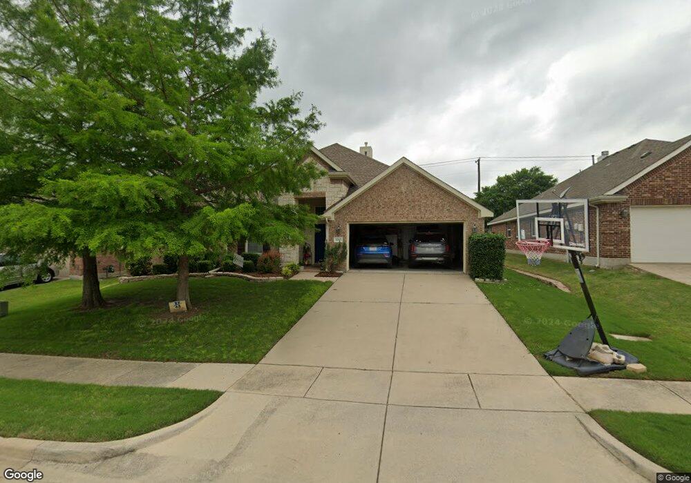
This home is located at 1203 Cedar Branch Dr, Wylie, TX 75098 and is currently estimated at $446,583, approximately $167 per square foot. 1203 Cedar Branch Dr is a home located in Collin County with nearby schools including Wally Watkins Elementary School, AB Harrison Intermediate School, and Grady Burnett J High School.
Ownership History
Date
Name
Owned For
Owner Type
Purchase Details
Closed on
May 6, 2008
Sold by
Rh Of Texas Lp
Bought by
Peterson Erik A and Peterson Valerie
Current Estimated Value
Home Financials for this Owner
Home Financials are based on the most recent Mortgage that was taken out on this home.
Original Mortgage
$169,248
Outstanding Balance
$107,072
Interest Rate
5.86%
Mortgage Type
Purchase Money Mortgage
Estimated Equity
$339,511
Create a Home Valuation Report for This Property
The Home Valuation Report is an in-depth analysis detailing your home's value as well as a comparison with similar homes in the area
Home Values in the Area
Average Home Value in this Area
Purchase History
| Date | Buyer | Sale Price | Title Company |
|---|---|---|---|
| Peterson Erik A | -- | None Available |
Source: Public Records
Mortgage History
| Date | Status | Borrower | Loan Amount |
|---|---|---|---|
| Open | Peterson Erik A | $169,248 |
Source: Public Records
Tax History Compared to Growth
Tax History
| Year | Tax Paid | Tax Assessment Tax Assessment Total Assessment is a certain percentage of the fair market value that is determined by local assessors to be the total taxable value of land and additions on the property. | Land | Improvement |
|---|---|---|---|---|
| 2025 | $6,412 | $430,430 | $99,750 | $353,270 |
| 2024 | $6,412 | $391,300 | $99,750 | $347,555 |
| 2023 | $6,412 | $355,727 | $90,250 | $347,213 |
| 2022 | $7,095 | $323,388 | $90,250 | $304,898 |
| 2021 | $6,917 | $293,989 | $66,500 | $227,489 |
| 2020 | $7,152 | $288,036 | $57,000 | $231,036 |
| 2019 | $7,412 | $282,049 | $57,000 | $225,049 |
| 2018 | $7,364 | $273,455 | $57,000 | $216,455 |
| 2017 | $6,850 | $256,769 | $47,500 | $209,269 |
| 2016 | $6,425 | $233,474 | $38,000 | $195,474 |
| 2015 | $5,234 | $210,220 | $38,000 | $172,220 |
Source: Public Records
Map
Nearby Homes
- 1210 Iron Horse St
- 1201 E Stone Rd
- 1318 Chestnut Hill Dr
- 1321 Iron Horse St
- 1320 Cedar Branch Dr
- 306 Foxwood Ct
- 1316 Taren Trail
- 1318 Taren Trail
- 825 Forest Edge Ln
- 1323 Canyon Creek Rd
- 312 Maltese Cir
- 407 Sparrow Dr
- 1330 Canyon Creek Rd
- 811 Forest Edge Ln
- 800 Twin Oaks Dr
- 1503 E Collins Blvd
- 820 Foxwood Ln
- 1209 Surrey Cir
- 825 Foxwood Ln
- 409 Cedar Ridge Dr
- 1205 Cedar Branch Dr
- 1201 Cedar Branch Dr
- 1207 Cedar Branch Dr
- 1202 Cedar Branch Dr
- 1204 Cedar Branch Dr
- 1200 Cedar Branch Dr
- 1209 Cedar Branch Dr
- 1211 Cedar Branch Dr
- 1014 E Fm 544
- 1206 Cedar Branch Dr
- 1201 Chestnut Hill Dr
- 1020 E Fm 544
- 1213 Cedar Branch Dr
- 1045 E Fm 544
- 1030 E Fm 544
- 1010 E Fm 544
- 1215 Cedar Branch Dr
- 1208 Cedar Branch Dr
- 1203 Chestnut Hill Dr
- 1206 Iron Horse St