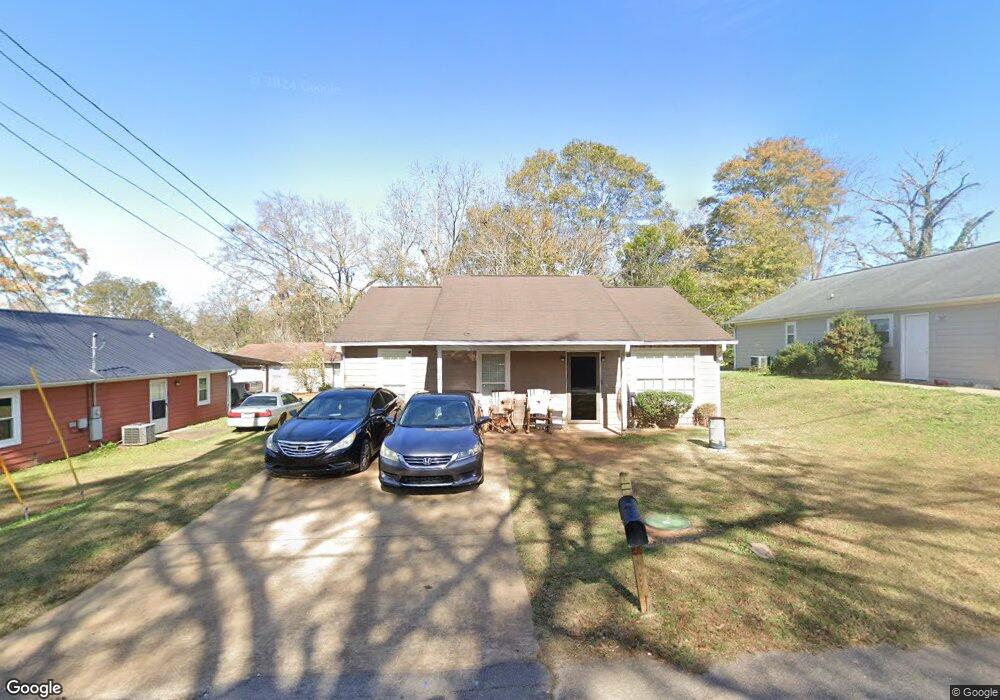
1203 Davidson St West Point, GA 31833
Estimated Value: $118,000 - $165,000
3
Beds
2
Baths
1,152
Sq Ft
$118/Sq Ft
Est. Value
About This Home
This home is located at 1203 Davidson St, West Point, GA 31833 and is currently estimated at $136,488, approximately $118 per square foot. 1203 Davidson St is a home with nearby schools including West Point Elementary School, Long Cane Elementary School, and Whitesville Road Elementary School.
Ownership History
Date
Name
Owned For
Owner Type
Purchase Details
Closed on
Feb 5, 2010
Sold by
Chattahoochee Fuller Cente
Bought by
Walker Turkeesa
Current Estimated Value
Purchase Details
Closed on
Jul 5, 1993
Sold by
Anthony D Matheny
Bought by
Pete Bryan W W
Purchase Details
Closed on
Jan 24, 1992
Sold by
Stribling Phillip E
Bought by
Anthony D Matheny
Purchase Details
Closed on
Dec 15, 1989
Sold by
Pearl C Harrell
Bought by
Stribling Phillip E
Purchase Details
Closed on
Jan 1, 1940
Bought by
Pearl C Harrell
Create a Home Valuation Report for This Property
The Home Valuation Report is an in-depth analysis detailing your home's value as well as a comparison with similar homes in the area
Home Values in the Area
Average Home Value in this Area
Purchase History
| Date | Buyer | Sale Price | Title Company |
|---|---|---|---|
| Walker Turkeesa | $90,000 | -- | |
| Pete Bryan W W | -- | -- | |
| Anthony D Matheny | -- | -- | |
| Stribling Phillip E | -- | -- | |
| Pearl C Harrell | -- | -- |
Source: Public Records
Tax History Compared to Growth
Tax History
| Year | Tax Paid | Tax Assessment Tax Assessment Total Assessment is a certain percentage of the fair market value that is determined by local assessors to be the total taxable value of land and additions on the property. | Land | Improvement |
|---|---|---|---|---|
| 2024 | $1,378 | $38,960 | $1,240 | $37,720 |
| 2023 | $1,072 | $39,320 | $1,240 | $38,080 |
| 2022 | $1,030 | $36,920 | $1,240 | $35,680 |
| 2021 | $976 | $32,360 | $1,240 | $31,120 |
| 2020 | $975 | $32,320 | $520 | $31,800 |
| 2019 | $953 | $31,588 | $1,228 | $30,360 |
| 2018 | $908 | $30,108 | $1,228 | $28,880 |
| 2017 | $908 | $30,108 | $1,228 | $28,880 |
| 2016 | $883 | $29,270 | $1,228 | $28,042 |
| 2015 | $921 | $30,476 | $1,228 | $29,248 |
| 2014 | $922 | $30,476 | $1,228 | $29,248 |
| 2013 | -- | $30,476 | $1,228 | $29,248 |
Source: Public Records
Map
Nearby Homes
- 509 Cleveland St
- 0 Arrowhead Dr Unit 10451860
- 804 E 6th St
- 713 Avenue H
- 1008 E 12th St
- 311 E 4th St
- 0 Sunset Dr Unit 10451831
- 112 Hillcrest Rd
- 128 Highland Dr
- 1505 Wisteria Dr
- 712 4th Ave
- 1007 4th Ave
- 4517 Georgia 18
- 4509 Georgia 18
- 4523 Georgia 18
- 4527 Georgia 18
- 1314 4th Ave
- 1410 Roper Ave
- 508 Pine St
- 107 Garden Walk
- 1205 Davidson St
- 500 Cleveland Ave
- 506 Cleveland Ave
- 1200 Davidson St
- 1301 Davidson St
- 510 Cleveland Ave
- 506 Alley St
- 1100 Davidson St
- 1101 Davidson St
- 1213 Davidson St
- 1211 Davidson St
- 512 Cleveland Ave
- 501 Avenue N
- 511 Cleveland Ave
- 100 Buddy St
- 503 Avenue N
- 505 Avenue N
- 1001 E 6th St
- 515 Cleveland Ave
- 1004 Davidson St