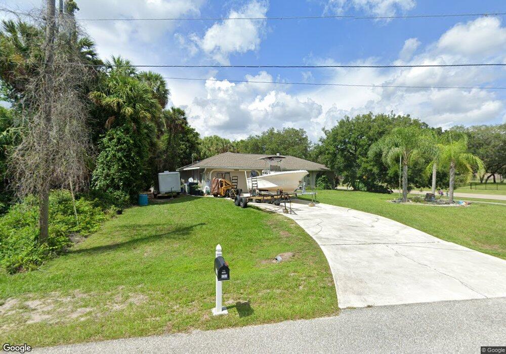
1203 Koltenborn Rd North Port, FL 34288
Estimated Value: $247,000 - $316,000
3
Beds
2
Baths
1,394
Sq Ft
$204/Sq Ft
Est. Value
About This Home
This home is located at 1203 Koltenborn Rd, North Port, FL 34288 and is currently estimated at $284,038, approximately $203 per square foot. 1203 Koltenborn Rd is a home located in Sarasota County with nearby schools including Atwater Elementary School, North Port High School, and Woodland Middle School.
Ownership History
Date
Name
Owned For
Owner Type
Purchase Details
Closed on
Nov 15, 2007
Sold by
Savage William
Bought by
Chorly Daniel
Current Estimated Value
Purchase Details
Closed on
Oct 17, 2005
Sold by
Savage William J and Savage Kimberly E
Bought by
Savage Kimberly E
Purchase Details
Closed on
Mar 21, 1997
Sold by
Windemere Homes Inc
Bought by
Savage William J and Savage Kimberly E
Home Financials for this Owner
Home Financials are based on the most recent Mortgage that was taken out on this home.
Original Mortgage
$70,400
Interest Rate
7.58%
Create a Home Valuation Report for This Property
The Home Valuation Report is an in-depth analysis detailing your home's value as well as a comparison with similar homes in the area
Home Values in the Area
Average Home Value in this Area
Purchase History
| Date | Buyer | Sale Price | Title Company |
|---|---|---|---|
| Chorly Daniel | $10,000 | Wci Title | |
| Savage Kimberly E | -- | -- | |
| Savage William J | $4,500 | -- |
Source: Public Records
Mortgage History
| Date | Status | Borrower | Loan Amount |
|---|---|---|---|
| Previous Owner | Savage William J | $70,400 |
Source: Public Records
Tax History Compared to Growth
Tax History
| Year | Tax Paid | Tax Assessment Tax Assessment Total Assessment is a certain percentage of the fair market value that is determined by local assessors to be the total taxable value of land and additions on the property. | Land | Improvement |
|---|---|---|---|---|
| 2024 | $1,615 | $99,036 | -- | -- |
| 2023 | $1,615 | $94,404 | $0 | $0 |
| 2022 | $1,520 | $91,654 | $0 | $0 |
| 2021 | $1,489 | $88,984 | $0 | $0 |
| 2020 | $1,464 | $87,755 | $0 | $0 |
| 2019 | $1,418 | $85,782 | $0 | $0 |
| 2018 | $1,190 | $77,064 | $0 | $0 |
| 2017 | $1,148 | $75,479 | $0 | $0 |
| 2016 | $1,153 | $112,600 | $5,400 | $107,200 |
| 2015 | $1,166 | $96,300 | $5,000 | $91,300 |
| 2014 | $1,150 | $71,754 | $0 | $0 |
Source: Public Records
Map
Nearby Homes
- 0 Nackman Rd Unit MFRC7512606
- TBD Nackman Rd
- 0 W Taggard Rd Unit 317421
- 0 Koltenborn Rd
- 0 Nabatoff St Unit C7446694
- 1325 Goshen Rd
- Lot 3 Goshen Rd
- 0 Goshen Rd Unit MFRC7491210
- 0 Goshen Rd Unit 2025015646
- 1309 Nackman Rd
- 0 Webster St Unit MFRA4656305
- 0 Webster St Unit MFRC7513601
- 1901 E Price Blvd
- 3243 Brewster Rd
- 0 Kaabe Ave
- 3259 Masuko Ave
- 1072 Henning St
- 0 Jinright Rd Unit C7457580
- 0 Jinright Rd Unit MFRO6294526
- 0 Jinright Rd Unit MFRA4631810