
Seller's Agent in 2025
Eric Hoffman
Keller Williams Realty East Monmouth
(732) 239-0272
1 in this area
78 Total Sales
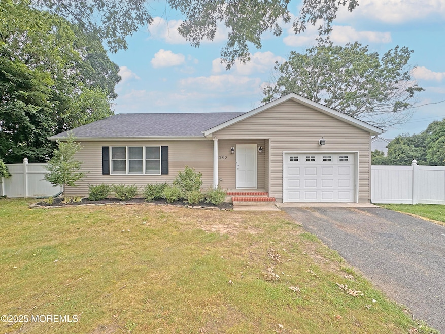
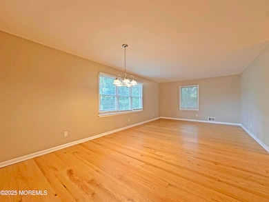
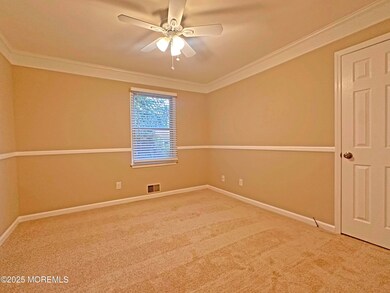
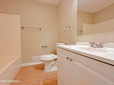
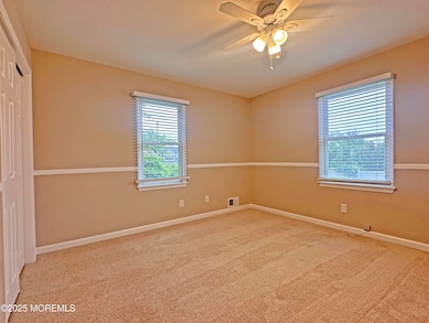
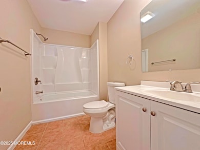
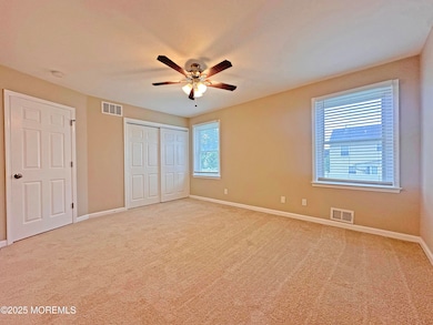
Under Contract but Continue to Show. This well-maintained ranch style home features 3 comfortable bedrooms and 2 full bathrooms, providing ample space for daily living. The single-story design offers convenient accessibility throughout the residence.
The finished basement adds valuable additional living space to the property. Central air conditioning ensures year-round comfort, while granite countertops enhance the kitchen's appeal. The private backyard provides a secluded retreat for relaxation and entertainment.
A large deck extends the living space outdoors, creating an ideal spot for gatherings and enjoying fresh air. The combination of indoor and outdoor amenities makes this property particularly attractive for those seeking both comfort and functionality in their next home.
Last Agent to Sell the Property
Keller Williams Realty East Monmouth License #1325947 Listed on: 07/04/2025
| Date | Type | Sale Price | Title Company |
|---|---|---|---|
| Deed | $820,000 | Anchor Title | |
| Deed | $435,000 | -- | |
| Deed | $219,000 | -- | |
| Deed | $105,000 | -- |
| Date | Status | Loan Amount | Loan Type |
|---|---|---|---|
| Previous Owner | $697,000 | New Conventional | |
| Previous Owner | $325,000 | Purchase Money Mortgage | |
| Previous Owner | $119,000 | Purchase Money Mortgage |
| Date | Event | Price | List to Sale | Price per Sq Ft |
|---|---|---|---|---|
| 09/25/2025 09/25/25 | Sold | $820,000 | 0.0% | $495 / Sq Ft |
| 07/04/2025 07/04/25 | For Sale | $819,900 | -- | $495 / Sq Ft |
| Year | Tax Paid | Tax Assessment Tax Assessment Total Assessment is a certain percentage of the fair market value that is determined by local assessors to be the total taxable value of land and additions on the property. | Land | Improvement |
|---|---|---|---|---|
| 2025 | $8,573 | $406,300 | $248,500 | $157,800 |
| 2024 | $8,317 | $406,300 | $248,500 | $157,800 |
| 2023 | $8,317 | $406,300 | $248,500 | $157,800 |
| 2022 | $8,114 | $406,300 | $248,500 | $157,800 |
| 2021 | $8,114 | $406,300 | $248,500 | $157,800 |
| 2020 | $8,016 | $406,300 | $248,500 | $157,800 |
| 2019 | $7,919 | $406,300 | $248,500 | $157,800 |
| 2018 | $7,850 | $406,300 | $248,500 | $157,800 |
| 2017 | $7,695 | $406,300 | $248,500 | $157,800 |
| 2016 | $7,533 | $406,300 | $248,500 | $157,800 |
| 2015 | $8,124 | $275,400 | $133,400 | $142,000 |
| 2014 | $7,830 | $271,500 | $129,500 | $142,000 |
Seller's Agent in 2025
Eric Hoffman
Keller Williams Realty East Monmouth
(732) 239-0272
1 in this area
78 Total Sales
A
Buyer's Agent in 2025
Amylee Monte
Realty One Group Emerge
(732) 996-0383
2 in this area
13 Total Sales
Source: MOREMLS (Monmouth Ocean Regional REALTORS®)
MLS Number: 22519810
APN: 52-00335-0000-00059
Disclaimer: Certain information contained herein is derived from information provided by parties other than Homes.com. All information provided is deemed reliable, but is not guaranteed to be accurate and should be independently verified.
![]() IDX information is provided exclusively for personal, non-commercial use, and may not be used for any purpose other than to identify prospective properties consumers may be interested in purchasing.
IDX information is provided exclusively for personal, non-commercial use, and may not be used for any purpose other than to identify prospective properties consumers may be interested in purchasing.
Information is deemed reliable but not guaranteed.