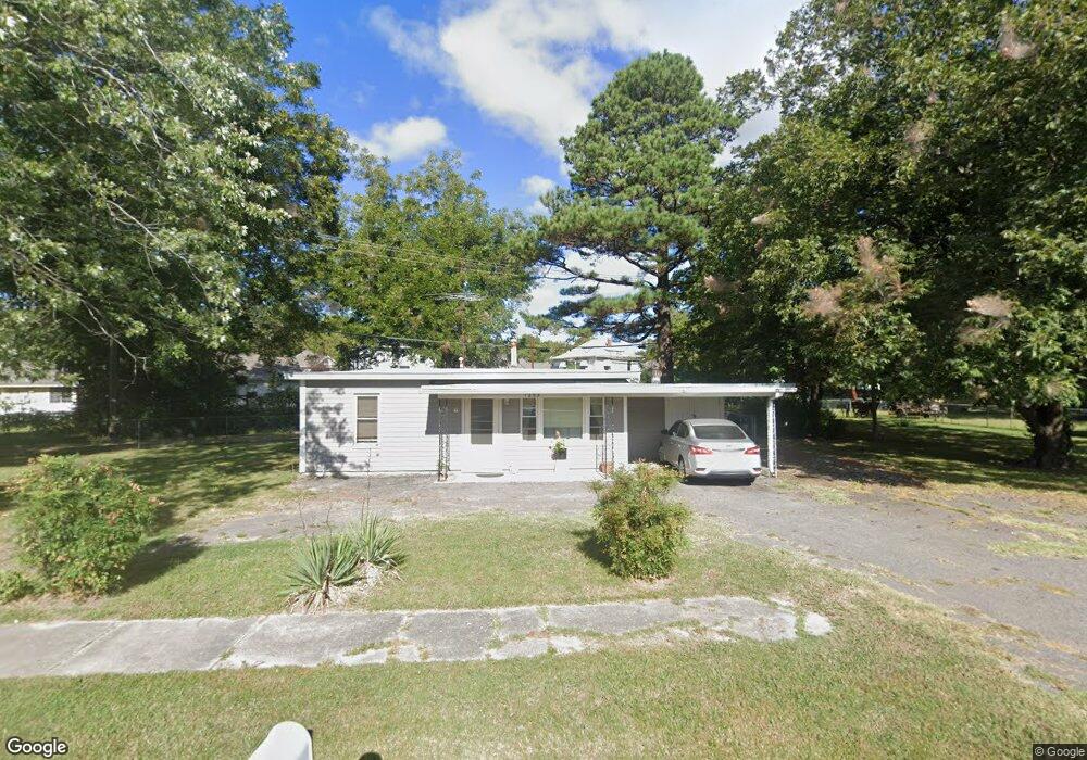
1203 Maple St Muskogee, OK 74403
Central Muskogee NeighborhoodEstimated Value: $57,000 - $118,000
2
Beds
1
Bath
672
Sq Ft
$115/Sq Ft
Est. Value
About This Home
This home is located at 1203 Maple St, Muskogee, OK 74403 and is currently estimated at $77,153, approximately $114 per square foot. 1203 Maple St is a home located in Muskogee County with nearby schools including Irving Elementary School, 8th & 9th Grade Academy @ Alice Robertson, and Muskogee High School.
Ownership History
Date
Name
Owned For
Owner Type
Purchase Details
Closed on
Jul 12, 2006
Sold by
Taylor Plina and Taylor Elizabeth D
Bought by
Cooper Francine C
Current Estimated Value
Home Financials for this Owner
Home Financials are based on the most recent Mortgage that was taken out on this home.
Original Mortgage
$25,325
Interest Rate
6.67%
Mortgage Type
New Conventional
Purchase Details
Closed on
Dec 30, 2004
Purchase Details
Closed on
Dec 9, 2004
Purchase Details
Closed on
Sep 1, 1992
Create a Home Valuation Report for This Property
The Home Valuation Report is an in-depth analysis detailing your home's value as well as a comparison with similar homes in the area
Home Values in the Area
Average Home Value in this Area
Purchase History
| Date | Buyer | Sale Price | Title Company |
|---|---|---|---|
| Cooper Francine C | $27,500 | None Available | |
| -- | -- | -- | |
| -- | -- | -- | |
| -- | -- | -- |
Source: Public Records
Mortgage History
| Date | Status | Borrower | Loan Amount |
|---|---|---|---|
| Closed | Cooper Francine C | $25,325 |
Source: Public Records
Tax History Compared to Growth
Tax History
| Year | Tax Paid | Tax Assessment Tax Assessment Total Assessment is a certain percentage of the fair market value that is determined by local assessors to be the total taxable value of land and additions on the property. | Land | Improvement |
|---|---|---|---|---|
| 2024 | $144 | $3,326 | $907 | $2,419 |
| 2023 | $144 | $3,326 | $682 | $2,644 |
| 2022 | $132 | $3,326 | $682 | $2,644 |
| 2021 | $133 | $3,326 | $840 | $2,486 |
| 2020 | $133 | $3,326 | $840 | $2,486 |
| 2019 | $231 | $3,688 | $931 | $2,757 |
| 2018 | $217 | $3,688 | $931 | $2,757 |
| 2017 | $107 | $3,135 | $931 | $2,204 |
| 2016 | $100 | $3,044 | $931 | $2,113 |
| 2015 | $193 | $3,044 | $931 | $2,113 |
| 2014 | $100 | $3,044 | $931 | $2,113 |
Source: Public Records
Map
Nearby Homes
- 1225 Maple St
- 1212 Summit St
- 1216 Summit St
- 1218 Summit St
- 1223 Maple St
- 1222 Summit St
- 1204 Summit St
- 1202 Summit St
- 1215 Manitou St
- 1226 Summit St
- 1160 Summit St
- 1229 Manitou St
- 1162 Summit St
- 1302 Lawrence St
- 1304 Lawrence St
- 1209 Summit St
- 1211 Summit St
- 1205 Summit St
- 1215 Summit St
- 1303 Maple St