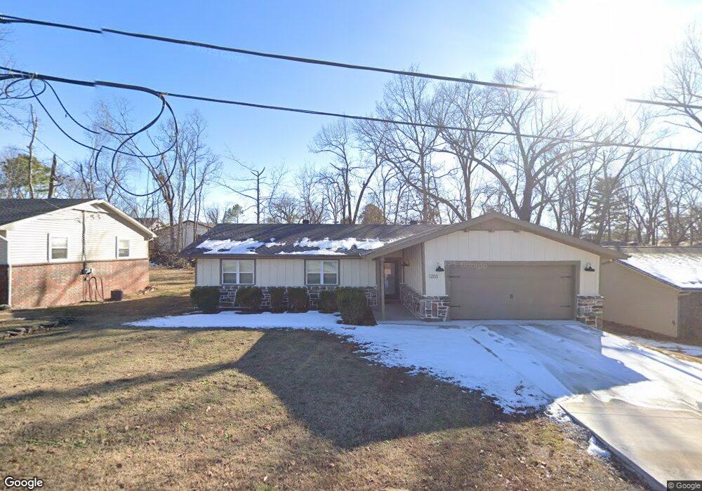
1203 NW 10th St Bentonville, AR 72712
Estimated Value: $404,000 - $434,680
3
Beds
2
Baths
1,456
Sq Ft
$286/Sq Ft
Est. Value
About This Home
This home is located at 1203 NW 10th St, Bentonville, AR 72712 and is currently estimated at $415,920, approximately $285 per square foot. 1203 NW 10th St is a home located in Benton County with nearby schools including Thomas Jefferson Elementary School, Lincoln Junior High School, and Ardis Ann Middle School.
Ownership History
Date
Name
Owned For
Owner Type
Purchase Details
Closed on
Feb 1, 2024
Sold by
Stl Group Llc
Bought by
Scott Capital Llc
Current Estimated Value
Purchase Details
Closed on
Jul 24, 2023
Sold by
Williams Shannon
Bought by
Stl Group Llc
Purchase Details
Closed on
Oct 5, 1999
Bought by
Williams
Purchase Details
Closed on
Jul 3, 1999
Bought by
Dod 07-03-1999
Purchase Details
Closed on
Nov 4, 1991
Bought by
Dod 11-04-1991
Purchase Details
Closed on
May 23, 1977
Bought by
Balcer
Create a Home Valuation Report for This Property
The Home Valuation Report is an in-depth analysis detailing your home's value as well as a comparison with similar homes in the area
Home Values in the Area
Average Home Value in this Area
Purchase History
| Date | Buyer | Sale Price | Title Company |
|---|---|---|---|
| Scott Capital Llc | -- | None Listed On Document | |
| Stl Group Llc | $170,000 | City Title | |
| Williams | $65,000 | -- | |
| Dod 07-03-1999 | -- | -- | |
| Dod 11-04-1991 | -- | -- | |
| Balcer | $39,000 | -- |
Source: Public Records
Tax History Compared to Growth
Tax History
| Year | Tax Paid | Tax Assessment Tax Assessment Total Assessment is a certain percentage of the fair market value that is determined by local assessors to be the total taxable value of land and additions on the property. | Land | Improvement |
|---|---|---|---|---|
| 2025 | $4,775 | $77,615 | $15,000 | $62,615 |
| 2024 | $4,797 | $77,615 | $15,000 | $62,615 |
| 2023 | $1,546 | $35,300 | $8,600 | $26,700 |
| 2022 | $1,140 | $35,300 | $8,600 | $26,700 |
| 2021 | $1,066 | $35,300 | $8,600 | $26,700 |
| 2020 | $1,010 | $23,210 | $3,800 | $19,410 |
| 2019 | $955 | $23,210 | $3,800 | $19,410 |
| 2018 | $925 | $23,210 | $3,800 | $19,410 |
| 2017 | $777 | $23,210 | $3,800 | $19,410 |
| 2016 | $777 | $23,210 | $3,800 | $19,410 |
| 2015 | $1,075 | $17,400 | $3,000 | $14,400 |
| 2014 | $725 | $17,400 | $3,000 | $14,400 |
Source: Public Records
Map
Nearby Homes
- 1201 NW 10th St
- 1002 NW 9th St
- 912 NW 9th St
- 1004 Robin Haven Dr
- 703 NW J St
- 1110 NW 7th St
- 820 NW 11th St Unit 11
- 9 NW K Place
- 1402 NW 11th St
- 701 NW Ford Ln
- 809 NW 11th St
- Lot 8 NW H St
- Lot 7 NW H St
- Lot 7 & 8 NW H St
- 820 NW 11th St
- 816 NW 11th St Unit 12
- 816 NW 11th St
- 809 Carson Dr
- 823 NW 8th St
- 827 NW 8th St
- 1205 NW 10th St
- 903 NW K St
- 0 NW 10th St
- 1103 NW 10th St
- 904 NW K St
- 910 NW L St
- 1204 NW 10th St
- 904 NW L St
- L20 Simsberry
- L1 Copperstone Subdivision
- 911 Dogwood Dr
- 901 NW K St
- 902 NW K St
- 1301 NW 10th St
- 7 Dogwood Place L15
- 227 Dogwood Place L6
- 1302 NW 10th St
- 1206 NW 10th St
- 1302 NW 9th St
- 1000 NW 9th St