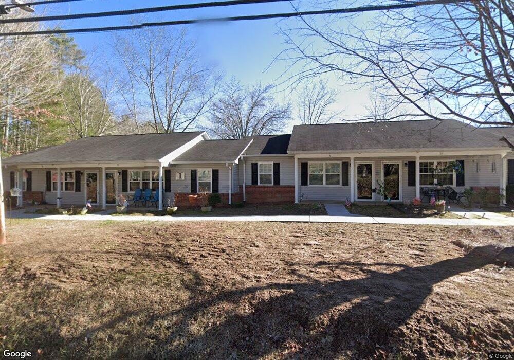
1203 Old 441 S Clayton, GA 30525
Estimated Value: $3,071,000 - $3,873,000
--
Bed
1
Bath
1,344
Sq Ft
$2,552/Sq Ft
Est. Value
About This Home
This home is located at 1203 Old 441 S, Clayton, GA 30525 and is currently estimated at $3,429,608, approximately $2,551 per square foot. 1203 Old 441 S is a home with nearby schools including Rabun County Primary School, Rabun County High School, and Great Oaks Montessori .
Ownership History
Date
Name
Owned For
Owner Type
Purchase Details
Closed on
Jul 25, 2013
Sold by
Brooks Lane Apartments Lp
Bought by
New Brooks Lane Apartments Llc
Current Estimated Value
Home Financials for this Owner
Home Financials are based on the most recent Mortgage that was taken out on this home.
Original Mortgage
$1,038,470
Outstanding Balance
$756,396
Interest Rate
3.96%
Mortgage Type
Commercial
Estimated Equity
$2,673,212
Purchase Details
Closed on
Nov 1, 1993
Bought by
Brookslane Apartments Lp
Create a Home Valuation Report for This Property
The Home Valuation Report is an in-depth analysis detailing your home's value as well as a comparison with similar homes in the area
Home Values in the Area
Average Home Value in this Area
Purchase History
| Date | Buyer | Sale Price | Title Company |
|---|---|---|---|
| New Brooks Lane Apartments Llc | $1,200,469 | -- | |
| New Brooks Lane Apartments Llc | $1,200,469 | -- | |
| Brookslane Apartments Lp | $57,500 | -- | |
| Brookslane Apartments Lp | $57,500 | -- |
Source: Public Records
Mortgage History
| Date | Status | Borrower | Loan Amount |
|---|---|---|---|
| Open | New Brooks Lane Apartments Llc | $1,038,470 | |
| Closed | New Brooks Lane Apartments Llc | $1,038,470 |
Source: Public Records
Tax History Compared to Growth
Tax History
| Year | Tax Paid | Tax Assessment Tax Assessment Total Assessment is a certain percentage of the fair market value that is determined by local assessors to be the total taxable value of land and additions on the property. | Land | Improvement |
|---|---|---|---|---|
| 2024 | $8,153 | $507,956 | $30,154 | $477,802 |
| 2023 | $8,673 | $473,860 | $30,154 | $443,706 |
| 2022 | $8,364 | $456,961 | $30,154 | $426,807 |
| 2021 | $7,428 | $396,139 | $30,154 | $365,985 |
| 2020 | $6,876 | $354,504 | $30,154 | $324,350 |
| 2019 | $6,924 | $354,504 | $30,154 | $324,350 |
| 2018 | $6,950 | $354,504 | $30,154 | $324,350 |
| 2017 | $6,665 | $354,504 | $30,154 | $324,350 |
| 2016 | $6,683 | $354,504 | $30,154 | $324,350 |
| 2015 | $6,559 | $340,607 | $30,154 | $310,453 |
| 2014 | $6,594 | $340,607 | $30,154 | $310,453 |
Source: Public Records
Map
Nearby Homes
- 5 W Pinecrest Dr
- 9 Golf Dr
- 0 Jericho Ln Unit 10498084
- 407 Hillside Dr
- 893 Old 441 S
- 7 Dry Pond Dr
- 335 S Main St
- 112 Clayton Dr
- 276 Dunlap St
- 49 Toole St
- 0 Toole St Unit 10538991
- 39 Antebellum Ln Unit 101
- 167 Travelers Ln
- 29 Cool Spring Ln
- 55 Cool Spring Ln
- 0 Travelers Ln Unit 10608680
- 0 Travelers Ln Unit 10590360
- 4528 Highway 76 W
- 445 Joe Davis Rd
- 66 Post Oak St
- 509 Leaning Chimney Dr
- 491 Leaning Chimney Dr
- 72 Hillside Dr
- 62 Hillside Dr
- 93 Hillside Dr
- 28 Hillside Dr
- 496 Leaning Chimney Dr
- 482 Leaning Chimney Dr
- 0 Hillside Dr Unit 40/41 8426535
- 0 Hillside Dr
- 0 Hillside Dr Unit 3255733
- 0 Hillside Dr Unit 8206846
- 0 Hillside Dr Unit 9075138
- 0 Hillside Dr Unit 3177785
- 0 Hillside Dr Unit 3236049
- 0 Hillside Dr Unit 7129575
- 0 Hillside Dr Unit 7215389
- 0 Hillside Dr Unit 7525343
- 0 Hillside Dr Unit 8402075
- 0 Hillside Dr Unit 8406692