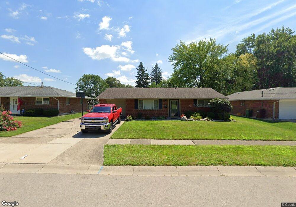
1203 W State Route 73 Springboro, OH 45066
Clearcreek Township NeighborhoodEstimated Value: $561,000 - $760,000
3
Beds
4
Baths
2,427
Sq Ft
$279/Sq Ft
Est. Value
About This Home
This home is located at 1203 W State Route 73, Springboro, OH 45066 and is currently estimated at $677,606, approximately $279 per square foot. 1203 W State Route 73 is a home with nearby schools including Clearcreek Elementary School, Springboro Intermediate School, and Dennis Elementary School.
Ownership History
Date
Name
Owned For
Owner Type
Purchase Details
Closed on
Aug 4, 2025
Sold by
Camealy J Bruce J and Camealy Jill E
Bought by
Camealy J Bruce J and Camealy Jill E
Current Estimated Value
Purchase Details
Closed on
Jul 28, 1988
Sold by
Kennedy Kennedy and Kennedy Lawrence
Bought by
Camealy Camealy and Camealy J. Bruce
Purchase Details
Closed on
Apr 5, 1988
Sold by
Staton Garland G and Staton Louis
Bought by
Kennedy and Kennedy Lawrence
Purchase Details
Closed on
Oct 3, 1979
Sold by
Burd Burd and Burd Russell S
Purchase Details
Closed on
Apr 26, 1978
Create a Home Valuation Report for This Property
The Home Valuation Report is an in-depth analysis detailing your home's value as well as a comparison with similar homes in the area
Home Values in the Area
Average Home Value in this Area
Purchase History
| Date | Buyer | Sale Price | Title Company |
|---|---|---|---|
| Camealy J Bruce J | -- | None Listed On Document | |
| Camealy Camealy | $35,000 | -- | |
| Kennedy | $30,000 | -- | |
| -- | $24,000 | -- | |
| -- | $21,500 | -- |
Source: Public Records
Tax History Compared to Growth
Tax History
| Year | Tax Paid | Tax Assessment Tax Assessment Total Assessment is a certain percentage of the fair market value that is determined by local assessors to be the total taxable value of land and additions on the property. | Land | Improvement |
|---|---|---|---|---|
| 2024 | $8,483 | $207,210 | $55,070 | $152,140 |
| 2023 | $7,233 | $161,021 | $26,295 | $134,725 |
| 2022 | $7,274 | $161,021 | $26,296 | $134,726 |
| 2021 | $6,795 | $161,021 | $26,296 | $134,726 |
| 2020 | $6,341 | $130,911 | $21,378 | $109,533 |
| 2019 | $5,888 | $130,911 | $21,378 | $109,533 |
| 2018 | $5,891 | $130,911 | $21,378 | $109,533 |
| 2017 | $5,692 | $113,827 | $17,815 | $96,012 |
| 2016 | $5,923 | $113,827 | $17,815 | $96,012 |
| 2015 | $5,927 | $113,827 | $17,815 | $96,012 |
| 2014 | $5,704 | $103,540 | $17,820 | $85,730 |
| 2013 | $5,705 | $119,210 | $17,820 | $101,390 |
Source: Public Records
Map
Nearby Homes
- 1045 Ohio 73
- 130 Magnolia Ln
- 85 Chestnut St
- 45 Chestnut St
- 55 Chestnut St
- 25 Chestnut St
- Rockford Plan at Clearview Crossing
- Sanibel Plan at Clearview Crossing
- Birmingham Plan at Clearview Crossing
- Avalon Plan at Clearview Crossing
- Somerset Plan at Clearview Crossing
- The Longwood Plan at Clearview Crossing
- Dallas Plan at Clearview Crossing
- Carlisle Plan at Clearview Crossing
- 165 Magnolia Ln
- 135 Magnolia Ln
- 80 N Lakeshore Dr
- 65 W Waterbury Dr
- 175 S Lakeshore Dr
- 6950 Red Lion 5 Points Rd
- 36 Stableton Way
- 28 Stableton Way
- 44 Stableton Way
- 1187 W State Route 73
- 52 Stableton Way
- 20 Stableton Way
- 1187 W State Route 73
- 1187 Ohio 73
- 60 Stableton Way
- 12 Stableton Way
- 68 Stableton Way
- 15 Stableton Way
- 25 Stableton Way
- 35 Stableton Way
- 45 Stableton Way
- 4 Stableton Way
- 220 Beckley Farm Way
- 55 Stableton Way
- 76 Stableton Way
- 188 Beckley Farm Way