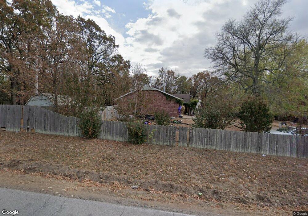
12033 Highway 82c Hulbert, OK 74441
Estimated Value: $125,000 - $196,000
3
Beds
2
Baths
1,230
Sq Ft
$122/Sq Ft
Est. Value
About This Home
This home is located at 12033 Highway 82c, Hulbert, OK 74441 and is currently estimated at $149,830, approximately $121 per square foot. 12033 Highway 82c is a home located in Cherokee County with nearby schools including Peggs Public School.
Ownership History
Date
Name
Owned For
Owner Type
Purchase Details
Closed on
Sep 20, 2023
Sold by
Henson Vicki Lee
Bought by
Department Of Transportation Of The State Of
Current Estimated Value
Purchase Details
Closed on
Aug 8, 2013
Sold by
Housing Authority Of Cherokee Nation Of
Bought by
Henson Vicki Lee
Purchase Details
Closed on
Aug 5, 1993
Sold by
Marts Charles H and Marts Sue E
Bought by
Housing Auth Cher Nation
Create a Home Valuation Report for This Property
The Home Valuation Report is an in-depth analysis detailing your home's value as well as a comparison with similar homes in the area
Home Values in the Area
Average Home Value in this Area
Purchase History
| Date | Buyer | Sale Price | Title Company |
|---|---|---|---|
| Department Of Transportation Of The State Of | -- | None Listed On Document | |
| Department Of Transportation Of The State Of | -- | None Listed On Document | |
| Henson Vicki Lee | -- | None Available | |
| Housing Auth Cher Nation | $4,000 | -- |
Source: Public Records
Tax History Compared to Growth
Tax History
| Year | Tax Paid | Tax Assessment Tax Assessment Total Assessment is a certain percentage of the fair market value that is determined by local assessors to be the total taxable value of land and additions on the property. | Land | Improvement |
|---|---|---|---|---|
| 2025 | $812 | $11,911 | $300 | $11,611 |
| 2024 | $812 | $11,372 | $330 | $11,042 |
| 2023 | $812 | $10,830 | $330 | $10,500 |
| 2022 | $736 | $10,315 | $393 | $9,922 |
| 2021 | $701 | $9,823 | $374 | $9,449 |
| 2020 | $668 | $9,355 | $356 | $8,999 |
| 2019 | $636 | $8,910 | $339 | $8,571 |
| 2018 | $606 | $8,486 | $323 | $8,163 |
| 2017 | $577 | $8,082 | $550 | $7,532 |
| 2016 | $577 | $8,082 | $550 | $7,532 |
| 2015 | $682 | $9,809 | $330 | $9,479 |
| 2014 | $682 | $9,809 | $330 | $9,479 |
Source: Public Records
Map
Nearby Homes
- 6947 N 460 Rd
- 8683 N 436 Rd
- 8268 N Shiloh Rd
- 10223 W 670 Rd
- 8030 N Shiloh Rd
- 14311 E 668 Rd
- 14000 Highway 82c
- 7373 N 485 Rd
- 8465 W 660 Rd Hulbert Unit OK 74441
- 12112 W 690 Rd
- 8465 W 660 Rd
- 12990 W Killabrew Rd
- 5580 E 610 Rd
- 15 W 691 Rd
- 16246 E 647 Rd
- 4100 N 430 Rd
- 0 E 630 Rd Unit 2527536
- 11388 Hwy 82
- 12665 S 4429
- 7167 E 618 Rd
- 12081 Highway 82c
- 12048 Highway 82c
- 12074 Hwy 82 C
- 12030 Highway 82c
- 12094 Highway 82c
- 12156 Highway 82c
- 8059 N 450 Rd
- 8151 Highway 82
- 12174 Highway 82c
- 7705 N 450 Rd
- 7870 N 450 Rd
- 8257 N 450 Rd
- 8269 Highway 82
- 8269 Highway 82
- 8300 Highway 82
- 8329 N 450 Rd
- 8239 N 450 Rd
- 12341 Highway 82c
- 12385 Highway 82c
- 8343 Highway 82